Category:1970s maps of Boston
Jump to navigation
Jump to search
Media in category "1970s maps of Boston"
The following 16 files are in this category, out of 16 total.
-
 1974 black background MBTA subway map.png 3,177 × 3,500; 22.87 MB
-
 1974 MBTA system map reverse.png 3,500 × 3,041; 23.09 MB
-
 1978 MBTA map reverse.png 3,500 × 3,105; 27.06 MB
-
 1978 MBTA subway map.png 855 × 822; 1.28 MB
-
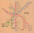
 1978 MBTA system map.png 3,500 × 3,949; 27.86 MB
-

-

-
 Boston fish pier feasibility study (1976) (19777852744).jpg 2,358 × 2,804; 1.61 MB
-
 Boston fish pier feasibility study (1976) (20212462840).jpg 2,376 × 3,150; 2.16 MB
-
 Boston fish pier feasibility study (1976) (20213842189).jpg 2,338 × 2,898; 1.52 MB
-
 Boston fish pier feasibility study (1976) (20374246446).jpg 2,322 × 2,852; 2.36 MB
-
 Boston fish pier feasibility study (1976) (20400541105).jpg 1,392 × 2,892; 684 KB
-
 Boston fish pier feasibility study (1976) (20400603395).jpg 2,092 × 3,151; 1.22 MB
-
 Boston National Historical Park, Massachusetts LOC 80690980.jpg 3,955 × 8,489; 5.15 MB
-
 Boston National Historical Park, Massachusetts LOC 80690980.tif 3,955 × 8,489; 96.06 MB
-
 Бостон 50 2.jpg 2,126 × 2,491; 569 KB


_under_title_i_of_the_grant_and_loan_for_public_works_and_development_facilities_program_(catalog_no._11.300)_for_rehabilitation_of_the_(19559332589).jpg)
_under_title_i_of_the_grant_and_loan_for_public_works_and_development_facilities_program_(catalog_no._11.300)_for_rehabilitation_of_the_(19746103305).jpg)
_(19777852744).jpg)
_(20212462840).jpg)
_(20213842189).jpg)
_(20374246446).jpg)
_(20400541105).jpg)
_(20400603395).jpg)

