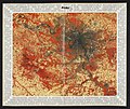
Category:1980s maps of Paris
Jump to navigation
Jump to search
Media in category "1980s maps of Paris"
The following 5 files are in this category, out of 5 total.
-
Les Espaces verts existant dans Paris (1980) - BHVP.jpg 4,805 × 3,205; 1.96 MB
-
Paris 1789-1989, sur les traces de la Révolution (Plan guide) - BHVP.jpg 4,191 × 2,982; 3.16 MB


