
Category:1910s maps of Philadelphia
Most populous urban areas of the world: Beijing [CN] · Boston [US] · Chicago [US] · Detroit [US] · Istanbul [TR] · London [GB] · Miami [US] · New York City [US] · Paris [FR] · Philadelphia [US] · San Francisco [US] · São Paulo [BR] · Tokyo [JP] · Toronto [CA] · Washington, D.C. [US]
Subcategories
This category has the following 10 subcategories, out of 10 total.
M
- Maps of streetcars in Philadelphia (1 P, 39 F)
S
Pages in category "1910s maps of Philadelphia"
This category contains only the following page.
Media in category "1910s maps of Philadelphia"
The following 6 files are in this category, out of 6 total.
-
 NSRW Philadelpia Map.jpg 615 × 915; 268 KB
-
 Map of port of Philadelphia (1918).jpg 1,208 × 2,814; 844 KB
-
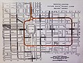 BSL Loop.jpg 3,116 × 2,389; 6.51 MB
-
 Philadelphia in the Civil War 1861-1865 (electronic resource) (1913) (14576036100).jpg 2,878 × 4,338; 2.25 MB
-
 Rand McNally map of University of Pennsylvania campus 1915.jpg 558 × 796; 139 KB
-
 Rand McNally Philadelphia guide to the city and environs (1915) (14780997114).jpg 2,188 × 2,976; 653 KB

.jpg)

_(1913)_(14576036100).jpg)

_(14780997114).jpg)