
Category:2000s maps of Philadelphia
Most populous urban areas of the world: Boston [US] · Detroit [US] · New York City [US] · Paris [FR] · Philadelphia [US] · San Francisco [US] · Toronto [CA] · Washington, D.C. [US]
Counties of Pennsylvania : Allegheny · Bucks · Crawford · Fayette · Lebanon · Luzerne · Philadelphia · York
Subcategories
This category has the following 10 subcategories, out of 10 total.
Media in category "2000s maps of Philadelphia"
The following 2 files are in this category, out of 2 total.
-
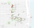 INHP NPS map.svg 1,511 × 1,263; 880 KB
-
 Philadelphia Mayor Democratic Primary 2007 by Ward.svg 810 × 824; 215 KB

