
Category:1910s maps of London
Subcategories
This category has only the following subcategory.
Media in category "1910s maps of London"
The following 15 files are in this category, out of 15 total.
-

-
 Britannica London 2.jpg 1,207 × 875; 271 KB
-
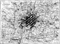 Britannica London 2.png 3,011 × 2,196; 609 KB
-
 A map of London; showing sites of medical and other interest Wellcome V0012883.jpg 3,137 × 2,501; 3.7 MB
-
 Hesper Mews on Ordnance Survey map of 1913.png 1,107 × 875; 1.56 MB
-
 London map - L. G. O. Co. - btv1b8459861p (1 of 2).jpg 7,306 × 5,052; 5.34 MB
-
 London map - L. G. O. Co. - btv1b8459861p (2 of 2).jpg 4,699 × 3,750; 2.33 MB
-
 A map of London; showing sites of medical interest in Lambet Wellcome V0012880.jpg 3,332 × 2,440; 4.12 MB
-
 Airfare of to-day and of the future (1918) (14598388997).jpg 2,096 × 2,100; 899 KB
-
 Britannica London 1.jpg 1,257 × 895; 242 KB
-
 Britannica London 1.png 3,136 × 2,264; 535 KB
-

-

-

-
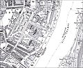 OS Millbank Tate etc 2.jpg 2,512 × 2,061; 737 KB
_-_Geographicus_-_London-smith-1910.jpg)


.jpg)
.jpg)

_(14598388997).jpg)


.jpg)


