Category:1837 maps
Jump to navigation
Jump to search
| ← · 1830 · 1831 · 1832 · 1833 · 1834 · 1835 · 1836 · 1837 · 1838 · 1839 · → |
Deutsch: Karten mit Bezug zum Jahr 1837
English: Maps related to the year 1837
Español: Mapas relativos al año 1837
Français : Cartes concernant l’an 1837
Русский: Карты 1837 года
Subcategories
This category has the following 6 subcategories, out of 6 total.
Media in category "1837 maps"
The following 99 files are in this category, out of 99 total.
-
1837 Dower Map of Van Dieman's Land or Tasmania - Geographicus - Tazmania-dower-1837.jpg 2,551 × 3,288; 1.21 MB
-
1837 Malte-Brun Map of Germany - Geographicus - GermanyNorth-mb-1837.jpg 2,355 × 1,746; 819 KB
-
1837 Western Railroad map, Springfield to State Line.jpg 13,398 × 9,994; 21.45 MB
-
1837 Western Railroad map, Worcester to Springfield.jpg 13,348 × 10,263; 19.91 MB
-
Admiralty Chart No 11 Khorya Morya Bay and Islands, Published 1840, Corrections to 1888.jpg 7,734 × 5,050; 7.87 MB
-
Aegyptus et Palaestina (FL33141944 3877888).jpg 5,717 × 6,955; 46.76 MB
-
Aragón - con las nuevas divisiones.jpeg 1,600 × 2,313; 410 KB
-
Auguste Henri Dufour, Plan of Jerusalem (FL6881487 2531327).jpg 2,200 × 2,785; 3.61 MB
-
Brussels 1837 Saint Gaugericus.jpg 1,362 × 1,128; 439 KB
-
Brussels 1837.jpeg 7,150 × 6,225; 10.69 MB
-
Brussels 1837.jpg 6,336 × 5,243; 5.52 MB
-
Carsten Niebuhr, Grundriss der Stadt Jerusalem (FL6880388 2368142).jpg 2,200 × 2,814; 2.43 MB
-
Carsten Niebuhr, Prospect der stadt Jerusalem vom Oelberge (FL6880654 2368141).jpg 3,000 × 2,078; 2.26 MB
-
Carte ancienne île de Batz.jpg 1,000 × 683; 180 KB
-
Carte du département de l'Eure - 1837.jpg 10,516 × 7,252; 11.28 MB
-
Chart of Georges Shoal & Bank LOC 92682131.jpg 13,280 × 11,972; 16.55 MB
-
Chart of Georges Shoal & Bank LOC 92682131.tif 13,280 × 11,972; 454.87 MB
-
City of Dublin 1837 map.jpg 2,934 × 2,028; 3.36 MB
-
City of New-York - by David H. Burr. NYPL434686.tiff 4,784 × 5,915; 80.97 MB
-
Cordova-mapa Norte.jpg 1,506 × 1,240; 947 KB
-
Cornelis van Baarsel, Rotterdam (FL167448473 2369961).jpg 12,409 × 10,154; 161.52 MB
-
County of the City of Dublin 1837 map.jpg 4,855 × 3,450; 2.36 MB
-
Das Biblische Palaestina (FL33144898 3882761).jpg 2,836 × 4,568; 14.7 MB
-
Der gestirnte Himmel - nördliche Halbkugel LOC 2013593223.jpg 11,282 × 8,556; 12.3 MB
-
Der gestirnte Himmel - nördliche Halbkugel LOC 2013593223.tif 11,282 × 8,556; 276.17 MB
-
Der gestirnte Himmel - südliche Halbkugel LOC 2014588303.jpg 11,232 × 8,721; 12.96 MB
-
Der gestirnte Himmel - südliche Halbkugel LOC 2014588303.tif 11,232 × 8,721; 280.25 MB
-
Dublin Kingstown railway 1837 map.jpg 2,612 × 808; 586 KB
-
Duvotenay Thunot, Canton de Fribourg (FL35077064 3498344).jpg 4,978 × 6,804; 47.49 MB
-
Duvotenay Thunot, Canton de Geneve (FL35077060 3498330).jpg 6,726 × 4,885; 42.77 MB
-
Duvotenay Thunot, Canton de Neuchatel (FL35077058 3498295).jpg 6,695 × 4,961; 47.92 MB
-
Duvotenay Thunot, Canton de Soleure (FL35077072 3498349).jpg 6,826 × 5,301; 47.13 MB
-
Duvotenay Thunot, Canton de Valais (FL35077104 3498352).jpg 6,792 × 5,013; 47.65 MB
-
Duvotenay Thunot, Canton de Vaud (FL35077059 3498351).jpg 6,753 × 4,977; 43.26 MB
-
Duvotenay Thunot, Carte Générale des Alpes (FL35077101 3498737).jpg 6,795 × 4,958; 46.12 MB
-
Hawaii map 1837 by Kalama.jpg 5,821 × 4,067; 6.42 MB
-
J.N.V., Situations plan von Jerusalem (FL6879754 2369825).jpg 2,180 × 2,821; 4.41 MB
-
Map of Christmas Island, 1837.jpg 139 × 200; 7 KB
-
Map of Farnham from 1837.png 505 × 301; 327 KB
-
Map of the territory west of the Rocky Mountains LOC 2007633935.jpg 5,130 × 5,535; 4.16 MB
-
Map of the territory west of the Rocky Mountains LOC 2007633935.tif 5,130 × 5,535; 81.24 MB
-
New Salem, home of Abraham Lincoln 1831 to 1837. LOC 75693219.jpg 9,856 × 5,952; 14.85 MB
-
New Salem, home of Abraham Lincoln 1831 to 1837. LOC 75693219.tif 9,856 × 5,952; 167.84 MB
-
Nikolskoe Friedhof Entwurf Lenné gez von Kloeber 28.11.1837.jpg 726 × 974; 219 KB
-
Nikolskoe Plan Lenné 1837 SPSG Potsdam.jpg 2,600 × 1,518; 1,000 KB
-
Novaiguacu mapaantigo.jpg 562 × 306; 45 KB
-
Oxford city plan (1837).jpg 2,550 × 3,508; 4.52 MB
-
P. Bineteau, Carte de l'Asie (FL32703274 2559293).jpg 7,395 × 5,927; 50.57 MB
-
P. Bineteau, Mappemonde par races et par religions (FL147409313 2726891).jpg 3,625 × 2,951; 9.69 MB
-
P. Bineteau, Mappemonde Phisique (FL158878698 2726898).jpg 7,651 × 6,070; 47.9 MB
-
Palaestina (FL33142002 3877882).jpg 5,736 × 6,930; 48.7 MB
-
Panorama Preußische Landaufnahem Quernheim.jpg 1,616 × 1,920; 1.38 MB
-
Paris map - Donnet (Kaufmann) Architectonographie 1837 - Gallica.jpg 6,398 × 4,928; 18.02 MB
-
Plan de Paris Alexis Donnet 1837.jpg 604 × 531; 152 KB
-
Plan der Kirche des heiligen Grabes in Jerusalem (FL155332341 2810269).jpg 10,261 × 6,342; 77.76 MB
-
Plan of Athens 1837 (Aldenhoven) near Zoodochos Pigi.jpg 600 × 481; 66 KB
-
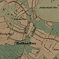
Rothsaifen OMSK 1837.jpg 3,000 × 3,000; 2.57 MB
-
Routes between New-York and Washington - drawn by I. Smith, geographer. NYPL434652.tiff 1,776 × 6,300; 32.02 MB
-
Sitio Sagunto.jpg 571 × 388; 76 KB
-
St. Michael's Parish, Berbice, 30 miles in extent. LOC 2001622459.jpg 6,267 × 2,525; 1.63 MB
-
St. Michael's Parish, Berbice, 30 miles in extent. LOC 2001622459.tif 6,267 × 2,525; 45.27 MB
-
T14-1.jpg 10,494 × 8,442; 4.46 MB
-
T14-2.jpg 9,911 × 7,727; 4.46 MB
-
T18.jpg 11,548 × 7,868; 6.27 MB
-
T21-1.jpg 12,243 × 8,296; 6.16 MB
-
T21-2.jpg 12,902 × 8,476; 6.44 MB
-
T22-1.jpg 12,717 × 9,320; 7.72 MB
-
T26-li.jpg 8,791 × 7,686; 4.31 MB
-
T27-li.jpg 9,020 × 12,568; 4.96 MB
-
T28-li.jpg 9,120 × 12,470; 4.66 MB
-
T29-li.jpg 12,707 × 9,482; 4.2 MB
-
T30-li.jpg 7,647 × 11,867; 3.83 MB
-
T31-li.jpg 8,945 × 9,969; 3.8 MB
-
T32-li.jpg 10,930 × 7,147; 3.8 MB
-
T33-Bis-li.jpg 11,289 × 8,963; 6.3 MB
-
T34-li.jpg 10,620 × 13,667; 5.8 MB
-
T36-li.jpg 10,451 × 9,370; 6.72 MB
-
T37-li.jpg 10,807 × 9,218; 6.12 MB
-
T38-B.jpg 12,773 × 9,120; 5.65 MB
-
T39-li.jpg 11,892 × 9,120; 4.79 MB
-
T40-li.jpg 11,269 × 8,497; 6.04 MB
-
T41-li.jpg 11,332 × 9,110; 4.95 MB
-
T42-li.jpg 7,646 × 11,318; 3.36 MB
-
T43-li.jpg 12,617 × 9,046; 3.45 MB
-
T46-Bis-li.jpg 8,822 × 12,237; 5.6 MB
-
T47-1.jpg 13,064 × 9,370; 12.75 MB
-
T48-1-li.jpg 11,309 × 8,527; 2.45 MB
-
T48-2-li.jpg 11,417 × 8,548; 5.98 MB
-
Thierry, Empire des Mongols (FL33131063 2490329).jpg 10,372 × 6,716; 85.53 MB
-
World moral map, 1837.jpg 3,444 × 2,147; 3.4 MB
-
Édouard Hocquart, Plan de Jérusalem a l'époque d'Hérode (FL6882337 2370341).jpg 2,750 × 2,240; 6.14 MB


