Category:1832 maps
Jump to navigation
Jump to search
| ← · 1830 · 1831 · 1832 · 1833 · 1834 · 1835 · 1836 · 1837 · 1838 · 1839 · → |
Deutsch: Karten mit Bezug zum Jahr 1832
English: Maps related to the year 1832
Español: Mapas relativos al año 1832
Français : Cartes concernant l’an 1832
Русский: Карты 1832 года
Subcategories
This category has the following 6 subcategories, out of 6 total.
Media in category "1832 maps"
The following 76 files are in this category, out of 76 total.
-

-
 SMYTHE(1832) 10 CHART, SHEWING THE POSITION OF THE NEW VOLCANIC ISLAND OF FERNANDEA.jpg 2,703 × 2,017; 2.38 MB
-
 1832 Delamarche Map of Germany in Roman Times - Geographicus - Germany-d-32.jpg 3,000 × 2,537; 2.01 MB
-
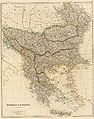
 1832 Delamarche Map of Greece and the Balkans - Geographicus - Greece-d-32.jpg 2,700 × 2,390; 1.46 MB
-
 1832 Delamarche Map of Northern Italy and Corsica - Geographicus - ItalyN-d-32.jpg 3,000 × 2,116; 1.62 MB
-
 1832 Delamarche Map of Switzerland - Geographicus - Switzerland-d-32.jpg 3,000 × 2,043; 1.32 MB
-
 1832 Ensingen+Eselsberg mit Burgrain UFK-Composit LeoBW.jpg 2,291 × 1,323; 2.82 MB
-
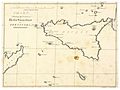
 1832 Map of Nubia and Abyssinia.png 840 × 599; 935 KB
-

-
 Alignements de Kerzérho - Murray Vicars 1832 et osm background.jpg 4,564 × 3,036; 2.88 MB
-
 Anegada-1832.jpg 2,319 × 1,944; 649 KB
-
 Balkans 1832.jpg 5,896 × 7,480; 11.32 MB
-
 Bransford 19th century map.PNG 329 × 285; 220 KB
-
 Breiters Wintergarten Lage.jpg 1,107 × 657; 496 KB
-

-
 Carl Ferdinand Weiland, Juda und Israel nach den Büchern der Könige (FL45582271 3918441).jpg 2,277 × 2,775; 1.81 MB
-
-
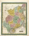 China. LOC 2006629352.jpg 3,678 × 4,478; 2.96 MB
-
 China. LOC 2006629352.tif 3,678 × 4,478; 47.12 MB
-
 City of New-York. LOC 75692381.jpg 4,738 × 5,720; 3.91 MB
-
 City of New-York. LOC 75692381.tif 4,738 × 5,720; 77.54 MB
-
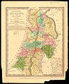 David H. Burr, Palestine or the Holy Land (FL27932972 2369500).jpg 7,572 × 9,142; 99.62 MB
-

-
 Die Ober Lausitz Koenigl. Saechsischen Antheils 1832.jpg 6,609 × 5,260; 8.26 MB
-
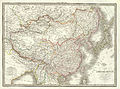 Empire Chinois, Japon (1832).jpg 9,174 × 6,811; 15.68 MB
-
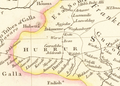
 Gulf of Burgas 1832.jpg 542 × 318; 89 KB
-
 J. Andriveau, Carte de L'Océanie (FL27963672 2518785).jpg 15,113 × 12,097; 251.35 MB
-
 J. Andriveau, Carte du Cours du Nil (FL25569784 2370196).jpg 12,056 × 15,099; 196.18 MB
-
 John Arrowsmith, Turkey in Asia (FL36010884 2716994).jpg 15,769 × 12,638; 280.43 MB
-
 John Lothian, Jerusalem (FL45582632 3924378).jpg 1,823 × 1,623; 833 KB
-
 Joseph Schwarz, Palestina (FL169298958 3488682).jpg 7,301 × 8,493; 70.95 MB
-
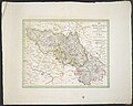
 Karte des königreichs. Lombardey-Venedig 1832.jpg 3,455 × 2,631; 7.27 MB
-
 Karte vom Herzogthume Krai 1832.jpg 9,616 × 7,040; 14.04 MB
-
 Karte von Tirol, Steyermark und Illyrien 1832.jpg 7,733 × 5,848; 8 MB
-
 Karte1832 Bermuthshain.jpg 896 × 720; 363 KB
-
 Karte1832 Crainfeld1.jpg 871 × 714; 378 KB
-
 Karte1832 grebenh.jpg 827 × 550; 235 KB
-
 Krystallpalast Leipzig 1832.jpg 1,244 × 934; 1.4 MB
-
 Plan von Leipzig 1832 df dk 0000495 retouched.jpg 4,959 × 5,618; 18.08 MB
-

-

-

-
 Map of Rochester from a correct survey LOC 2003623826.jpg 9,602 × 7,581; 9.83 MB
-
 Map of Rochester from a correct survey LOC 2003623826.tif 9,602 × 7,581; 208.26 MB
-
 Map of the city and county of New York - with the adjacent country - by David H. Burr. NYPL434694.tiff 10,172 × 5,457; 158.82 MB
-

-

-
 Map of Virginia and Maryland, constructed from the latest authorities. LOC 2012593331.jpg 6,699 × 5,099; 6.12 MB
-
 Map of Virginia and Maryland, constructed from the latest authorities. LOC 2012593331.tif 6,699 × 5,099; 97.73 MB
-
 Neueste Special Karte des Cillier Kreises im Herzogthume Steyermark 1832.jpg 7,795 × 6,088; 35.6 MB
-
 NeulouisendorfGrundriss.jpg 935 × 592; 173 KB
-
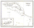
 New South Wales 1832.jpg 1,016 × 916; 248 KB
-
 New zealand 1832.jpg 780 × 1,371; 95 KB
-
 Nikolskoe Lenné erster Entwurf 1832-33.jpg 1,476 × 1,012; 290 KB
-

-
 OACanstatt-Karte.jpg 5,600 × 6,300; 5.63 MB
-
 OF Karte C-Frank 1832.jpg 7,301 × 6,056; 55.15 MB
-
 Palestine (FL51366956 2370293).jpg 4,462 × 5,606; 20.77 MB
-
 Plan en Profilteekening van het riviervak op den Ouden IJssel.jpg 8,142 × 3,550; 3.97 MB
-
 Plan Mont 1832.jpg 683 × 473; 65 KB
-
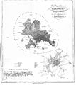
 Plan of the Dracontium of Carnac. Surveyed April 1832 - osm background.jpg 10,120 × 5,656; 7.68 MB
-
 Plan of the Dracontium of Carnac. Surveyed April 1832.jpg 14,927 × 5,830; 3.57 MB
-

-

-
 Reymann Neuester Grundriss von Berlin 1832.jpg 13,431 × 10,139; 31.08 MB
-

-

-
 T53.jpg 9,245 × 12,842; 5.03 MB
-
 Talhausen UFK von 1832 LABW.jpg 1,954 × 1,977; 2.72 MB
-
 The state of New York from the most recent surveys. NYPL434749.tiff 5,104 × 5,987; 87.43 MB
-
 Thomas Starling, Plan of the city of Jerusalem (FL45582616 3924269).jpg 2,007 × 1,335; 855 KB
-
 Westliche halbkugel (3120218905).jpg 2,000 × 1,675; 2.86 MB
-
 Wuerttembergische Flurkarte 1-2.500 Blatt NO LV 31.jpg 2,162 × 2,197; 1.71 MB
-
 Wuerttembergische Flurkarte 1-2.500 Blatt NO LV 32.jpg 2,164 × 2,190; 1.82 MB
-
 Yu sheng yu tu. LOC gm71005030.jpg 11,096 × 16,476; 16.49 MB
-
 Yu sheng yu tu. LOC gm71005030.tif 11,096 × 16,476; 523.05 MB

_10_CHART,_SHEWING_THE_POSITION_OF_THE_NEW_VOLCANIC_ISLAND_OF_FERNANDEA.jpg)


.jpg)


.jpg)
.jpg)


.jpg)

.jpg)

.jpg)
.jpg)
.jpg)
.jpg)
.jpg)


.jpg)


_Landesarchiv_BW_EL_68_VI_Nr_3232_Bild_1_(2-5303600-1).png)


.jpg)


.jpg)
.jpg)


