Category:1836 maps
Jump to navigation
Jump to search
| ← · 1830 · 1831 · 1832 · 1833 · 1834 · 1835 · 1836 · 1837 · 1838 · 1839 · → |
Deutsch: Karten mit Bezug zum Jahr 1836
English: Maps related to the year 1836
Español: Mapas relativos al año 1836
Français : Cartes concernant l’an 1836
Русский: Карты 1836 года
Subcategories
This category has the following 7 subcategories, out of 7 total.
Media in category "1836 maps"
The following 82 files are in this category, out of 82 total.
-
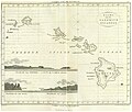
BOELEN(1836) T3 p042 KAART VAN DE SANDWICH EILANDEN.jpg 5,017 × 4,269; 8.58 MB
-
BOELEN(1836) T3 p286 SCHETS VAN DE HAVEN VAN MACAO.jpg 2,004 × 2,525; 2.45 MB
-
1836 Cary Map of Greece and the Balkans - Geographicus - TurkeyinEurope-cary-1836.jpg 3,063 × 3,777; 2.02 MB
-
1836 Eastern Railroad plan.jpg 19,856 × 4,320; 21.2 MB
-
1836 Limburg a. d. Lenne.jpg 2,545 × 1,702; 2.55 MB
-
1836 Malte-brun Map of Russia in Asia and Siberia - Geographicus - Siberie-mb-1836.jpg 3,000 × 2,275; 1.46 MB
-
1837 Malte-Brun Map of China and Japan - Geographicus - China-mb-1837.jpg 2,328 × 1,758; 772 KB
-
A map of Canaan, adapted to the book of Genesis (FL6881837 2508837).jpg 2,124 × 2,878; 1.83 MB
-
A map of Canaan, adapted to the book of Judges (FL6880175 2508844).jpg 2,180 × 2,874; 1.78 MB
-
A map of Canaan, adapted to the book of Samuel (FL6881318 2508846).jpg 2,130 × 2,909; 1.84 MB
-
A plat of lands belonging to the Company of Grocers (27114684914).jpg 5,295 × 4,360; 9.12 MB
-
A Plat of the towne of Colerane as it now stands built and fortifd (27449185330).jpg 5,307 × 4,372; 9.2 MB
-
AMH-5541-NA Map of the south eastern islands.jpg 2,400 × 1,611; 457 KB
-
Auguste Toussaint, Carte de la Terre Sainte ou de la Palestine (FL199992259 2369089).jpg 11,918 × 9,014; 57.01 MB
-
Bielsko Miasto - Bielitz Stadt mapa katastralna 1836 ze zmianami około 1885.jpg 1,106 × 1,073; 520 KB
-
British possessions in North America - drawn and engraved by J. & C. Walker. NYPL433892.tiff 4,200 × 5,067; 60.89 MB
-
Carte de l'arrondissement d'Avesnes - 1836.jpg 7,038 × 5,298; 3.54 MB
-
Carte routière du département de l'Aude.jpg 9,984 × 7,108; 7.47 MB
-
Charles-François Beautemps-Beaupré, Carte générale de L'Afrique (FL13728536 2511601).jpg 7,213 × 5,373; 58.46 MB
-
Charte der Landdrostei Hildesheim (Hildesheim).jpg 2,082 × 1,918; 2.84 MB
-
Charte von Palæstina (FL32715061 3876863).jpg 5,265 × 6,785; 49.75 MB
-
City of Washington. LOC 88694080.jpg 4,658 × 3,706; 2.61 MB
-
Doubrava SK 1836.jpg 3,000 × 2,000; 2.16 MB
-
Dublin 1836.jpg 6,336 × 5,135; 4.25 MB
-
Département de la Moselle - 1836.jpg 10,761 × 7,566; 12.72 MB
-
First Nation Control over North America about 1600 AD.jpg 5,660 × 5,196; 23.06 MB
-
Félix Delamarche, Judée divisée en ses douze Tribus sous Josué (FL37129668 3911658).jpg 4,867 × 3,499; 3.55 MB
-
Gentilly New Orleans Map 1836.jpg 1,846 × 1,984; 854 KB
-
A map of Illinois, 1836 - NARA - 306590.tif 3,061 × 3,750; 32.84 MB
-
Jean-Baptiste Glaire, Carte du midi de la Judée ou Terre - Sainte (FL36566962 3906431).jpg 4,875 × 3,255; 7.39 MB
-
Jean-Baptiste Glaire, Carte du royaume d'Hérode (FL36566997 3906455).jpg 3,504 × 5,094; 5.16 MB
-
Jerusalem and places adjacent (FL173354384 2502736).jpg 3,517 × 3,054; 6.59 MB
-
Königreich Illyrien, Gouvernement Laibach Charte der Kreise 1836.jpg 10,292 × 8,608; 10.04 MB
-
Map of Two Hemispheres, 1836, engraved by Kalama.jpg 400 × 250; 19 KB
-
Map showing the lands assigned to emigrant Indians west of Arkansas and Missouri. LOC 99446197.tif 7,477 × 9,136; 195.44 MB
-
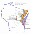
Menominee land cession of 1836.png 1,858 × 2,054; 1.67 MB
-
Carta particolare della nuoua Belgia è parte della nuoua Anglia (NYPL b20644060-5831483).tiff 7,760 × 10,328, 2 pages; 229.61 MB
-
Carta particolare della nuoua Belgia è parte della nuoua Anglia (NYPL b20644060-5831483).jpg 6,956 × 8,424; 39.86 MB
-
Oberamt Ravensburg Karte.jpg 6,557 × 7,272; 6.3 MB
-
Pianosa map 1836 by Attilio Zuccagni-Orlandini.jpg 736 × 1,000; 103 KB
-
Plan of Winnisimmet, in Chelsea (6093626163).jpg 2,000 × 1,395; 2.5 MB
-
Royal Commission on Metropolitan Termini Map.jpg 7,372 × 4,598; 31.42 MB
-
Sidney Hall, Map of the countries north east of Palestine (FL6879988 2509087).jpg 2,931 × 2,150; 2.35 MB
-
Society for the Diffusion of Useful Knowledge, Moscow (FL167448493 2369995).jpg 9,904 × 8,250; 91.09 MB
-
State of New York - in Senate Jany. 7th, 1836. NYPL434743.tiff 7,230 × 5,428; 112.28 MB
-
T10-ny.jpg 12,188 × 7,847; 6.46 MB
-
T11-2.jpg 7,724 × 11,104; 3.18 MB
-
T20-2.jpg 12,867 × 9,823; 7.18 MB
-
T24-li.jpg 13,167 × 9,296; 6.95 MB
-
T25-li.jpg 9,122 × 9,772; 4.39 MB
-
T44-li.jpg 7,746 × 10,744; 4.54 MB
-
T45-1-li.jpg 10,745 × 10,263; 11.57 MB
-
T7-3.jpg 10,326 × 8,748; 5.68 MB
-
T72 (Bis).jpg 11,926 × 8,507; 7.11 MB
-
Tours cadastre napoléonien amphi.jpg 706 × 479; 211 KB
-
Upravni zemljevid Kranjske leta 1836.jpg 800 × 669; 155 KB
-
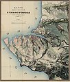
Россия. Крым. Карта окрестностей Севастополя, 1836г MapSev e1cr.jpg 4,560 × 5,350; 6.76 MB
-
אהרן בן חיים מהורדנה, המסעות וגבולי ארץ צבי והכרמל לפי רשי (FL199992243 2369223).jpg 6,281 × 5,215; 21.89 MB
