Category:1830 maps
Jump to navigation
Jump to search
| ← · 1830 · 1831 · 1832 · 1833 · 1834 · 1835 · 1836 · 1837 · 1838 · 1839 · → |
Deutsch: Karten mit Bezug zum Jahr 1830
English: Maps related to the year 1830
Español: Mapas relativos al año 1830
Français : Cartes concernant l’an 1830
Русский: Карты 1830 года
Subcategories
This category has the following 8 subcategories, out of 8 total.
Media in category "1830 maps"
The following 76 files are in this category, out of 76 total.
-
1850 moscow.jpg 13,740 × 10,780; 52.76 MB
-
A map of Canaan, adapted to the book of Judges (FL200036867 2368466).jpg 2,436 × 3,232; 10.08 MB
-
A map of Canaan, adapted to the Gospel history (FL200036828 2368469).jpg 2,440 × 3,220; 10.15 MB
-
A map of Canaan, shewing the captivieties of Israel and Judah (FL200036829 2368468).jpg 2,404 × 3,180; 10.73 MB
-
A map of Georgetown in the District of Columbia LOC 88693290.jpg 8,569 × 7,022; 8.48 MB
-
Amby, sectie B, blad 2 (detail, Het Kerksken).jpg 2,021 × 1,467; 546 KB
-
Amby, sectie B, blad 2 (detail2, Het Kerksken).jpg 998 × 779; 138 KB
-
Amby, sectie B, blad 2 (detail2, Withuishof).jpg 1,057 × 795; 234 KB
-
Amby, sectie B, blad 2 (MIN11001B02) (detail, Withuishof).jpg 2,291 × 2,848; 1.41 MB
-
Amby, sectie B, blad 2 (MIN11001B02).jpg 11,668 × 7,682; 6.23 MB
-
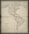
America - politische Karte.jpg 6,447 × 7,670; 15.04 MB
-
An Hieroglyphic for 1830 (caricature) RMG PW3937.jpg 1,280 × 923; 1.29 MB
-
Avenue Kléber 1.jpg 430 × 629; 312 KB
-
Bilany1830-intravilan obce na indikační skici Stabilního katasru.jpg 1,736 × 2,733; 853 KB
-
Brussel 1830.reduced.tif 3,150 × 2,824; 17.47 MB
-
C. Bruder, Jerusalem (FL32703858 2655872).jpg 17,623 × 13,975; 390.13 MB
-
China. LOC 2006629421.jpg 6,760 × 4,200; 4.81 MB
-
China. LOC 2006629421.tif 6,760 × 4,200; 81.23 MB
-
Christoph Fembo, Constantinopolis (FL51871500 2728732).jpg 5,009 × 4,283; 25.03 MB
-
Das Gelobte Land (FL33142026 3877866).jpg 6,922 × 8,079; 78.74 MB
-
Fried Hausch, Charte der Märsche & und Eroberungen Alexanders des Grossen (FL80427987 2725381).jpg 13,385 × 8,223; 123.1 MB
-
Heer, sectie A, blad 3 (MIN11036A03).jpg 11,490 × 8,016; 9.76 MB
-
Hellespont or channel of the Dardanelles LOC 2018588034.jpg 4,960 × 2,929; 2.06 MB
-
Hellespont or channel of the Dardanelles LOC 2018588034.tif 4,960 × 2,929; 41.56 MB
-
Jerusalem at different periods (FL6879905 2368004).jpg 2,180 × 2,847; 2.04 MB
-
Jerusalem at different periods.jpg 2,180 × 2,847; 2.21 MB
-
John Dower, Palestine (FL37121946 3898173).jpg 2,232 × 2,737; 3.49 MB
-
Kaart der vrije jagt van de havezate Walfort.jpg 10,482 × 7,152; 22.99 MB
-
Karl Christoph Gottlieb Zerrenner, Karte von Palaestina (FL45584605 3927460).jpg 2,409 × 2,183; 1.64 MB
-
La Ciotat Plan 1830.png 466 × 510; 562 KB
-
Lənkəranı (Атлас крепостей российской империи. 1830).jpg 595 × 1,008; 283 KB
-
Map of Dublin – The Gentleman's and citizen's almanack for the year (1830) (14796769703).jpg 3,930 × 3,248; 3.08 MB
-
Map of Plymouth settled in 1620 (3720083685).jpg 709 × 1,024; 713 KB
-
Map of the country from Sues to Mount Sinai (FL50795193 2368462).jpg 9,154 × 5,587; 65.02 MB
-
Map of the suburbs of the Eastern Capital, or, Edo (14742563064).jpg 2,500 × 1,963; 2.01 MB
-
Map old rockingham.jpg 7,568 × 6,827; 2.97 MB
-
North Southwark 1830.png 1,711 × 1,368; 5.6 MB
-
Orbis terratum Herodoti (FL158878703 2726912).jpg 10,102 × 7,432; 74.31 MB
-
Plan der Haupt Stadt Laibach im Königreiche Illyrien 1830.jpg 9,592 × 7,432; 12.34 MB
-
Plan of Newton & Needham (3720901774).jpg 1,024 × 766; 526 KB
-
Péloponnès d'après Ptolémée (FL169298824 2531793).jpg 7,243 × 4,674; 49.99 MB
-
Péloponnèse du Tabula Peutingeriana (FL35071906 2531790).jpg 7,324 × 11,159; 120.28 MB
-
Roman Dardania part of Moesia Superior part of old map made 1830.jpg 1,018 × 817; 873 KB
-
Saiken Ise no Kuni ezu (14006160049).jpg 2,500 × 1,856; 1.83 MB
-
Schlacht von barosa.png 1,767 × 1,025; 212 KB
-
Sekai daisō no zu. LOC 88694871.jpg 9,051 × 18,708; 25.45 MB
-
Sekai daisō no zu. LOC 88694871.tif 9,051 × 18,708; 484.45 MB
-
Sidney Hall, Canaan as divided among the Tribes (FL35098524 3892364).jpg 4,911 × 3,935; 27.61 MB
-
Simssee 1830 Karte im Stromatlas.jpg 1,362 × 1,193; 362 KB
-
Singapore 1830 map by John Murray.jpg 2,362 × 1,516; 548 KB
-
Situations-Plan der Stadt Leipzig.jpg 8,064 × 9,987; 15.79 MB
-
Situs et regio antuquae Babylonis (FL35865347 2491846).jpg 8,350 × 6,916; 74.36 MB
-
Southern Syria (FL35098528 3892358).jpg 5,242 × 6,694; 48.79 MB
-
Sunday School teacher's and Bible class map of Palestine (FL35098837 3892745).jpg 6,385 × 9,535; 81.67 MB
-
Syria (FL35098537 3892356).jpg 5,370 × 6,724; 48.72 MB
-
Terra Sancta vel Palaestina (FL35098552 3892349).jpg 5,457 × 6,614; 48.07 MB
-
Terrestrial inflatable globe RMG D7913 4.jpg 1,280 × 1,247; 813 KB
-
Thomas Conder, A map of Canaan for general purposes (FL200036756 2368464).jpg 2,428 × 3,204; 10.35 MB
-
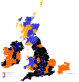
United Kingdom general election 1830.svg 1,164 × 1,209; 4.88 MB
-
İrəvan qalası (Атлас крепостей российской империи. 1830).jpg 593 × 521; 169 KB
-
Şuşa (Атлас крепостей российской империи. 1830).jpg 595 × 526; 186 KB


