Category:1680s maps of Africa
Jump to navigation
Jump to search
Temperate regions: North America · South America · Africa · Europe · Asia · Oceania – Polar regions: – Other regions:
Subcategories
This category has the following 11 subcategories, out of 11 total.
- 1680 maps of Africa (6 F)
- 1681 maps of Africa (10 F)
- 1682 maps of Africa (3 F)
- 1683 maps of Africa (51 F)
- 1684 maps of Africa (5 F)
- 1685 maps of Africa (13 F)
- 1687 maps of Africa (2 F)
- 1688 maps of Africa (9 F)
- 1689 maps of Africa (12 F)
E
- 1680s maps of Egypt (16 F)
- 1680s maps of Ethiopia (6 F)
Media in category "1680s maps of Africa"
The following 19 files are in this category, out of 19 total.
-

-

-
-

-
 Atlas Van der Hagen-KW1049B13 056-AFRICAE ACCURATA TABULA.jpeg 5,500 × 4,454; 3.68 MB
-
 Diego Rodrigues discovery 1680 map.jpg 2,538 × 3,363; 5.14 MB
-
 Dutch map of Africa, 1680.jpg 2,528 × 2,161; 4.63 MB
-
 Exacta totius Africae tabula - Kungliga Biblioteket - 8250653-thumb.png 10,592 × 8,096; 311.31 MB
-
 Exacta totius Africae tabula - Kungliga Biblioteket - 8250653.tif 10,592 × 8,096, 2 pages; 490.74 MB
-
 Map - Special Collections University of Amsterdam - OTM- HB-KZL 33.22.04.tif 7,571 × 6,546; 141.79 MB
-
 Map of ancient Africa, 1685.jpg 658 × 900; 422 KB
-
 Map of ancient interior Libya, 1683.jpg 725 × 1,078; 164 KB
-
 Map of Bildulgerid, 1685.jpg 678 × 900; 376 KB
-
 Map of Madagascar, 1685.jpg 644 × 900; 413 KB
-
 Map of the ancient northern coast, 1683.jpg 725 × 1,078; 182 KB
-
 Pays de Negres, 1685.jpg 640 × 900; 416 KB
-
 Totius Africae accuratissima tabula RMG F8177.tiff 4,800 × 4,007; 55.03 MB
-
 UBBasel Map 1683-1690 Kartenslg Mappe 252-62 Habessinia seu Abassia.tiff 12,184 × 9,408, 2 pages; 327.98 MB
-

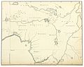
_p238_PLATE_2_-_REDRAWING_OF_Olfert_Dapper%27s_MAP_OF_CENTRAL_AFRICA_(IN_1686).jpg)


