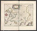
Category:17th-century maps of the Arctic
Jump to navigation
Jump to search
Subcategories
This category has only the following subcategory.
Media in category "17th-century maps of the Arctic"
The following 6 files are in this category, out of 6 total.
-
Si0151x1024.jpg 1,024 × 759; 227 KB
-
"Fretum Nassouium vulgo de Straet Nassou. " (21630353374).jpg 3,908 × 1,782; 1.12 MB
-
"Regiones sub Polo Arctico - Auctore Guiljelmo Blaeu." (22269330921).jpg 3,838 × 3,023; 2.09 MB
-
Baffin Chart of Hudson Strait.png 1,212 × 960; 1.16 MB


