Maps of France
Jump to navigation
Jump to search
 This gallery has been nominated for deletion since 11 September 2024. To discuss it, please visit the nomination page.
Do not remove this tag until the deletion nomination is closed. Reason for the nomination: Strictly redundant to the corresponding atlas page.
| |||
| |||
Ελληνικά: Χάρτες της Γαλλίας
English: Maps of France
Français : Cartes de France
日本語: フランス地図
ភាសាខ្មែរ: ផែនទីប្រទេសបារាំង
Slovenščina:
- Zemljevidi Francije.
Cartes radar
[edit]Location maps
[edit]-
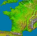
Location map for France
-
Location map for France in Europe
-
Location map for French Guiana
-
Map of Corse
-
Map of the railways of Corse
General maps from the CIA World Factbook
[edit]-
Map of France with Bulgarian text
-
Map of France with English text
-
Map of France with French text
-
Map of France with German text
-
Map of France with Gujarati text
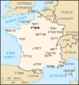
-
Map of France with Hebrew text
Historical maps
[edit]-
Provinces of France
-
Map od Aix Les Bains. 1914
-
Map of environs of Aix Les Bains. 1914
-
Map of Ajaccio. 1914
-
Map of Albi. 1914
-
Map of Angouleme. 1914
-
Map of Annecy. 1914
-
Map of Annecy Les Bauges. 1914
-
Map of Arles. 1914
-
Map of Aure. 1914
-
Map of Auvergne. 1914
-
Map of Avignon. 1914
-
Map of Palais de Papes in Avignon. 1914
-
Map of Bagneres de Bigorre. 1914
-
Map of Bagneres de Luchon. 1914
-
Map of Departement of Ille-Vilaine, centered on Rennes (1793)
Départements
[edit]Cities
[edit]-
Caen
-
Rennes
Institutions, Agences
[edit]-
régions de compétence ONEMA


