Category:Travel maps of the United States
Jump to navigation
Jump to search
Countries of the Americas: Argentina · Barbados · Belize · Bolivia · Brazil · Canada · Chile · Colombia · Costa Rica · Cuba · Dominica · Ecuador · El Salvador · Guatemala · Guyana · Haiti · Honduras · Jamaica · Mexico · Nicaragua · Panama · Paraguay · Peru · Saint Kitts and Nevis · Saint Lucia · Saint Vincent and the Grenadines · Suriname · United States of America · Uruguay · Venezuela
Other areas: Anguilla · Bermuda · British Virgin Islands · Cayman Islands · Falkland Islands · French Guiana · Greenland · Puerto Rico · Saint Barthélemy
Other areas: Anguilla · Bermuda · British Virgin Islands · Cayman Islands · Falkland Islands · French Guiana · Greenland · Puerto Rico · Saint Barthélemy
Subcategories
This category has the following 6 subcategories, out of 6 total.
*
M
T
V
Media in category "Travel maps of the United States"
The following 41 files are in this category, out of 41 total.
-
308 of 'History of Utah ... 1540-1887. (With a bibliography.)' (11116603186).jpg 1,412 × 542; 203 KB
-
A Continental Trail.png 584 × 351; 154 KB
-
A Very Short Route Through All National Parks in the Western United States.png 1,014 × 1,100; 1.15 MB
-
Annandale map.png 2,048 × 1,536; 353 KB
-
Annandale map.svg 744 × 1,052; 658 KB
-
Estados Unidos en Wikivoyage.svg 1,181 × 731; 6.59 MB
-
Map - A Thousand Mile Walk to the Gulf.jpg 1,828 × 2,656; 876 KB
-
Map of John Francis’s Journey.jpg 1,780 × 1,194; 341 KB
-
Map USA Carnivale Route.PNG 1,513 × 983; 82 KB
-
Map-USA-Mid Atlantic01 (es).png 1,643 × 1,637; 416 KB
-
Map-USA-Mid Atlantic01 (ru).png 1,643 × 1,637; 398 KB
-
Map-USA-Mid Atlantic01.png 1,643 × 1,637; 423 KB
-
Map-USA-Mid Atlantic01.svg 744 × 1,052; 744 KB
-
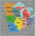
Map-USA-Midwest01.png 1,626 × 1,675; 396 KB
-
Map-USA-Midwest01.svg 744 × 1,052; 326 KB
-
Map-USA-Pacific Northwest01.svg 744 × 1,052; 274 KB
-
Map-USA-Regions (zh-hans)-美国地图.png 1,860 × 1,929; 1.11 MB
-
Map-USA-Regions01(ja).png 1,500 × 1,246; 598 KB
-
Map-USA-Regions01(pt).png 1,500 × 1,246; 684 KB
-
Map-USA-Regions01.png 1,500 × 1,246; 661 KB
-
Map-USA-Regions02 (fr).png 2,504 × 2,598; 1.64 MB
-
Map-USA-Regions02 (ru).png 1,855 × 1,924; 1.14 MB
-
Map-USA-Regions02.png 2,506 × 2,600; 1.65 MB
-
R66.png 689 × 432; 87 KB
-
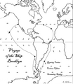
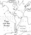
Route of the Ship Brooklyn.png 1,357 × 1,564; 354 KB
-
The California Expositions Opening on Time (1915) (14589376710).jpg 5,088 × 8,752; 4.58 MB
-
Truman1948Stops.png 4,800 × 3,600; 1.42 MB
-
TrumanOct23Nov3.png 3,000 × 1,800; 524 KB
-
TrumanOct6Oct19.png 2,400 × 3,000; 639 KB
-
TrumanSept6Oct1.png 4,800 × 3,600; 1.32 MB
-
Unicoi Turnpike map.jpg 3,504 × 2,406; 7.29 MB
-
USA regions map (cs).png 2,350 × 2,438; 1.44 MB
-
Voyage of the Ship Brooklyn.png 1,514 × 1,704; 2.7 MB
-
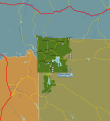
Yellowstone-area-map.png 2,261 × 2,416; 805 KB
-
Yellowstone-area-map.svg 2,386 × 2,609; 4.87 MB
-
Yellowstone-map.png 845 × 926; 258 KB


