Category:Trail maps of the United States
Jump to navigation
Jump to search
Subcategories
This category has the following 4 subcategories, out of 4 total.
Media in category "Trail maps of the United States"
The following 17 files are in this category, out of 17 total.
-
 1873 Map of Chisholm Trail with subsidiary trails in Texas.jpg 1,560 × 2,132; 2.41 MB
-

-

-
 Beargrass Creek State Nature Preserve Trail Map.jpg 2,360 × 1,239; 278 KB
-
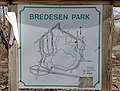 Bredesen Park Trail Map.jpg 3,855 × 2,937; 2.05 MB
-
 DSC05721 (21895439789).jpg 3,632 × 5,456; 4.53 MB
-
 East Coast Greenway Map.svg 283 × 822; 13.95 MB
-
 GAP's Boston Trail Map and Point of Interest (50066981891).jpg 3,024 × 4,032; 2.96 MB
-
 Master Plan for Yosemite National Park - Trail System.tif 8,000 × 5,207, 2 pages; 94.76 MB
-
 Natchez Trace route map via National Park Service OpenStreets.png 848 × 1,344; 471 KB
-
 NPS arches-delicate-arch-map.jpg 920 × 319; 100 KB
-
 Piney Run Park 200.JPG 4,272 × 2,848; 4.33 MB
-
 Tallapoosa County - Horseshoe Bend National Military Park - 20220711145800.jpg 3,024 × 4,032; 4.11 MB
-
 Three waysides in McPherson, Kansas (68b61db275f04d519ae73fb0dfb8a0b6).JPG 3,264 × 2,448; 1.33 MB
-
 Trail Map (12003680614).jpg 5,616 × 3,744; 3.44 MB
-
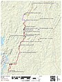 Uwharrie end to end.jpg 1,539 × 2,040; 678 KB
-
 Yellowstone Trail Map.jpg 998 × 389; 88 KB


.jpg)
.jpg)


.JPG)
.jpg)
