Category:Travel maps of Canada
Jump to navigation
Jump to search
Countries of the Americas: Argentina · Barbados · Belize · Bolivia · Brazil · Canada · Chile · Colombia · Costa Rica · Cuba · Dominica · Ecuador · El Salvador · Guatemala · Guyana · Haiti · Honduras · Jamaica · Mexico · Nicaragua · Panama · Paraguay · Peru · Saint Kitts and Nevis · Saint Lucia · Saint Vincent and the Grenadines · Suriname · United States of America · Uruguay · Venezuela
Other areas: Anguilla · Bermuda · British Virgin Islands · Cayman Islands · Falkland Islands · French Guiana · Greenland · Puerto Rico · Saint Barthélemy
Other areas: Anguilla · Bermuda · British Virgin Islands · Cayman Islands · Falkland Islands · French Guiana · Greenland · Puerto Rico · Saint Barthélemy
Subcategories
This category has the following 14 subcategories, out of 14 total.
T
- Trail maps of Canada (2 F)
- Travel maps of Nunavut (4 F)
- Travel maps of Ontario (26 F)
- Travel maps of Quebec (8 F)
V
- Travel maps of Vancouver (12 F)
- Visa maps of Canada (14 F)
Media in category "Travel maps of Canada"
The following 23 files are in this category, out of 23 total.
-
Atlantic provinces map.png 710 × 1,014; 251 KB
-
Atlantic regions (fr).png 710 × 1,014; 257 KB
-
Atlantic regions (ja).png 710 × 1,014; 203 KB
-
Atlantic regions.svg 710 × 1,014; 520 KB
-
Canada north map (fr).png 1,272 × 970; 389 KB
-
Canada north map.svg 1,084 × 920; 598 KB
-
Canada northern regions.png 1,272 × 970; 376 KB
-
Canada regions map (cs).png 1,874 × 1,791; 914 KB
-
Canada regions map (fr).png 2,000 × 1,912; 768 KB
-
Canada regions map (ru).png 2,000 × 1,912; 656 KB
-
Canada regions map.png 2,000 × 1,912; 663 KB
-
Canada regions map.svg 1,380 × 1,319; 1.37 MB
-
Canada WV region map EN.png 2,000 × 1,535; 840 KB
-
Eastern Ontario regions discussion.png 1,777 × 1,404; 2.35 MB
-
Frank Wolf Expeditions Map 2021.jpg 1,420 × 1,329; 2.32 MB
-
FRANK WOLF North American expeditions map.jpg 1,280 × 1,086; 534 KB
-
Marathon of Hope Map.png 2,500 × 1,500; 282 KB
-
McKenzie, A. - Map of America - Travel 1789.png 1,763 × 1,009; 926 KB
-
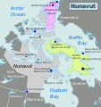
Nunavut Static Map.png 431 × 459; 163 KB
-
Nunavut Static Map.svg 460 × 490; 352 KB
-
Prairies map (fr).png 2,175 × 1,503; 1.1 MB
-
Prairies map.png 2,175 × 1,503; 1.08 MB
-
Prairies map.svg 2,175 × 1,503; 1.92 MB


