Category:Travel maps of Ontario
Jump to navigation
Jump to search
Provinces and territories of Canada: Alberta · British Columbia · Manitoba · New Brunswick · Newfoundland and Labrador · Nova Scotia · Ontario · Quebec · Saskatchewan · Nunavut ·
Media in category "Travel maps of Ontario"
The following 26 files are in this category, out of 26 total.
-
Central Ontario region map.svg 767 × 709; 3.63 MB
-
Central Ontario WV region map EN.png 1,600 × 1,480; 852 KB
-
Cityoftorontosmall.png 525 × 390; 234 KB
-
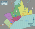
GTA regions map.png 2,344 × 1,953; 795 KB
-
GTA regions map.svg 750 × 625; 2.86 MB
-
Northern Ontario Static Map.png 5,000 × 4,561; 1.23 MB
-
Northern Ontario Static Map.svg 703 × 641; 203 KB
-
Ontario regions map (es).png 2,004 × 1,979; 231 KB
-
Ontario regions map (fr).png 2,000 × 1,979; 333 KB
-
Ontario regions map (ru).png 2,000 × 1,976; 229 KB
-
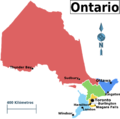
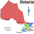
Ontario regions map.png 2,004 × 1,979; 236 KB
-
Ontario regions map.svg 377 × 379; 974 KB
-
PrescottRussell-Northeast.png 500 × 386; 218 KB
-
PrescottRussell-Northwest.png 500 × 386; 165 KB
-
PrescottRussell-South.png 500 × 386; 210 KB
-
Southwestern Counties Ontario Map Wikivoyage.png 1,405 × 2,000; 324 KB
-
Southwestern Ontario Static Map.svg 394 × 342; 29 KB
-
TOR WV entertainment-financial district map.png 1,600 × 1,073; 452 KB
-
TOR WV yonge-dundas district map.png 1,600 × 1,080; 422 KB
-
TOR WV yorkville-annex district map.png 1,600 × 1,147; 456 KB
-
Toronto districts proposal - city.png 1,200 × 877; 92 KB
-
Toronto districts proposal - downtown.png 1,200 × 991; 1.76 MB
-
Toronto printable tourist attractions map.jpg 2,105 × 1,488; 1.5 MB
-
Toronto Wikivoyage districts map.svg 5,195 × 3,794; 924 KB
-
Toronto WV districts map.png 3,000 × 2,191; 1.24 MB
-
Toronto WV downtown districts map.png 1,600 × 1,322; 631 KB


