Category:Spanish-language SVG maps of Greece
Jump to navigation
Jump to search
Media in category "Spanish-language SVG maps of Greece"
The following 73 files are in this category, out of 73 total.
-
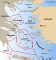
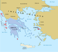
Aegean islands demilitarisation-es.svg 433 × 550; 198 KB
-
Aegean Sea map bathymetry-es.svg 3,750 × 4,560; 3.42 MB
-
Aegean Sea map-es.svg 3,750 × 4,560; 2.14 MB
-
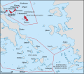
Aegean Sea with island groups labeled-es.svg 432 × 467; 336 KB
-
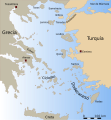
Aegean with legends-es.svg 432 × 467; 256 KB
-
AncientGreekDialects (Woodard) es.svg 660 × 555; 1.15 MB
-
Argo-saronic es.svg 901 × 774; 1.01 MB
-
Axios-Vardar river map-es.svg 1,900 × 1,279; 122 KB
-
Battle-of-Cynossema-es.svg 512 × 455; 20 KB
-
Boeotia ancient-es.svg 778 × 478; 9.13 MB
-
Chios topographic map-es.svg 1,580 × 1,150; 1.35 MB
-
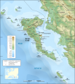
Corfu topographic map-es.svg 2,100 × 2,345; 2.49 MB
-
Cyclades-es.svg 1,483 × 1,202; 316 KB
-
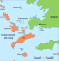
Dodekanes-es.svg 1,423 × 1,035; 6.39 MB
-
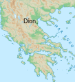
Díon location-es.svg 530 × 584; 2.92 MB
-
Epirus across Greece Albania4-es.svg 819 × 1,063; 267 KB
-
Gr-map-ES.svg 787 × 689; 5.26 MB
-
Grece 1832-es.svg 778 × 694; 281 KB
-
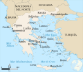
GreciaEgeoMapaTopográfico.svg 787 × 689; 17.88 MB
-
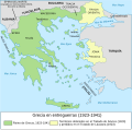
GreciaEnEntreguerras.svg 2,029 × 2,000; 420 KB
-
Greece linguistic minorities-es.svg 566 × 617; 495 KB
-
Greece, administrative divisions - es - colored.svg 1,003 × 825; 2.44 MB
-
Homeric Greece-es.svg 1,502 × 1,253; 857 KB
-
ImbrosTenedos 2-es.svg 725 × 674; 203 KB
-
Imia with legends-es.svg 570 × 588; 87 KB
-
Ionian Islands-es.svg 1,003 × 825; 782 KB
-
IslasEspóradas.svg 1,600 × 1,396; 1.96 MB
-
Isole della Grecia-es.svg 1,003 × 825; 1.48 MB
-
Korinth Isthmus es(1).svg 585 × 524; 317 KB
-
La Liga aquea en 188 aC.svg 1,848 × 1,252; 2.8 MB
-
La Liga aquea en 194 aC.svg 1,848 × 1,252; 2.78 MB
-
Lechaeum-es.svg 2,416 × 1,820; 138 KB
-
Lelantine War-es.svg 711 × 723; 279 KB
-
Life of Orpheus Greek Mythology - (Español).svg 992 × 794; 3.65 MB
-
Map athenian empire 431 BC-es.svg 993 × 794; 3.8 MB
-
Map Byzantine Empire 1025-es.svg 1,963 × 1,104; 96 KB
-
Map Byzantine Empire 1076-es.svg 1,963 × 1,104; 90 KB
-
Map Ciudades Antiguas Asia Menor.svg 728 × 991; 1.11 MB
-
Map Greco-Persian Wars-es.svg 992 × 794; 4.63 MB
-
Map Greece expansion 1832-1947-es.svg 734 × 962; 981 KB
-
Map greek sanctuaries- santuarios griegos-es.svg 993 × 793; 2.96 MB
-
Map greek sanctuaries-es.svg 992 × 794; 3.97 MB
-
Map Peloponnesian War 431 BC-es.svg 992 × 794; 4.48 MB
-
Map roman cities in Greece-es.svg 704 × 792; 3.61 MB
-
Mapa Grecia Antigua Duotono.svg 993 × 794; 2.87 MB
-
Mapa Grecia Antigua.svg 992 × 794; 3.57 MB
-
MapaTopográficoDeAlbaniaGreciaYElEgeo.svg 992 × 794; 3.44 MB
-
MapaTopográficoDeGreciaCentral.svg 920 × 617; 6.81 MB
-
Modern Greek dialects es.svg 750 × 700; 3.78 MB
-
Ohrid and Prespa lakes topographic map-es.svg 692 × 602; 5.38 MB
-
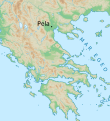
Pella location-es.svg 529 × 579; 2.92 MB
-
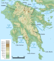
PeloponesoTopográfico.svg 708 × 474; 16.12 MB
-
PeloponesoTopográfico2.svg 1,476 × 1,656; 16.51 MB
-
Peloponnese Middle Ages map-es.svg 1,861 × 1,527; 16.63 MB
-
Pidna-es.svg 569 × 606; 3.52 MB
-
Plan Aphaia sanctuary-es.svg 1,780 × 2,780; 187 KB
-
Plan Archaeological Museum of Olympia-es.svg 1,775 × 2,110; 42 KB
-
Plan battle of Pydna-es.svg 1,520 × 2,000; 369 KB
-
Plan Olympia sanctuary-es.svg 2,500 × 1,580; 774 KB
-
Plan Pella-es.svg 389 × 500; 72 KB
-
Plan Samothrace sanctuary-es.svg 520 × 580; 90 KB
-
Plan Troy-Hisarlik-es.svg 1,280 × 1,155; 158 KB
-
Prespa lakes map-es.svg 391 × 452; 646 KB
-
RegióndeLócride.svg 1,025 × 581; 10.57 MB
-
RodasTopográfico.svg 1,048 × 595; 2.21 MB
-
RodasTopográfico2.svg 1,048 × 669; 2.54 MB
-
Saronic Gulf map-es.svg 1,490 × 1,280; 921 KB
-
Second Roman–Macedonian War-es.svg 992 × 794; 4.14 MB
-
TesaliaMapaTopográfico.svg 467 × 456; 9.4 MB
-
Tessaglia classica map-es.svg 2,044 × 2,386; 320 KB
-
Thermopylae map 480bc-es.svg 676 × 520; 39 KB
-
Topographic map of Macedonia (Greece).svg 802 × 570; 3.38 MB
-
ÉlipeMapaTopográfico.svg 414 × 471; 5.85 MB


