Category:Spanish-language SVG maps of Russia
Jump to navigation
Jump to search
Media in category "Spanish-language SVG maps of Russia"
The following 26 files are in this category, out of 26 total.
-
Bely Island-es.svg 451 × 635; 462 KB
-
Ciudades de más de un millón de habitantes en la Federación Rusa en 2017.svg 1,052 × 744; 288 KB
-
Dagestan topographic map-es.svg 400 × 512; 4.04 MB
-
Dagestan-es.svg 391 × 528; 866 KB
-
Finnish advance in Karelia during the Continuation War-es.svg 1,272 × 1,200; 339 KB
-
Franz Josef Land location-es.svg 507 × 470; 61 KB
-
Kuban basin-es.svg 1,493 × 957; 871 KB
-
Laptev Sea map-es.svg 1,498 × 839; 270 KB
-
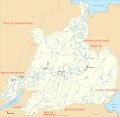
Lena es.svg 1,306 × 1,269; 931 KB
-
Map of Franz Josef Land-es.svg 1,289 × 862; 726 KB
-
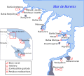
Map of Northern Fleet bases SP.svg 424 × 381; 68 KB
-
Map of Russia-es.svg 977 × 500; 231 KB
-
Mapa sujetos federales de Rusia.svg 1,131 × 1,018; 245 KB
-
Matochkin Strait-es.svg 451 × 635; 462 KB
-
Nordenskiöld Archipelago map-es.svg 843 × 898; 459 KB
-
Northern Russia and the Arctic Ocean-es.svg 855 × 557; 1.43 MB
-
Pechora-es.svg 984 × 1,065; 634 KB
-
Russky island topographic map-es.svg 1,100 × 900; 288 KB
-
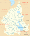
Rybinsk vdhr-es.svg 954 × 1,129; 843 KB
-
Saint-Petersburg climate diagram-es.svg 469 × 469; 95 KB
-
Severnaya Dvina es.svg 1,149 × 846; 550 KB
-
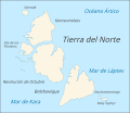
Severnaya Zemlya-es.svg 580 × 503; 15 KB
-
SevernyIsland-es.svg 451 × 635; 455 KB
-
Vostotchnye Island map-es.svg 1,053 × 1,101; 853 KB
-
Yeniseirivermap-es.svg 876 × 693; 4.96 MB
-
YuzhnyIsland-es.svg 451 × 635; 455 KB


