Category:SVG maps of Nova Scotia
Jump to navigation
Jump to search
Provinces and territories of Canada: Alberta · British Columbia · Manitoba · New Brunswick · Newfoundland and Labrador · Nova Scotia · Ontario · Prince Edward Island · Quebec · Saskatchewan · Northwest Territories · Nunavut · Yukon
Media in category "SVG maps of Nova Scotia"
The following 19 files are in this category, out of 19 total.
-
Acadie Nouvelle-Écosse.svg 1,342 × 1,096; 980 KB
-
Canada Nova Scotia location map 2.svg 1,342 × 1,096; 664 KB
-
Canada Nova Scotia location map.svg 1,342 × 1,096; 572 KB
-
Carte administrative des Provinces Maritimes du Canada.svg 2,928 × 2,106; 900 KB
-
Carte topographique des Provinces Maritimes du Canada.svg 2,928 × 2,106; 973 KB
-
Carte topographique Nouvelle-Écosse de-William Alexander 1632.svg 2,928 × 2,106; 723 KB
-
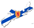
Flag-map of Nova Scotia.svg 615 × 513; 115 KB
-
Kejimkujik National Park.svg 3,146 × 1,655; 4.27 MB
-
Nouvelle-Écosse Köppen.svg 900 × 945; 580 KB
-
Nova Scotia Election 2006 - Results by Riding.svg 1,058 × 894; 389 KB
-
Nova Scotia Election 2009 - Results by Riding.svg 1,058 × 894; 365 KB
-
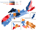
Nova Scotia Election 2013 Results Map.svg 1,018 × 1,058; 860 KB
-
Nova Scotia Election 2017 Results Map.svg 1,018 × 1,058; 844 KB
-
Nova Scotia Election Map 2013.svg 1,400 × 1,065; 164 KB
-
Nova Scotia general election, 2003 results by riding.svg 1,058 × 894; 380 KB
-
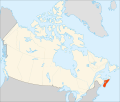
Nova Scotia in Canada (modern).svg 512 × 492; 245 KB
-
Nova Scotia Köppen.svg 900 × 945; 583 KB
-
Nova Scotia peninsula.svg 1,084 × 920; 93 KB
-
Universities in Nova Scotia.svg 860 × 680; 144 KB


