Category:SVG maps of North Rhine-Westphalia
Jump to navigation
Jump to search
Federal states of Germany:
Subcategories
This category has the following 2 subcategories, out of 2 total.
Media in category "SVG maps of North Rhine-Westphalia"
The following 55 files are in this category, out of 55 total.
-
Alsdorfer Weiher fertig Pfad.svg 2,411 × 1,540; 476 KB
-
Area of eschweiler and stolberg.svg 402 × 639; 27 KB
-
Routenplan Bus Bahn Eisenbahn Bielefeld.svg 1,024 × 768; 578 KB
-
Blausteinsee-Lageplan.svg 888 × 797; 22 KB
-
Cologne Germany street map.svg 3,127 × 5,264; 30.27 MB
-
Fußball- und Leichtathletik-Verband Westfalen location map.svg 406 × 456; 696 KB
-
Fußball-Verband Mittelrhein location map.svg 290 × 248; 695 KB
-
Fußballverband Niederrhein location map.svg 250 × 231; 696 KB
-
Karte Leichtathletik-Verband Nordrhein.svg 606 × 765; 611 KB
-
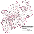
Landtagswahlkreise NRW 2017.svg 1,164 × 718; 306 KB
-
Lippe north rhine westphalia.svg 557 × 555; 1.17 MB
-
Niederkassel in SU.svg 590 × 470; 355 KB
-
Nordrhein-Westfalen Landtagswahlkarte 2017.svg 1,164 × 718; 216 KB
-
North rhine w municipalities.svg 660 × 660; 688 KB
-
North rhine w template 2 topography.svg 871 × 764; 7.65 MB
-
Kreis Gütersloh location map.svg 286 × 284; 15.15 MB
-
North Rhine-Westphalia location map 01.svg 527 × 524; 1.22 MB
-
North Rhine-Westphalia location map 04.svg 527 × 524; 1.07 MB
-
North Rhine-Westphalia location map 06.svg 527 × 524; 1.46 MB
-
North Rhine-Westphalia location map 07.svg 527 × 524; 5.32 MB
-
North Rhine-Westphalia location map G.svg 657 × 656; 607 KB
-
North Rhine-Westphalia location map 02.svg 527 × 524; 1.83 MB
-
North Rhine-Westphalia location map 03.svg 527 × 524; 6.76 MB
-
North Rhine-Westphalia location map 05.svg 527 × 524; 4.42 MB
-
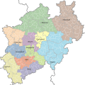
Northrhinewestphalia-regions.svg 619 × 647; 2.16 MB
-
NRW cut 5.834–7.678°E, 50.453–52.515°N.png 529 × 792; 301 KB
-
NRW cut 5.834–7.9546°E, 50.551–52.277°N2.png 598 × 792; 309 KB
-
NRW relief cut 5.834–7.6046°E, 50.551–52.277°N.png 504 × 792; 281 KB
-
NRW relief cut 5.834–8.718°E, 50.453–52.515°N.png 808 × 948; 634 KB
-
NRW Städte und Gemeinden.svg 669 × 664; 675 KB
-
Radschnellwege NRW.svg 1,053 × 1,049; 732 KB
-
Regionalverband Ruhr location map 02.svg 7,042 × 4,764; 981 KB
-
Regionalverband Ruhr location map 03.svg 7,042 × 4,764; 981 KB
-
Regionalverband Ruhr location map 04.svg 7,042 × 4,764; 1,006 KB
-
Regionalverband Ruhr location map.svg 7,042 × 4,764; 981 KB
-
Routenplan BVO und moBiel Bielefeld.svg 1,024 × 768; 554 KB
-
SPNV NRW 0x.svg 4,500 × 3,000; 348 KB
-
SPNV NRW 1x.svg 4,500 × 3,000; 339 KB
-
SPNV NRW 2x.svg 4,500 × 3,000; 333 KB
-
SPNV NRW 3x.svg 4,500 × 3,000; 338 KB
-
SPNV NRW 4x.svg 4,500 × 3,000; 336 KB
-
SPNV NRW 5x.svg 4,500 × 3,000; 329 KB
-
SPNV NRW 6x.svg 4,500 × 3,000; 331 KB
-
SPNV NRW 7x.svg 4,500 × 3,000; 329 KB
-
SPNV NRW 8x.svg 4,500 × 3,000; 326 KB
-
SPNV NRW 9x.svg 4,500 × 3,000; 331 KB
-
SPNV NRW abellio.svg 4,500 × 3,000; 331 KB
-
SPNV NRW eurobahn.svg 4,500 × 3,000; 336 KB
-
SPNV NRW Hagen Hbf.svg 4,500 × 3,000; 339 KB
-
SPNV NRW RRX.svg 4,500 × 3,000; 311 KB
-
SPNV NRW S.svg 4,500 × 3,000; 346 KB
-
SPNV NRW.svg 4,500 × 3,000; 326 KB
-
Transport corridors in North Rheine-Westphalia DE.svg 540 × 520; 990 KB
-
Wahlkreise NRW 2017.svg 717 × 711; 730 KB
-
WDR Lokalzeit-Studios.svg 660 × 660; 662 KB


