Category:SVG maps of Brandenburg
Jump to navigation
Jump to search
Federal states of Germany:
Subcategories
This category has the following 2 subcategories, out of 2 total.
Media in category "SVG maps of Brandenburg"
The following 22 files are in this category, out of 22 total.
-
Brandenburg in German Democratic Republic 1949 - 1952.svg 618 × 789; 574 KB
-
Brandenburg Kreise (nummeriert).svg 401 × 401; 37 KB
-
Brandenburg location map G.svg 1,022 × 1,075; 438 KB
-
Brandenburg location map.svg 1,022 × 1,075; 275 KB
-
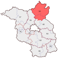
BWahlkreis 58.svg 530 × 530; 45 KB
-
Brandenburg Kommunalwahlen 2014 Kandidaten BVB Freie Waehler.svg 1,022 × 1,075; 430 KB
-
Flag map of Brandenburg.svg 943 × 955; 88 KB
-
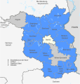
Karte der Ämter in Brandenburg (svg).svg 584 × 610; 399 KB
-
Karte NORDAL.svg 2,269 × 3,840; 956 KB
-
Deutschland Lage von Berlin Brandenburg.svg 592 × 801; 109 KB
-
Landkreise Brandenburg.svg 825 × 826; 115 KB
-
Landkreise Brandenburg BIP-NUTS-Regionen.svg 1,000 × 1,000; 183 KB
-
Landtagswahlkarte Brandenburg 1994.svg 1,042 × 708; 483 KB
-
Landtagswahlkarte Brandenburg 1999.svg 1,042 × 708; 483 KB
-
Landtagswahlkarte Brandenburg 2004.svg 1,042 × 708; 329 KB
-
Landtagswahlkarte Brandenburg 2009.svg 1,042 × 708; 329 KB
-
Landtagswahlkarte Brandenburg 2014.svg 1,042 × 708; 326 KB
-
Landtagswahlkarte Brandenburg 2019.svg 1,042 × 708; 329 KB
-
Landtagswahlkreise Brandenburg 2004.svg 1,042 × 708; 192 KB
-
Landtagswahlkreise Brandenburg 2014.svg 1,042 × 708; 293 KB
-
Landtagswahlkreise Brandenburg 2024.svg 1,042 × 708; 193 KB
-
Municipalities in Brandenburg.svg 668 × 603; 5.47 MB


