Category:SVG locator maps of counties of England
Jump to navigation
Jump to search
Subcategories
This category has the following 3 subcategories, out of 3 total.
Media in category "SVG locator maps of counties of England"
The following 110 files are in this category, out of 110 total.
-
Bedfordshire UK location map.svg 1,120 × 1,266; 1.34 MB
-
Berkshire UK location map.svg 1,425 × 741; 1.51 MB
-
BNPcounties.svg 1,108 × 1,345; 303 KB
-
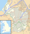
Bristol UK location map.svg 1,138 × 1,266; 683 KB
-
Buckinghamshire UK location map.svg 1,070 × 1,266; 2.13 MB
-
Cambridgeshire UK location map.svg 1,125 × 1,266; 1.79 MB
-
Ceremonial counties of England labeled.svg 1,129 × 1,385; 132 KB
-
Ceremonial counties of England.svg 1,129 × 1,385; 107 KB
-
Cheshire UK location map.svg 1,425 × 1,098; 2.23 MB
-
ConservativePartycounties.svg 1,108 × 1,345; 302 KB
-
Cornwall UK location map.svg 1,425 × 1,048; 1.66 MB
-
Cornwall UK mainland location map.svg 1,224 × 1,187; 1.67 MB
-
Cumberland en 1851.svg 1,108 × 1,345; 329 KB
-
Cumbria UK location map.svg 1,140 × 1,345; 2.05 MB
-
Derbyshire UK location map.svg 884 × 1,305; 2.38 MB
-
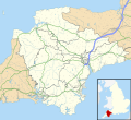
Devon UK location map.svg 1,292 × 1,187; 2.43 MB
-
Dorset UK location map.svg 1,425 × 990; 1.64 MB
-
Durham UK location map.svg 1,425 × 934; 1.39 MB
-
East Riding of Yorkshire UK location map.svg 1,425 × 1,107; 1.33 MB
-
East Sussex UK location map.svg 1,425 × 928; 1.35 MB
-
Eng County.svg 1,129 × 1,385; 108 KB
-
England and Wales Historic Counties HCT map.svg 1,108 × 1,345; 955 KB
-
EnglandYorkshire1851.svg 956 × 1,265; 136 KB
-
English ceremonial counties 1996.svg 1,108 × 1,345; 307 KB
-
English ceremonial counties 1997.svg 1,108 × 1,345; 307 KB
-
English ceremonial counties 1998 (named).svg 1,108 × 1,345; 346 KB
-
English ceremonial counties 1998 (numbered).svg 1,108 × 1,345; 348 KB
-
English ceremonial counties 1998.svg 1,108 × 1,345; 306 KB
-
English ceremonial counties 2010 (multi-coloured).svg 1,129 × 1,385; 299 KB
-
English counties 1974 (named).svg 1,108 × 1,345; 527 KB
-
English counties 1974 (numbered).svg 1,108 × 1,345; 528 KB
-
English counties 1974.svg 1,108 × 1,345; 487 KB
-
English county councils 2021.svg 1,108 × 1,345; 371 KB
-
English metropolitan and non-metropolitan counties 1996.svg 1,108 × 1,345; 482 KB
-
English metropolitan and non-metropolitan counties 1997.svg 1,108 × 1,345; 481 KB
-
English metropolitan and non-metropolitan counties 1998.svg 1,108 × 1,345; 481 KB
-
English metropolitan and non-metropolitan counties 2009 (numbered).svg 1,108 × 1,345; 557 KB
-
English metropolitan and non-metropolitan counties 2009.svg 1,108 × 1,345; 480 KB
-
English metropolitan and non-metropolitan counties by type 2009.svg 1,108 × 1,345; 340 KB
-
English metropolitan and non-metropolitan counties coloured map 2019.svg 1,108 × 1,345; 480 KB
-
English metropolitan and non-metropolitan counties coloured map 2021.svg 1,108 × 1,345; 482 KB
-
English metropolitan and non-metropolitan counties coloured map 2023.svg 1,108 × 1,345; 485 KB
-
English metropolitan and non-metropolitan counties map coloured by type 2019.svg 1,108 × 1,345; 349 KB
-
English metropolitan and non-metropolitan counties map coloured by type 2021.svg 1,108 × 1,345; 351 KB
-
English metropolitan and non-metropolitan counties map coloured by type 2023.svg 1,108 × 1,345; 354 KB
-
English metropolitan and non-metropolitan counties numbered map 2019.svg 1,108 × 1,345; 556 KB
-
English metropolitan and non-metropolitan counties numbered map 2021.svg 1,108 × 1,345; 558 KB
-
English metropolitan and non-metropolitan counties numbered map 2023.svg 1,108 × 1,345; 563 KB
-
English metropolitan counties 2009.svg 1,108 × 1,345; 340 KB
-
English metropolitan counties map 2021.svg 1,108 × 1,345; 348 KB
-
English non-metropolitan counties 2009.svg 1,108 × 1,345; 340 KB
-
English non-metropolitan counties 2021.svg 1,108 × 1,345; 363 KB
-
English non-metropolitan counties coloured by type map 2019.svg 1,108 × 1,345; 464 KB
-
English non-metropolitan counties coloured by type map 2020.svg 1,108 × 1,345; 463 KB
-
English non-metropolitan counties coloured by type map 2021.svg 1,108 × 1,345; 465 KB
-
English non-metropolitan counties coloured by type map 2023.svg 1,108 × 1,345; 469 KB
-
English non-metropolitan counties map 2019.svg 1,108 × 1,345; 347 KB
-
English non-metropolitan counties map 2021.svg 1,108 × 1,345; 348 KB
-
English non-metropolitan counties map 2023.svg 1,108 × 1,345; 352 KB
-
English unitary authorities 2009.svg 1,039 × 1,261; 1 MB
-
English unitary authorities 2020.svg 831 × 1,009; 1.3 MB
-
English unitary authorities 2021.svg 1,108 × 1,345; 371 KB
-
English unitary authorities map 2019.svg 1,108 × 1,345; 392 KB
-
English unitary authorities map 2020.svg 1,108 × 1,345; 392 KB
-
English unitary authorities map 2021.svg 1,108 × 1,345; 394 KB
-
English unitary authorities map 2023.svg 1,108 × 1,345; 397 KB
-
Essex UK location map.svg 1,425 × 1,141; 2.52 MB
-
Former postal counties of England.svg 1,108 × 1,345; 297 KB
-
Gloucestershire UK location map.svg 1,089 × 1,266; 2.27 MB
-
Greater London UK location map 2.svg 1,425 × 1,140; 2.18 MB
-
Greater London UK location map.svg 1,425 × 1,140; 1.73 MB
-
Greater Manchester UK location map 2.svg 1,425 × 993; 1.73 MB
-
Greater Manchester UK location map.svg 1,425 × 993; 1.49 MB
-
Hampshire UK location map.svg 1,425 × 1,213; 2.35 MB
-
Herefordshire UK location map.svg 999 × 1,266; 1.55 MB
-
Hertfordshire UK location map.svg 1,425 × 992; 1.84 MB
-
Isle of Wight UK location map.svg 1,425 × 868; 843 KB
-
Kent UK location map.svg 1,425 × 1,000; 2.11 MB
-
Lancashire UK location map.svg 1,116 × 1,305; 2.3 MB
-
Leicestershire UK location map.svg 1,425 × 1,123; 2.23 MB
-
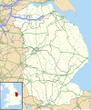
Lincolnshire UK location map.svg 1,086 × 1,305; 2.71 MB
-
Local Government Act 1985 English metropolitan counties abolished.svg 1,108 × 1,345; 340 KB
-
Merseyside UK location map.svg 1,231 × 1,305; 1.3 MB
-
Middlesex ĝis 1881.svg 1,108 × 1,345; 323 KB
-
Norfolk UK location map.svg 1,425 × 886; 1.93 MB
-
North Yorkshire UK location map (1974-2023).svg 1,425 × 1,037; 3.22 MB
-
North Yorkshire UK location map (2023).svg 1,425 × 1,037; 2.88 MB
-
Northamptonshire UK location map (1974-2021).svg 1,106 × 1,266; 2 MB
-
Northamptonshire UK location map (2021).svg 1,037 × 1,187; 1.95 MB
-
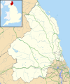
Northumberland UK location map.svg 1,120 × 1,345; 1.68 MB
-
Nottinghamshire UK location map.svg 1,030 × 1,305; 1.95 MB
-
Oxfordshire UK location map.svg 1,077 × 1,266; 1.98 MB
-
Rutland UK location map.svg 1,425 × 1,140; 856 KB
-
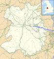
Shropshire UK location map.svg 1,198 × 1,305; 2.13 MB
-
Somerset UK location map.svg 1,425 × 901; 2.38 MB
-
South Yorkshire UK location map.svg 1,425 × 974; 1.47 MB
-
Staffordshire UK location map.svg 1,024 × 1,305; 2.68 MB
-
Suffolk UK location map.svg 1,425 × 927; 1.82 MB
-
Surrey UK location map.svg 1,425 × 1,081; 1.93 MB
-
Sussex en 1851.svg 1,108 × 1,345; 323 KB
-
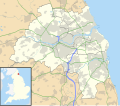
Tyne and Wear UK location map.svg 1,425 × 1,252; 1.09 MB
-
Warwickshire UK location map.svg 1,042 × 1,266; 2.18 MB
-
West Midlands UK location map.svg 1,425 × 974; 1.35 MB
-
West Sussex UK location map.svg 1,425 × 995; 1.49 MB
-
West Yorkshire UK location map.svg 1,425 × 1,039; 1.76 MB
-
Westmorland en 1851.svg 1,108 × 1,345; 323 KB
-
Wiltshire UK location map.svg 1,039 × 1,266; 1.76 MB
-
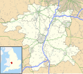
Worcestershire UK location map.svg 1,425 × 1,262; 1.8 MB
-
Yorkshire UK 1851 locator map.svg 1,108 × 1,345; 310 KB
-
Yorkshire UK locator map.svg 1,108 × 1,345; 303 KB


