Category:SVG blank district maps of counties of England
Jump to navigation
Jump to search
Media in category "SVG blank district maps of counties of England"
The following 62 files are in this category, out of 62 total.
-
Bedfordshire UK district map (blank).svg 1,120 × 1,266; 675 KB
-
Berkshire UK district map (blank).svg 1,425 × 741; 735 KB
-
Bristol UK district map (blank).svg 1,138 × 1,266; 488 KB
-
Buckinghamshire UK district map 2010 (blank).svg 1,070 × 1,266; 921 KB
-
Buckinghamshire UK district map 2020 (blank).svg 1,070 × 1,266; 874 KB
-
Cambridgeshire UK district map (blank).svg 1,125 × 1,266; 894 KB
-
Cheshire UK district map (blank).svg 1,425 × 1,098; 999 KB
-
Cornwall UK district map (blank).svg 1,425 × 1,048; 1.1 MB
-
Cornwall UK mainland district map (blank).svg 1,224 × 1,187; 1.08 MB
-
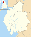
Cumbria UK district map 2010 (blank).svg 1,140 × 1,345; 1.2 MB
-
Cumbria UK district map 2023 (blank).svg 1,140 × 1,345; 1.14 MB
-
Derbyshire districts transparent overlay.svg 360 × 530; 199 KB
-
Derbyshire UK district map (blank).svg 884 × 1,305; 1,000 KB
-
Devon UK district map (blank).svg 1,292 × 1,187; 1.43 MB
-
Dorset UK district map 2010 (blank).svg 1,425 × 990; 998 KB
-
Dorset UK district map 2019 (blank).svg 1,425 × 990; 753 KB
-
Durham UK district map (blank).svg 1,425 × 934; 756 KB
-
East Riding of Yorkshire UK district map (blank).svg 1,425 × 1,107; 767 KB
-
East Sussex UK district map (blank).svg 1,425 × 928; 787 KB
-
Essex UK district map (blank).svg 1,425 × 1,141; 1.41 MB
-
Gloucestershire UK district map (blank).svg 1,089 × 1,266; 1.09 MB
-
Greater London UK district map (blank).svg 1,425 × 1,140; 1.05 MB
-
Greater Manchester UK district map (blank).svg 1,425 × 993; 860 KB
-
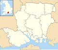
Hampshire UK district map (blank).svg 1,425 × 1,213; 1.23 MB
-
Herefordshire UK district map (blank).svg 999 × 1,266; 758 KB
-
Hertfordshire UK district map (blank).svg 1,425 × 992; 846 KB
-
Isle of Wight UK district map (blank).svg 1,425 × 868; 617 KB
-
Isle of Wight UK district map 1974.svg 1,425 × 868; 639 KB
-
Kent UK district map (blank).svg 1,425 × 1,000; 1.18 MB
-
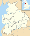
Lancashire UK district map (blank).svg 1,116 × 1,305; 1.25 MB
-
Leicestershire UK district map (blank).svg 1,425 × 1,123; 1,021 KB
-
Lincolnshire UK district map (blank).svg 1,086 × 1,305; 1.27 MB
-
Liverpool City Region UK map.svg 770 × 797; 888 KB
-
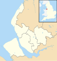
Merseyside UK district map (blank).svg 1,231 × 1,305; 782 KB
-
Norfolk UK district map (blank).svg 1,425 × 886; 1.13 MB
-
North Yorkshire UK district map 2010 (blank).svg 1,425 × 1,037; 1.26 MB
-
North Yorkshire UK district map 2023 (blank).svg 1,425 × 1,037; 1.11 MB
-
Northamptonshire districts transparent overlay.svg 380 × 410; 153 KB
-
Northamptonshire UK district map (blank).svg 1,106 × 1,266; 995 KB
-
Northamptonshire UK district map 2021 (blank).svg 1,106 × 1,266; 930 KB
-
Northumberland UK district map (blank).svg 1,120 × 1,345; 836 KB
-
Nottinghamshire UK district map (blank).svg 1,030 × 1,305; 906 KB
-
Oxfordshire UK district map (blank).svg 1,077 × 1,266; 921 KB
-
Rutland UK district map (blank).svg 1,425 × 1,140; 564 KB
-
Shropshire UK district map (blank).svg 1,198 × 1,305; 945 KB
-
Somerset districts transparent overlay.svg 600 × 400; 189 KB
-
Somerset UK district map 2010 (blank).svg 1,425 × 901; 1.16 MB
-
Somerset UK district map 2019 (blank).svg 1,425 × 901; 1.15 MB
-
Somerset UK district map 2023 (blank).svg 1,425 × 901; 1.05 MB
-
South Yorkshire UK district map (blank).svg 1,425 × 974; 691 KB
-
Staffordshire UK district map (blank).svg 1,024 × 1,305; 1.03 MB
-
Suffolk UK district map 2010 (blank).svg 1,425 × 927; 995 KB
-
Suffolk UK district map 2020 (blank).svg 1,425 × 927; 1,024 KB
-
Surrey UK district map (blank).svg 1,425 × 1,081; 948 KB
-
Tyne and Wear UK district map (blank).svg 1,425 × 1,252; 683 KB
-
Warwickshire UK district map (blank).svg 1,042 × 1,266; 909 KB
-
West Midlands UK district map (blank).svg 1,425 × 974; 720 KB
-
West Sussex UK district map (blank).svg 1,425 × 995; 896 KB
-
West Yorkshire UK district map (blank).svg 1,425 × 1,039; 765 KB
-
Wiltshire UK district map (blank).svg 1,039 × 1,266; 741 KB
-
Worcestershire UK district map (blank).svg 1,425 × 1,262; 890 KB
-
Worcestershire UK district map numbered.svg 1,425 × 1,262; 898 KB


