
Category:Roads in Illinois
States of the United States: Alabama · Alaska · Arizona · Arkansas · California · Colorado · Connecticut · Delaware · Florida · Georgia · Hawaii · Idaho · Illinois · Indiana · Iowa · Kansas · Kentucky · Louisiana · Maine · Maryland · Massachusetts · Michigan · Minnesota · Mississippi · Missouri · Montana · Nebraska · Nevada · New Hampshire · New Jersey · New Mexico · New York · North Carolina · North Dakota · Ohio · Oklahoma · Oregon · Pennsylvania · Rhode Island · South Carolina · South Dakota · Tennessee · Texas · Utah · Vermont · Virginia · Washington · West Virginia · Wisconsin · Wyoming – District of Columbia: Washington, D.C.
Puerto Rico
Puerto Rico
Wikimedia category | |||||
| Upload media | |||||
| Instance of | |||||
|---|---|---|---|---|---|
| Category combines topics | |||||
| Illinois | |||||
state of the United States of America .jpg)    | |||||
| Pronunciation audio | |||||
| Instance of | |||||
| Part of | |||||
| Named after | |||||
| Location |
| ||||
| Located in or next to body of water |
| ||||
| Capital | |||||
| Legislative body | |||||
| Highest judicial authority | |||||
| Official language |
| ||||
| Anthem |
| ||||
| Head of government |
| ||||
| Inception |
| ||||
| Highest point |
| ||||
| Population |
| ||||
| Area |
| ||||
| Elevation above sea level |
| ||||
| Different from | |||||
| Maximum temperature record |
| ||||
| Minimum temperature record |
| ||||
| official website | |||||
 | |||||
Subcategories
This category has the following 22 subcategories, out of 22 total.
Media in category "Roads in Illinois"
The following 27 files are in this category, out of 27 total.
-
 119th Street looking east (3410211866).jpg 1,050 × 756; 259 KB
-

-
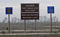 AASHO Test Road Site.jpg 541 × 332; 37 KB
-
 Abandoned highway segment 20150911 03 U S 66, McCook, Illinois.jpg 2,816 × 2,112; 1.65 MB
-

-
 Corn fields near Royal, Illinois (cropped).jpg 6,504 × 2,200; 4.9 MB
-
 Corn fields near Royal, Illinois.jpg 10,421 × 2,200; 7.63 MB
-
 End Lincoln Heritage Trail and Lincoln Trail Homestead State Park signs.jpg 3,456 × 2,304; 1.62 MB
-
 End of the Line, Concordia Cemetery.jpg 1,576 × 1,088; 617 KB
-
 Euclid Avenue in southern Palatine, Illinois.jpg 4,032 × 3,024; 5.25 MB
-
 Grant Highway Markers, Bartlett, Illinois.jpg 680 × 1,023; 481 KB
-
 Historic highways of America (Volume 8) - IV.jpg 1,339 × 1,109; 731 KB
-
 IL 81 approaching I 74.jpg 4,608 × 3,456; 5.45 MB
-
 Ill 106.jpg 5,184 × 3,456; 5.69 MB
-
 Ill 57.jpg 5,184 × 3,456; 6.63 MB
-
 La Prairie Road East Curves (41149628670).jpg 2,400 × 1,600; 2.36 MB
-
 La Prairie Road East Yellow Wildflowers (42058193465).jpg 2,400 × 1,600; 2.33 MB
-
 Lake Cook Road.jpg 3,082 × 2,323; 1.84 MB
-
 LAKE MICHIGAN STORM FLOODED THIS ROAD IN ZION - NARA - 547185.jpg 3,000 × 2,016; 837 KB
-
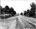
 Muddy Road Illinois 1903.PNG 351 × 262; 177 KB
-
 Ohio fg01.jpg 1,600 × 1,200; 193 KB
-
 Path at Red Hills State Park in Fall.jpg 952 × 714; 282 KB
-
 Public square in Barry, western side.jpg 6,016 × 4,000; 6.74 MB
-
 Road with wagon tracks (3409402797).jpg 1,050 × 757; 216 KB
-
 Six Flags Great America's Entrance.jpg 2,592 × 1,944; 1.08 MB
-

-
 Wayne2011Snow.png 1,513 × 1,285; 3.2 MB
.jpg)
.JPG)


.JPG)


_-_IV.jpg)


.jpg)
.jpg)


.jpg)

.JPG)

.jpg)