Category:Roads in Connecticut
Jump to navigation
Jump to search
States of the United States: Alabama · Alaska · Arizona · Arkansas · California · Colorado · Connecticut · Delaware · Florida · Georgia · Hawaii · Idaho · Illinois · Indiana · Iowa · Kansas · Kentucky · Louisiana · Maine · Maryland · Massachusetts · Michigan · Minnesota · Mississippi · Missouri · Montana · Nebraska · Nevada · New Hampshire · New Jersey · New Mexico · New York · North Carolina · North Dakota · Ohio · Oklahoma · Oregon · Pennsylvania · Rhode Island · South Carolina · South Dakota · Tennessee · Texas · Utah · Vermont · Virginia · Washington · West Virginia · Wisconsin · Wyoming – District of Columbia: Washington, D.C.
Puerto Rico
Puerto Rico
Wikimedia category | |||||
| Upload media | |||||
| Instance of | |||||
|---|---|---|---|---|---|
| Category combines topics | |||||
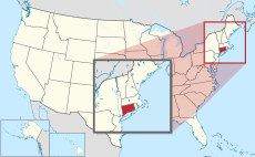
| Connecticut | |||||
state of the United States of America | |||||
| Pronunciation audio | |||||
| Instance of | |||||
| Part of | |||||
| Named after | |||||
| Location |
| ||||
| Located in or next to body of water | |||||
| Capital | |||||
| Legislative body | |||||
| Executive body | |||||
| Highest judicial authority | |||||
| Anthem |
| ||||
| Head of government |
| ||||
| Inception |
| ||||
| Highest point | |||||
| Population |
| ||||
| Area |
| ||||
| Elevation above sea level |
| ||||
| Replaces | |||||
| Different from | |||||
| Maximum temperature record |
| ||||
| Minimum temperature record |
| ||||
| official website | |||||
 | |||||
Subcategories
This category has the following 19 subcategories, out of 19 total.
Media in category "Roads in Connecticut"
The following 57 files are in this category, out of 57 total.
-
A Winding Auto Route through the Litchfield Hills, Torrington, Conn (67064).jpg 3,302 × 2,096; 2.99 MB
-
Atwoodville Road, Atwoodville CT.jpg 4,032 × 3,024; 5.21 MB
-
Autobahn in Connecticut.jpg 4,032 × 3,024; 6.25 MB
-
Bend in Broad Brook Road, Ellington CT.jpg 4,032 × 3,024; 5.29 MB
-
Bipartisan Infrastructure Law Sign in Avon, CT.jpg 2,620 × 2,015; 2.84 MB
-
Birchwood Road, Windsor CT.jpg 4,032 × 3,024; 5.96 MB
-
Blain Road, West Thompson CT.jpg 4,032 × 3,024; 6.88 MB
-
Capitol Avenue - Hartford (36127790493).jpg 2,400 × 1,600; 2.23 MB
-
Conlan Highway and Conn. River entering Hartford, Conn (78042).jpg 3,305 × 2,172; 2.86 MB
-
CoventryCT HutchinsonRoad.jpg 1,024 × 680; 248 KB
-
DowntownNewHaven-ShadeTrees (36127773833).jpg 2,400 × 1,600; 2.93 MB
-
English Drive, East Rock Park, New Haven, Conn (61793).jpg 3,310 × 2,170; 2.92 MB
-
Fabyan Road, Fabyan CT.jpg 4,032 × 3,024; 4.73 MB
-
Fitchville Road, Fitchville CT.jpg 4,032 × 3,024; 4.67 MB
-
Griffin Road, South Windsor CT.jpg 4,032 × 3,024; 6.63 MB
-
Griswold Road, Griswoldville CT.jpg 4,032 × 3,024; 6.18 MB
-
Hanover Road, Hanover CT.jpg 4,032 × 3,024; 5.94 MB
-
HartfordCT WestBoulevardHD.jpg 1,024 × 680; 296 KB
-
Hayden Station Road, Hayden Station CT.jpg 4,032 × 3,024; 5.39 MB
-
Hungary Road northbound, Granby CT.jpg 4,032 × 3,024; 4.7 MB
-
Hungary Road, Granby CT.jpg 4,032 × 3,024; 6.62 MB
-
Johnsonville Road, Johnsonville CT.jpg 4,032 × 3,024; 5.94 MB
-
MA-CT-StateLineMarker-Rt189 (32217121104).jpg 1,600 × 2,400; 2.61 MB
-
Moore Avenue, Winsted CT.jpg 4,032 × 3,024; 7 MB
-
Moose Meadow Road, East Willington CT.jpg 4,032 × 3,024; 5.29 MB
-
Mountain Ave at Duncaster Rd, Bloomfield CT.jpg 4,032 × 3,024; 5.95 MB
-
NewHavenRoads-ToInt95Int91signs (36101894614).jpg 2,400 × 1,600; 1.76 MB
-
NewtownCT ReservoirRoad RochambeauRoute.jpg 1,024 × 680; 279 KB
-
Oakdale Road, Oakdale CT.jpg 4,032 × 3,024; 7.22 MB
-
Old West Thompson Road entering West Thompson Lake, West Thompson CT.jpg 4,032 × 3,024; 6.47 MB
-
Old West Thompson Road, West Thompson CT.jpg 4,032 × 3,024; 7.99 MB
-
Pine Hill Drive, Simsbury CT.jpg 4,032 × 3,024; 6.67 MB
-
PlainfieldCT MarchRoute OldCanterburyRoad.jpg 1,024 × 680; 289 KB
-
PomfretCT MashamoquetBrookStatePark Roadway.jpg 1,024 × 680; 229 KB
-
Quaddick Road, Quaddick CT.jpg 4,032 × 3,024; 9.9 MB
-
Quinebaug-Nehantic Crossover Trail's Lee Road section.jpg 2,592 × 1,936; 2.55 MB
-
Recreation Drive, Roton Point, South Norwalk, Conn (66863).jpg 3,350 × 2,150; 2.83 MB
-
RidgefieldCT RidgeburyRoad RochambeauRoute.jpg 1,024 × 680; 224 KB
-
Rising Corner Road, Rising Corner CT.jpg 4,032 × 3,024; 5.25 MB
-
Road-to-chester-swamp.png 3,020 × 2,008; 12.08 MB
-
Rochambeau Route, Manship and Barstow Rds junction, Canterbury, CT.JPG 2,592 × 1,944; 1.86 MB
-
Rochambeau Route, Manship Rd from Westminster Rd, Canterbury, CT.JPG 1,944 × 2,592; 2.23 MB
-
Rochambeau Route, Manship Rd, Canterbury, CT.JPG 2,592 × 1,944; 2.01 MB
-
Schoephoester Road To I-91 and CT20 (32247232003).jpg 2,400 × 1,600; 1.89 MB
-
ScotlandCT PalmerRoadRochambeauRoute 1.jpg 1,024 × 680; 278 KB
-
ScotlandCT PalmerRoadRochambeauRoute 2.jpg 1,024 × 680; 277 KB
-
Sodom Road, Somers CT.jpg 4,032 × 3,024; 6.97 MB
-
South Brooksvale historic district sign, Cheshire CT.jpg 4,032 × 3,024; 6.71 MB
-
Sun shower on Round Hill Road, Cheshire CT.jpg 4,032 × 3,024; 3.77 MB
-
Sunrise Hill, Sunrise State Park, East Haddam CT.jpg 4,032 × 3,024; 10.77 MB
-
Thrall Road, Windsor CT.jpg 4,032 × 3,024; 3.31 MB
-
ToInt91Int84signsHartford (39409467731).jpg 1,600 × 2,400; 1.69 MB
-
Village Hill Road, Lebanon CT.jpg 4,032 × 3,024; 6.51 MB
-
Waterman Road, Lebanon CT.jpg 4,032 × 3,024; 5.83 MB
-
Wauregan Road, West Wauregan CT.jpg 4,032 × 3,024; 4.54 MB
-
Williamsville Road, Rogers CT.jpg 4,032 × 3,024; 4.02 MB
-
York Street, New Haven.jpg 2,592 × 1,944; 1.04 MB


