Category:OpenStreetMap maps of Baden-Württemberg
Jump to navigation
Jump to search
Federal states of Germany:
Urban districts (cities): Freiburg · Heilbronn · Karlsruhe · Mannheim · Stuttgart ·
Subcategories
This category has the following 5 subcategories, out of 5 total.
*
M
S
Media in category "OpenStreetMap maps of Baden-Württemberg"
The following 86 files are in this category, out of 86 total.
-
24 Stops.svg 823 × 605; 1.89 MB
-
Urzeitliche Fundstellen um Blaubeuren.png 865 × 486; 259 KB
-
Anschlussstelle Ulm West an der A8.png 1,521 × 1,135; 372 KB
-
Archéoparc Vogelherd openstreetmap plan 2.png 967 × 533; 83 KB
-
Archéoparc Vogelherd openstreetmap plan 3.png 959 × 538; 91 KB
-
Baden-Württemberg Land-Stadt-Fluss.jpg 8,735 × 10,240; 11.26 MB
-
Befundplan Brückenkopfkastelle Zuzach-Rheinheim.png 1,512 × 1,106; 851 KB
-
Befundskizze spätrömische Kastelle in Zurzach (CH) und Rheinheim (D).png 1,512 × 1,106; 835 KB
-
Brettach-verlauf.png 1,274 × 940; 1.01 MB
-
BudS - Baden-Württemberg - Bevölkerungsdichte Kommunen.jpg 8,735 × 10,240; 16.55 MB
-
BudS - Baden-Württemberg Topo.jpg 8,735 × 10,240; 62.65 MB
-
Campus FES Lörrach.png 664 × 993; 413 KB
-
Clinicumsgasse in Tübingen (OpenStreetMap).png 2,000 × 1,018; 573 KB
-
D-BW-Friedrichshafen - OpenStreetMap.png 802 × 774; 669 KB
-
DB 4260 railway map.png 1,517 × 1,088; 2.28 MB
-
DB 4310 railway map.png 1,413 × 1,009; 1.9 MB
-
DB 4423 railway map.png 1,641 × 1,099; 2.55 MB
-
Elsenz OSM.png 718 × 1,296; 1.52 MB
-
Freiburg map.png 1,265 × 973; 2.77 MB
-
Freundeskreis Feldbahn in Leutenbach-Nellmersbach (OpenStreetMap).jpg 1,765 × 687; 132 KB
-
Friedingen 1.png 1,146 × 777; 677 KB
-
Friedingen 3.png 1,399 × 711; 571 KB
-
Gemarkung und Lage der Gemeinde Igersheim (kompakt).png 401 × 498; 141 KB
-
Gemarkung und Lage der Gemeinde Igersheim.png 1,380 × 868; 662 KB
-
Geniesserpfad-karlsruher-grat.png 2,502 × 1,228; 3.37 MB
-
Haaggasse in Tübingen (OpenStreetMap).png 1,361 × 665; 529 KB
-
Lagekarte Knorrsche Zichorienfabrik Heilbronn Bahnhofsvorstadt.png 2,633 × 1,921; 807 KB
-
Heutiger Grenzverlauf zwischen Baden-Württemberg und dem Kanton Schaffhausen.png 1,052 × 616; 744 KB
-
Hinterzarten OSM 01.png 1,122 × 692; 1.13 MB
-
Hinterzarten OSM 02.png 1,122 × 692; 1.91 MB
-
Hinterzarten OSM 03.png 1,284 × 1,030; 1.73 MB
-
Hoheneck Herbertingen Verlauf.png 854 × 951; 1.22 MB
-
Industrie- und Hafenbahn Heilbronn.png 1,519 × 832; 584 KB
-
Kaisersträßle Radweg.png 1,449 × 482; 464 KB
-
Tram-Liniennetz VBK Stadtkreis Karlsruhe 2009.png 2,246 × 2,121; 1.95 MB
-
Tram-Liniennetz VBK Stadtkreis Karlsruhe 2009.svg 1,078 × 1,018; 4.01 MB
-
Karte der Stadtmauer Waiblingen.svg 650 × 651; 306 KB
-
Karte PZN in Wiesloch Openmap 2017.jpg 1,005 × 657; 114 KB
-
Karte Rheinstetten-Forchheim und Silberstreifen.svg 2,490 × 2,311; 11.85 MB
-
Karte Rheinstetten-Forchheim.svg 2,114 × 1,676; 7.83 MB
-
Karte Rheinstetten-Mörsch.svg 1,514 × 1,084; 7.39 MB
-
Karte Rheinstetten-Neuburgweier mit Fermasee.svg 1,088 × 1,480; 3.05 MB
-
Karte Rheinstetten-Neuburgweier.svg 1,081 × 855; 2.31 MB
-
Karte Rheinstetten-Silberstreifen.svg 2,698 × 1,980; 3.29 MB
-
Karte Tunnel Rastatt.png 1,237 × 1,217; 486 KB
-
Karte Waldheide OSM roh.png 1,663 × 2,374; 596 KB
-
Karte Wiesloch Openmap 2017.jpg 1,002 × 650; 142 KB
-
Kesslergrube Openstreetmap.PNG 644 × 552; 78 KB
-
KirchhausenAussen.jpg 1,263 × 893; 274 KB
-
KirchhausenInnenOpenStreetMap.JPG 3,456 × 2,084; 1.05 MB
-
Klemmbach.png 1,476 × 880; 1.44 MB
-
Klinik am Weissenhof in Weinsberg.jpg 1,007 × 657; 102 KB
-
Kompaktfreileitung Hilpertsau Weisenbach.png 683 × 592; 161 KB
-
Lage NSG Leudelsbachtal vereinfacht, nur annaehernd.png 718 × 1,016; 698 KB
-
Lagekarte Welland.png 860 × 706; 1.2 MB
-
D-BW-Langenargen - Oberdorf.png 678 × 824; 838 KB
-
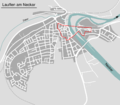
Karte Denkmalschutz Lauffen Gesamtanlage.png 1,480 × 1,293; 392 KB
-
Lagekarte Lauffen Alte Burg.png 1,480 × 1,293; 376 KB
-
Location map Stuttgart.svg 2,433 × 2,556; 107.48 MB
-
MörgeninEppishausen.svg 1,186 × 1,349; 1,004 KB
-
N48E009 OSM Landscape Germany, Baden-Württemberg.jpg 1,512 × 2,221; 707 KB
-
Nordsuedverlauf.jpg 926 × 958; 851 KB
-
OSM Grenzverlauf 79J-BFH-NSU.jpg 1,300 × 579; 332 KB
-
OSM Grenzverlauf BWF-BFH-ONA.jpg 1,355 × 609; 344 KB
-
OSM Jagstkanal.jpg 561 × 590; 148 KB
-
OSM OpenStreetMap Stammtisch Freiberg Logo.png 1,478 × 1,035; 678 KB
-
OSM Salinenkanal.jpg 1,238 × 526; 133 KB
-
Projekttage MSG 2.jpg 3,262 × 2,266; 1.85 MB
-
Rastatt OSM 01.png 1,334 × 1,436; 3.4 MB
-
Rastatt OSM 02.png 1,334 × 1,436; 4.43 MB
-
Rastatt OSM 03.png 1,142 × 1,204; 2.42 MB
-
Remsbahn Karte OSM.png 1,828 × 535; 873 KB
-
Réseau Express Métropolitain (REM) Strasbourg.png 1,443 × 895; 1.91 MB
-
Römerstraße-NAA-2022-OSM.png 1,928 × 2,888; 2.48 MB
-
Salinengebiet Jagstfeld OSM.jpg 1,482 × 1,051; 311 KB
-
Schauinsland-blizzard-disaster.png 696 × 888; 693 KB
-
Schindhautunnel Verlauf.jpg 563 × 531; 349 KB
-
Schloss Lichtenstein OSM map 2023.jpg 1,341 × 894; 213 KB
-
Straßenbahn Ulm Netzplan.png 1,340 × 1,029; 1.53 MB
-
Straßenbahn Ulm Netzplan.svg 1,340 × 1,029; 2.86 MB
-
Karte Industriebahn Feuerbach 1989.png 1,919 × 1,468; 671 KB
-
Karte Ulm Hauptbahnhof.png 416 × 1,353; 560 KB
-
Karte Ulm Hbf.jpg 522 × 1,408; 140 KB
-
Wikipedia Artikel über Tübingen, die Koordinaten enthalten.jpg 1,920 × 964; 551 KB
-
Württemberger Weinstraße.png 1,250 × 1,196; 2.23 MB
-
Württembergischer Weinwanderweg.png 984 × 986; 1.4 MB


