Category:OpenStreetMap maps of Schleswig-Holstein
Jump to navigation
Jump to search
Federal states of Germany:
Subcategories
This category has only the following subcategory.
U
Media in category "OpenStreetMap maps of Schleswig-Holstein"
The following 39 files are in this category, out of 39 total.
-
2018-06-23-Billetal Radtour.jpg 963 × 700; 233 KB
-
Basislinie Nordfriesland.svg 1,026 × 1,134; 176 KB
-
DB 1103 railway map.png 1,310 × 1,005; 518 KB
-
DB 1203 railway map.png 1,231 × 911; 352 KB
-
Fehmarn2022OSM.png 4,542 × 3,775; 3.48 MB
-
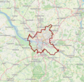
Hambourg OSM 01.png 584 × 571; 427 KB
-
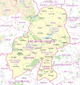
Karte Amt Mittelangeln.png 1,685 × 1,787; 823 KB
-
Karte Nord-Ostsee-Kanal.png 1,814 × 1,407; 3.83 MB
-
Karte Reußenköge.png 1,245 × 1,277; 1.23 MB
-
Karte Schloss Glücksburg mit Kloster Rüde.svg 928 × 971; 192 KB
-
Kiel map.png 1,682 × 2,370; 3.32 MB
-
Kiel Airport - OpenSeaMap.jpg 1,001 × 659; 182 KB
-
Kolberger Heide.jpg 1,051 × 705; 67 KB
-
Lagekarte NSG Helgoländer Felssockel.png 845 × 920; 80 KB
-
Map of the Kiel Canal.png 1,814 × 1,407; 1.69 MB
-
Meimersdorfer Moor (ehemalig) Openstreetmap.jpeg 1,000 × 500; 635 KB
-
Moorlagerschuppen der Bad Bramstedter Moorbahn.jpg 1,225 × 802; 218 KB
-
OpenSeaMap Kiel Fjord.png 862 × 545; 410 KB
-
OpenStreetMap Reinbek.png 1,200 × 899; 616 KB
-
OSM-Karte mit dem Leuchtturm in Lübeck-Travemünde 2021.jpg 1,553 × 842; 187 KB
-
Region Lübeck.png 1,456 × 1,361; 3.89 MB
-
Versenkungsgebiete Neustädter Bucht.jpg 811 × 816; 94 KB
-
WP Karte Absalonshorst.jpg 2,298 × 3,631; 4.76 MB
-
WP Karte Bothenhorst.jpg 2,298 × 3,631; 4.76 MB
-
WP Karte Brunshorst.jpg 2,298 × 3,631; 4.75 MB
-
WP Karte Dritter Fischerbuden.jpg 2,298 × 3,631; 4.78 MB
-
WP Karte Erster Fischerbuden.jpg 2,298 × 3,631; 4.75 MB
-
WP Karte Goldberg.jpg 2,298 × 3,631; 4.74 MB
-
WP Karte Harbershorst.jpg 2,298 × 3,631; 4.76 MB
-
WP Karte Huntenhorst.jpg 2,298 × 3,631; 4.75 MB
-
WP Karte Müggenbusch.jpg 2,298 × 3,631; 4.76 MB
-
WP Karte Nädlershorst.jpg 2,298 × 3,631; 4.77 MB
-
WP Karte Spieringshorst.jpg 2,298 × 3,631; 4.74 MB
-
WP Karte Stoffershorst.jpg 2,298 × 3,631; 2.41 MB
-
WP Karte Ziegelhorst.jpg 2,298 × 3,631; 4.76 MB
-
WP Karte Zweiter Fischerbuden.jpg 2,298 × 3,631; 4.77 MB
-
WP Lübeck - Große Petersgrube.jpg 2,958 × 3,638; 4.99 MB
-
WP St.-Annen-Kirchhof - Lagevergleich.jpg 1,857 × 2,294; 3.6 MB


