
Category:Old maps of the Austrian Empire
Austrian Empire · Austria-Hungary · Great Britain · British Empire · Byzantine Empire · Carolingian Empire · Republic of Genoa · Habsburg Monarchy · Holy Roman Empire · Polish-Lithuanian Commonwealth · Ottoman Empire · Prussia · Grand Duchy of Moscow · Tsardom of Russia · Russian Empire · Soviet Union · Spanish Empire ·
 1804–1867
.svg)
Subcategories
This category has the following 9 subcategories, out of 9 total.
I
O
Media in category "Old maps of the Austrian Empire"
The following 25 files are in this category, out of 25 total.
-

-
 1853 Mitchell Map of Austria - Geographicus - Austrai-mitchell-1853.jpg 3,000 × 2,385; 2.43 MB
-
 Austrian Dominions (Pinkerton, 1810).jpg 9,019 × 6,556; 13.71 MB
-
 Austrian Dominions (Thomson, 1816).jpg 7,732 × 6,481; 9.33 MB
-
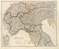
 Austrian Empire (Arrowsmith, 1842 - part 1).jpg 9,200 × 7,522; 16.38 MB
-
 Austrian Empire (Arrowsmith, 1842 - part 2, Kingdom of Lombardy–Venetia).jpg 9,200 × 7,640; 15.98 MB
-
 Austrian Empire (Dower, 1844).jpg 7,257 × 5,944; 6.71 MB
-
 Austrian Empire (Dufour, 1863).jpg 9,282 × 6,945; 11.04 MB
-
 Austrian Empire (Gaspari, 1817).jpg 9,227 × 7,665; 13.77 MB
-
 Austrian Empire (Hall, 1828).jpg 6,536 × 5,369; 7.74 MB
-
 Austrian Empire (Johnston, 1861).jpg 10,500 × 7,081; 15.01 MB
-
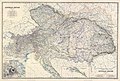
 Austrian Empire (Weiland, 1836).jpg 10,143 × 7,977; 16.18 MB
-
 Austrian Empire, composite map (Johnston, 1861).jpg 9,900 × 6,677; 14.68 MB
-
 C. 1812 Central Europe.jpg 1,552 × 1,200; 1.47 MB
-
 Carte des états composant l'Empire d'Autriche en mai 1809 (34553312285).jpg 7,762 × 6,568; 33.78 MB
-
 Ethnographic map of austrian monarchy czoernig 1855.jpg 7,997 × 5,862; 23.73 MB
-
 Ethnographic map of Czoernig.jpg 1,202 × 910; 372 KB
-
 Ethnographic map of the Austrian Empire 1855 Czoernig - Istra.jpg 716 × 584; 344 KB
-
 Lage des Kaplanhofes nach dem Franziszeischem Kataster.JPG 579 × 511; 42 KB
-
 Map of the Austrian Empire, 1855.jpg 640 × 522; 87 KB
-
 Militargrenze, Wojwodowena und Banat.jpg 900 × 312; 115 KB
-
 Wojwodowena und Banat.jpg 400 × 295; 42 KB
-
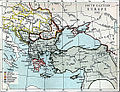 South-eastern Europe 1861.jpg 1,122 × 859; 359 KB
-
 Theatre de la guerre - CBT 5873291.jpg 5,807 × 4,773; 9.58 MB
-
 Україна на карті Європи. Рис.24.png 683 × 506; 815 KB
.jpg)

.jpg)
.jpg)
.jpg)
.jpg)
.jpg)
.jpg)
.jpg)
.jpg)
.jpg)
.jpg)
.jpg)

.jpg)


