
Category:Old maps of the Kingdom of Galicia (Central Europe)
Subcategories
This category has the following 3 subcategories, out of 3 total.
Media in category "Old maps of the Kingdom of Galicia (Central Europe)"
The following 26 files are in this category, out of 26 total.
-
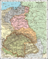
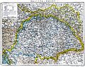
 Galizien und Lodomerien.jpg 3,666 × 3,102; 6.93 MB
-
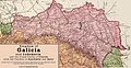
 Galicia1836.gif 658 × 806; 318 KB
-
 Королівство Галичини і Володимирії 1851.png 567 × 403; 459 KB
-
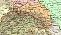
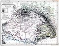 Hungary, Galicia and Transylvania.jpg 3,000 × 2,354; 2.48 MB
-

-
-
 01900 Karte des Königreichs Galizien und Lodomerien von Karol Lange.jpg 960 × 766; 202 KB
-
 Galizien&TescheWahlKarte1907.png 1,630 × 978; 1.79 MB
-
 The Harmsworth atlas and Gazetter 1908 (135849312).jpg 6,410 × 9,567; 61.7 MB
-
 Geografia kraju ojczystego i Monarchii Austryacko-Wegierskiej 1912 (103253026).jpg 3,984 × 2,830; 1.53 MB
-
 Deutsche Siedlungen in Galizien 1913.jpg 3,000 × 1,920; 3.22 MB
-

-
 Austrian Dominions-Galicia,Eastern- Hungary, Transylvania.jpg 1,359 × 1,536; 404 KB
-
 Galicia (Osztrák-Magyar Birodalom).JPG 4,320 × 3,240; 5.77 MB
-
 Galicia 1897 1.jpg 2,260 × 1,163; 952 KB
-
 Galicia.jpg 502 × 288; 94 KB
-
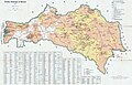
 Galician Transversal Railway 1904.jpg 3,016 × 1,765; 8.57 MB
-
 Galicya.i.Wegry.jpg 3,428 × 2,721; 3.63 MB
-
 Josephinische Landaufnahme Gallicischen.jpg 3,388 × 2,482; 1.13 MB
-
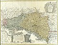
 Lubomeriae et Galliciae Regni tabula geographica ; F.L.G.jpg 3,768 × 2,912; 3.78 MB
-
 Lubomeriae et Galliciae Regni Tabula Geographica Gussefeld 1775 RCIN.jpg 4,558 × 3,522; 4.53 MB
-
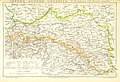
 Straßenkarte Galizien 1820.png 1,358 × 923; 1.22 MB
-
 Straßenkarte von Galizien 1820 II.png 1,358 × 923; 1.44 MB
-
 Podrecznik geografii ojczystej 1894 (117388849) (cropped).jpg 3,078 × 2,152; 1.32 MB
-
 Восточнославянский-клин.png 800 × 544; 854 KB
-
 Галичина1800.jpg 1,630 × 991; 454 KB


%27_(11248440585).jpg)


.jpg)
.jpg)


.JPG)


_(cropped).jpg)

