Category:Old maps of regions of France
Jump to navigation
Jump to search
Administrative regions and territorial collectivity of Metropolitan France (‡ since start of 2016):
Auvergne-Rhône-Alpes‡ · Bourgogne-Franche-Comté‡ · Bretagne · Centre-Val de Loire · Corsica · Grand Est‡ · Hauts-de-France‡ · Île-de-France · Normandie‡ · Nouvelle-Aquitaine‡ · Occitanie‡ · Pays de la Loire · Provence-Alpes-Côte d'Azur
Former administrative regions of Metropolitan France (until end of 2015):
Alsace · Aquitaine · Auvergne · Bourgogne · Champagne-Ardenne · Franche-Comté · Languedoc-Roussillon · Limousin · Lorraine · Midi-Pyrénées · Nord-Pas-de-Calais · Basse-Normandie · Haute-Normandie · Picardie · Poitou-Charentes · Rhône-Alpes
Overseas departments and regions: Guadeloupe · Martinique · French Guiana · Réunion · Mayotte
Overseas collectivities: Saint-Barthélemy · Saint-Martin (France) · Saint-Pierre and Miquelon · French Polynesia · Wallis and Futuna · the French Southern and Antarctic Lands+ ≈ French Southern and Antarctic Lands+
Sui generis territories: New Caledonia · Clipperton Island+
Use the appropriate category for maps showing all or a large part of regions of France. See subcategories for smaller areas:
| If the map shows | Category to use |
|---|---|
| regions of France on a recently created map | Category:Maps of regions of France or its subcategories |
| regions of France on a map created more than 70 years ago | Category:Old maps of regions of France or its subcategories |
| the history of regions of France on a recently created map | Category:Maps of the history of regions of France or its subcategories |
| the history of regions of France on a map created more than 70 years ago | Category:Old maps of the history of regions of France or its subcategories |
Subcategories
This category has the following 12 subcategories, out of 12 total.
B
- Old maps of Bourbonnais (12 F)
- Old maps of Brie (4 F)
G
- Old maps of Gâtinais (2 F)
O
- Old maps of Dauphine (31 F)
- Old maps of Vermandois (24 F)
X
~
- Old maps of the Pyrenees (13 F)
Media in category "Old maps of regions of France"
The following 34 files are in this category, out of 34 total.
-
Atlas national portatif de la France 1792 (105093192) (cropped).jpg 5,641 × 4,438; 4.82 MB
-
1797 Tardieu Map of Champagne, France - Geographicus - Champagne-tardieu-1797.jpg 6,000 × 4,933; 6.08 MB
-
381 of 'La France Illustrée- géographie générale ... Par F. J' (11292336443).jpg 1,195 × 1,332; 393 KB
-
1780 Bonne Map of Alsace ^ Lorainne, France - Geographicus - AlcaseLoraine-bonne-1780.jpg 3,000 × 2,082; 1.46 MB
-
Auvergne.jpg 1,202 × 1,656; 829 KB
-
Baillage d'Hesdin - 1659.png 512 × 512; 580 KB
-
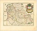
Blaeu 1645 - Artesia Comitatus Artois.jpg 3,589 × 3,031; 1.47 MB
-
Buxton Map.c.jpg 863 × 771; 294 KB
-
Camargue baedeker.png 250 × 295; 55 KB
-
Carte de l'Île de France - 1635 - Damien de Templeux.jpg 5,500 × 4,395; 5.79 MB
-
Chinonois (map) & Rabelais (portraits).jpeg 1,004 × 900; 474 KB
-
De Vyerighe Colom - La Flandre Gallicane.jpg 2,700 × 1,865; 1.73 MB
-
Gallia Sacra SW.JPG 126 × 126; 24 KB
-
Kärtchen zu den Gefechten bei Orléans (12.1870).jpg 754 × 451; 151 KB
-
Reilly 702.jpg 321 × 273; 46 KB
-
Reilly 704.jpg 358 × 268; 52 KB
-
Robert de Vaugondy - Environs de Paris.jpg 3,459 × 2,909; 2.94 MB
-
La Gaule Narbonnaise.jpg 729 × 596; 188 KB
-
LaBerillais Lieux.jpg 333 × 226; 33 KB
-
Le Capitulaire de Servais, 853. Carte des Pagi et des Missatica.png 1,127 × 877; 795 KB
-
Lyon StÉtienne Andrézieux Roanne1849.png 768 × 612; 1,018 KB
-
Map en county of Toulouse 1154.jpg 394 × 293; 74 KB
-
Map of County of Guines.jpg 1,459 × 1,244; 385 KB
-
Map of kingdom of Arles.jpg 500 × 659; 112 KB
-
Map of the district of Chaumont in 1805 by Reilly 715.jpg 575 × 395; 74 KB
-
Map of the département of Alpes-maritimes in 1805 by Reilly 825.jpg 329 × 276; 50 KB
-
1640-Belsia vulgo, La Beauce.JPG 358 × 300; 28 KB
-
1702-Aurelianensis praefectura generalis.JPG 357 × 300; 34 KB
-
Tassin - Les Plans et profils de toutes les principales villes et lieux considérables de France - 1638.djvu 4,670 × 3,460, 1,036 pages; 36.41 MB


