Category:Old maps of Dauphine
Jump to navigation
Jump to search
Media in category "Old maps of Dauphine"
The following 31 files are in this category, out of 31 total.
-
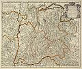
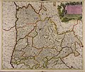
Le Daulphiné, Languedoc, Gascoigne, Provence et Xaintonge - btv1b550046724.jpg 6,964 × 5,277; 4.44 MB
-
Le Daulphiné, Languedoc, Gascoigne, Provence et Xaintonge - btv1b84464932.jpg 7,896 × 6,216; 9.03 MB
-
Gouvernement Général du Dauphiné.jpg 2,500 × 2,099; 1.2 MB
-
Atlante Veneto Volume 2 020.jpg 10,289 × 7,196; 10.13 MB
-
1771 Bonne Map of Dauphine and Provence, France - Geographicus - Provence-bonne-1771.jpg 2,549 × 3,500; 2.8 MB
-
Btv1b8444422c carta bella piu grande.jpg 3,497 × 5,890; 19.6 MB
-
Carte de Dauphiné - btv1b84696455.jpg 8,509 × 6,107; 9.71 MB
-
Carte des Gouvernements de Dauphiné et de Provence.png 891 × 1,245; 2.53 MB
-
Carte du Dauphiné - btv1b530532836.jpg 11,237 × 10,367; 20.16 MB
-
Carte du Languedoc-Dauphiné-Provence, Delamarche 1794.jpg 3,542 × 3,104; 1.46 MB
-
Carte jours avant bataille Jarrie 2.pdf 1,118 × 1,168; 8.19 MB
-
Cartes de Dauphiné 1613.jpg 8,448 × 5,549; 20.17 MB
-
Delphinatus. NYPL1632246.tiff 7,230 × 5,428; 112.28 MB
-
Detail Carte du Dauphiné 1654 de Beins 1.jpg 1,623 × 1,237; 2.03 MB
-
G. Bruno - Le Tour de la France par deux enfants p162.jpg 876 × 1,188; 284 KB
-
Grenoble Tassin 1638.jpg 1,812 × 1,232; 1.12 MB
-
Le Tour du monde-02-p370.jpg 826 × 1,246; 382 KB
-
Le Tour du monde-02-p404.jpg 840 × 952; 310 KB
-
Partie du Dauphiné - (par Jean-Baptiste d'Anville) - btv1b530091031.jpg 3,634 × 3,150; 1.25 MB
-
Région de Grenoble, carte par Jean de Beins (1622).jpg 3,648 × 2,432; 3.68 MB


