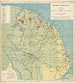
Category:Old maps of French Guiana
Jump to navigation
Jump to search
Administrative regions and territorial collectivity of Metropolitan France (‡ since start of 2016):
Auvergne-Rhône-Alpes‡ · Bourgogne-Franche-Comté‡ · Brittany · Centre-Val de Loire · Corsica · Grand Est‡ · Hauts-de-France‡ · Île-de-France · Normandy‡ · Nouvelle-Aquitaine‡ · Occitania‡ · Pays de la Loire · Provence-Alpes-Côte d'Azur
Former administrative regions of Metropolitan France (until end of 2015):
Alsace · Aquitaine · Auvergne · Burgundy · Champagne-Ardenne · Franche-Comté · Languedoc-Roussillon · Limousin · Lorraine · Midi-Pyrénées · Nord-Pas-de-Calais · Lower Normandy · Upper Normandy · Picardy · Poitou-Charentes · Rhône-Alpes
Overseas departments and regions: Guadeloupe · Martinique · French Guiana · Réunion · Mayotte
Overseas collectivities: Saint Barthélemy · Saint-Martin · Saint Pierre and Miquelon · French Polynesia · Wallis and Futuna · French Southern and Antarctic Lands+
Sui generis territories: New Caledonia · Clipperton Island+
Departments of Metropolitan France: Ain [01] · Aisne [02] · Allier [03] · Alpes-de-Haute-Provence [04] · Hautes-Alpes [05] · Alpes-Maritimes [06] · Ardèche [07] · Ardennes [08] · Ariège [09] · Aube [10] · Aude [11] · Aveyron [12] · Bouches-du-Rhône [13] · Calvados [14] · Cantal [15] · Charente [16] · Charente-Maritime [17] · Cher [18] · Corrèze [19] · Corse-du-Sud [2A]† · Haute-Corse [2B]† · Côte-d’Or [21] · Côtes-d'Armor [22] · Creuse [23] · Dordogne [24] · Doubs [25] · Drôme [26] · Eure [27] · Eure-et-Loir [28] · Finistère [29] · Gard [30] · Haute-Garonne [31] · Gers [32] · Gironde [33] · Hérault [34] · Ille-et-Vilaine [35] · Indre [36] · Indre-et-Loire [37] · Isère [38] · Jura [39] · Landes [40] · Loir-et-Cher [41] · Loire [42] · Haute-Loire [43] · Loire-Atlantique [44] · Loiret [45] · Lot [46] · Lot-et-Garonne [47] · Lozère [48] · Maine-et-Loire [49] · Manche [50] · Marne [51] · Haute-Marne [52] · Mayenne [53] · Meurthe-et-Moselle [54] · Meuse [55] · Morbihan [56] · Moselle [57] · Nièvre [58] · Nord [59] · Oise [60] · Orne [61] · Pas-de-Calais [62] · Puy-de-Dôme [63] · Pyrénées-Atlantiques [64] · Hautes-Pyrénées [65] · Pyrénées-Orientales [66] · Bas-Rhin [67] · Haut-Rhin [68] · departmental district of the Rhône [69] · Haute-Saône [70] · Saône-et-Loire [71] · Sarthe [72] · Savoie [73] · Haute-Savoie [74] · Paris [75] · Seine-Maritime [76] · Seine-et-Marne [77] · Yvelines [78] · Deux-Sèvres [79] · Somme [80] · Tarn [81] · Tarn-et-Garonne [82] · Var [83] · Vaucluse [84] · Vendée [85] · Vienne [86] · Haute-Vienne [87] · Vosges [88] · Yonne [89] · Territoire de Belfort [90] · Essonne [91] · Hauts-de-Seine [92] · Seine-Saint-Denis [93] · Val-de-Marne [94] · Val-d'Oise [95]
Overseas departments and regions: Guadeloupe [971] · Martinique [972] · French Guiana [973] · Réunion [974] · Mayotte [976]
Overseas collectivities: Saint Pierre and Miquelon [975] · Saint Barthélemy [977] · Saint-Martin [978] · Wallis and Futuna [986] · French Polynesia [987] · French Southern and Antarctic Lands [984]+
Sui generis territories: New Caledonia [988] · Clipperton Island [989]+
Use the appropriate category for maps showing all or a large part of French Guiana. See subcategories for smaller areas:
| If the map shows | Category to use |
|---|---|
| French Guiana on a recently created map | Category:Maps of French Guiana or its subcategories |
| French Guiana on a map created more than 70 years ago | Category:Old maps of French Guiana or its subcategories |
| the history of French Guiana on a recently created map | Category:Maps of the history of French Guiana or its subcategories |
| the history of French Guiana on a map created more than 70 years ago | Category:Old maps of the history of French Guiana or its subcategories |
Subcategories
This category has the following 4 subcategories, out of 4 total.
*
O
Media in category "Old maps of French Guiana"
The following 61 files are in this category, out of 61 total.
-
Amazonaskarte Bry 1599.jpg 1,982 × 1,489; 1.43 MB
-
1599 Guyana Hondius.jpg 5,500 × 4,241; 2.45 MB
-
1635 Blaeu Map Guiana, Venezuela, and El Dorado - Geographicus - Guiana-blaeu-1635.jpg 4,000 × 3,084; 3.51 MB
-
1656 Sanson Map of Guiana, Venezuela, and El Dorado - Geographicus - Guiane-sanson-1656.jpg 4,000 × 3,115; 3.32 MB
-
Map of venezuela(1760-1839).jpg 760 × 504; 76 KB
-
Nuevo Reino Granada.jpg 700 × 472; 192 KB
-
1780 Raynal and Bonne Map of Guyana and Surinam - Geographicus - Guyane-bonne-1780.jpg 1,728 × 2,500; 1.04 MB
-
1780 Raynal and Bonne Map of Northern South America - Geographicus - Grenade-bonne-1780.jpg 2,500 × 1,693; 1.22 MB
-
Kaart van Guiana - Engelsch, Nederlandsch en Fransch (1888).jpg 5,500 × 3,948; 1.68 MB
-
1925 Air Routes of French Guiana.jpg 961 × 586; 209 KB
-
44 of 'Histoire de la Guyane française' (11200833623).jpg 1,541 × 2,451; 504 KB
-
51 of 'Atlas' (11188953964).jpg 3,852 × 4,290; 3.96 MB
-
A la France Partie de la Guyane - btv1b53103532j.jpg 6,914 × 5,343; 3.97 MB
-
Aaron Arrowsmith 1812.jpg 789 × 650; 320 KB
-
Archives des missions scientifiques et littéraires (1879) (19753217325).jpg 1,988 × 2,616; 863 KB
-
Archives des missions scientifiques et littéraires (1883) (19565331830).jpg 2,976 × 2,800; 1.5 MB
-
Carte Générale de la Guyane.jpg 3,189 × 2,489; 4.44 MB
-
English guiana guayana inglesa y Venezuela en 1831.jpg 618 × 461; 59 KB
-
French Guiana. LOC 84691667.jpg 3,809 × 3,442; 1.58 MB
-
French Guiana. LOC 84691667.tif 3,809 × 3,442; 37.51 MB
-
GranColombia1829.jpg 767 × 540; 306 KB
-
Guiana and Caribana WDL11336.png 1,363 × 1,024; 2.79 MB
-
Guiana's.jpg 1,000 × 751; 203 KB
-
Guillaume Thomas Francois Raynal. Wellcome L0002250.jpg 1,166 × 1,688; 848 KB
-
Iles du Salut-Carte 1764.png 614 × 746; 805 KB
-
Iles du Salut-Carte 180x.png 614 × 532; 706 KB
-
Iles du Salut-Carte 1852.jpg 707 × 800; 190 KB
-
Kartenskizze, Palikur und Uaca.jpg 1,270 × 3,248; 598 KB
-
La Guyane française, Voyage dans la Guyane française, Hachette, 1866, Cartographie.png 2,332 × 3,426; 4.12 MB
-
Land-kaart van het eiland en de volksplanting van Cayenne (1769).jpg 5,500 × 4,315; 2.07 MB
-
Map of Cayenne, or French Guyana, 1685.jpg 642 × 900; 473 KB
-
Map of French Guiana. Wellcome L0002631EC.jpg 1,150 × 1,670; 889 KB
-
Map of French Guyana and of the Island of Cayenne WDL1203.png 1,422 × 1,024; 2.92 MB
-
Map of the republics of northern South America (1860).jpg 3,177 × 2,096; 2.63 MB
-
Martinique1865.jpg 737 × 656; 135 KB
-
Partie de Terre Ferme ou sont Guiane et Caribane (4586556023).jpg 2,000 × 1,469; 2.75 MB
-
Propriae Lugudunensis Generalitatis Mappa Chorographica.jpg 7,795 × 6,565; 17.09 MB
-
Rigobert-Bonne-Atlas-de-toutes-les-parties-connues-du-globe-terrestre MG 0013.tif 5,263 × 3,618; 54.51 MB
-
Rigobert-Bonne-Atlas-de-toutes-les-parties-connues-du-globe-terrestre MG 0014.tif 3,611 × 5,284; 54.62 MB
-
The Guianas.jpg 2,272 × 1,704; 3.65 MB
-
Venezuela and British Guiana in 1826.jpg 748 × 474; 119 KB
-
Le Tour du monde - 13 (page 339 crop).jpg 1,922 × 2,857; 1.59 MB


