Category:19th-century maps of Southern Africa
Jump to navigation
Jump to search
Subcategories
This category has the following 9 subcategories, out of 9 total.
Media in category "19th-century maps of Southern Africa"
The following 124 files are in this category, out of 124 total.
-
(Afrique centrale et australe.) - DPLA - 3728af04b60cb07f368700dba4a20c41.jpg 971 × 1,000; 234 KB
-
1809 Pinkerton Map of Southern Africa - Geographicus - SouthernAfrica-pinkerton-1809.jpg 4,000 × 2,935; 1.73 MB
-
Southern Africa - DPLA - d0c198150815e8eef2c2af95e4f725eb.jpg 1,000 × 784; 224 KB
-
1855 Colton Map of Southern Africa - Geographicus - AfricaSouth-c-1855.jpg 4,000 × 3,257; 2.26 MB
-
Colton and Johnson Johnson's Africa 1862 UTA (bottom).jpg 3,772 × 2,614; 5.67 MB
-
17 of 'Part II. Second edition' (11110772326).jpg 1,528 × 2,650; 878 KB
-
South Africa - DPLA - 8f485e0d204b0adde827ae9c44984d53.jpg 1,001 × 762; 247 KB
-
Map of Southern Africa (T. Fisher Unwin).jpg 2,492 × 2,068; 2.67 MB
-
34 of 'Part III. Sixth edition' (11241871585).jpg 2,544 × 1,563; 735 KB
-
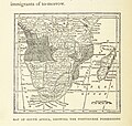
122 of 'White Man's Africa ... Illustrated by R. C. Woodville, etc' (11294761843).jpg 1,309 × 1,247; 545 KB
-
Politisch-militaerische Karte von Süd-Afrika.png 8,845 × 7,884; 126.54 MB
-
Karte von Süd-Afrika mit besonderer Berücksichtigung der deutschen Kolonien (1900).png 10,417 × 6,015; 99.81 MB
-
209 of 'Afrika. Eine allgemeine Landeskunde, etc' (11209218364).jpg 2,784 × 1,817; 1.16 MB
-
6 of 'In the Land of Cecil Rhodes' (11233922614).jpg 1,888 × 2,756; 848 KB
-
Africa Australe - DPLA - d6d2a3df270f566024eac2d4e1b8beb1.jpg 1,000 × 773; 322 KB
-
Afrique (Sud) - DPLA - 9d1df1f513e2c312160870fd84d269ed.jpg 647 × 1,000; 241 KB
-
Afrique méridionale. Dressé par - V. Monin.. . - btv1b84695949.jpg 5,419 × 4,210; 3.59 MB
-
Carte de l'Afrique méridionale - par Félix Delamarche, fils - btv1b8468358f.jpg 7,966 × 5,720; 5.5 MB
-
Europe in Africa in the nineteenth century (1895) (14584071758).jpg 2,118 × 1,664; 690 KB
-
Juta's Map of South Africa - DPLA - 3f11a7af2748568d25a67a1e191f62a6.jpg 1,000 × 792; 197 KB
-
Le Transvaal et les régions limitrophes de l'Afrique australe - btv1b8442046s.jpg 7,258 × 5,146; 4.88 MB
-
Luederitzland-1888.jpg 745 × 754; 304 KB
-
Map of South Africa containing Cape colony.. . - by T. B. Johnston... - btv1b53088730b.jpg 10,656 × 8,384; 12.77 MB
-
Map of the south african Republic and adjoining territories - btv1b53029328g.jpg 8,413 × 7,533; 11.53 MB
-
Matabelaland. - Map of part of Matabililand - btv1b8441319m.jpg 6,043 × 8,026; 6 MB
-
North Africa; South Africa - DPLA - 877b5001438caf8e24a443c776ecbe18.jpg 880 × 1,000; 229 KB
-
PT-TT-CMP-0015 m0001 derivada.jpg 4,273 × 3,776; 4.48 MB
-
Seat of War in Natal, South Africa - DPLA - 990678c020aa8d3ee06e34578e580bdf.jpg 729 × 1,000; 253 KB
-
South Africa (Cape Colony) - DPLA - 2db3cd5adb67949affe87c9f89afb56a.jpg 1,000 × 801; 207 KB
-
South Africa - DPLA - 0449ffcba1455f21ea6dba1bb82f52a4.jpg 1,000 × 771; 392 KB
-
South Africa - DPLA - 1d682c934cb07faa05ab074b722fefba.jpg 1,000 × 674; 133 KB
-
South Africa - DPLA - 30cbf1d30df2fd7ef83dee793cdafa65.jpg 1,000 × 790; 360 KB
-
South Africa - DPLA - 3fcfb8d3380a6b3adce9c2c3b33aae2f.jpg 1,000 × 789; 309 KB
-
South Africa - DPLA - 42334f568f1f24d9fa4b747b388e2904.jpg 1,001 × 725; 132 KB
-
South Africa - DPLA - 4fbbda7b28bef21c5d40a81f56a8b9ef.jpg 699 × 1,000; 252 KB
-
South Africa - DPLA - 9c86fde13082c4fabf3d7738c12e593e.jpg 1,000 × 746; 333 KB
-
South Africa - DPLA - d564446668c3e794078a2088df819867.jpg 1,000 × 846; 260 KB
-
South Africa - DPLA - e268cdedba0ca829eea8235ba68e5469.jpg 1,000 × 772; 294 KB
-
South Africa - DPLA - efcc1d40dad38b6a29c07c9a4d3c4303.jpg 1,000 × 709; 168 KB
-
SouthAfrica1885.jpg 3,336 × 2,884; 4.95 MB
-
Southern Africa - DPLA - 9149352626d562efa2cb00e31c959a39.jpg 1,000 × 659; 218 KB
-
Southern Africa - DPLA - 9cde886e2fd00f6100e2fe4013d14019.jpg 1,000 × 630; 210 KB
-
Southern Africa - DPLA - ece98e234d31e7c56c43c056e4721fad.jpg 1,000 × 818; 280 KB
-
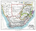
Southern Africa 1890s Political.jpg 2,090 × 1,817; 469 KB
-
Southern Africa. 1885.jpg 2,417 × 1,746; 861 KB
-
Sud-Africa mit Madagascar... - Bearbeitet von Adolf Grâf... - btv1b8458476f.jpg 10,884 × 8,878; 13.46 MB
-
Süd Afrika - DPLA - bf53150a8a55738df70b53fcc9293376.jpg 1,000 × 625; 225 KB
-
Süd-Africa Mit Madagascar.jpg 5,710 × 4,654; 6.98 MB
-
Süd-Africa mit Madagascar.jpg 5,738 × 4,616; 6.65 MB
-
Süd-Africa.jpg 5,639 × 4,679; 6.05 MB
-
Süd-Afrika - DPLA - f46d3f2c16fdd0a1f966bfbb52ad6024.jpg 1,000 × 744; 274 KB
-
Südliches Afrika - DPLA - 5f9f6a6164a32640a4c4f06a7b112286.jpg 1,000 × 822; 261 KB
-
Touat - DPLA - 539062b962a2920cde515007d9c5bc43.jpg 1,000 × 892; 313 KB
-
War District - DPLA - a09ca2442b74913e98755a3d00b8eae9.jpg 1,000 × 734; 281 KB
-
Le Tour du monde - 13 (page 36 crop).jpg 1,961 × 2,396; 2 MB


