Category:Old maps of Middlesex County, Massachusetts
Jump to navigation
Jump to search
Subcategories
This category has the following 25 subcategories, out of 25 total.
1
A
B
C
H
L
M
N
O
S
W
Media in category "Old maps of Middlesex County, Massachusetts"
The following 36 files are in this category, out of 36 total.
-
Middlesex Canal (Massachusetts) map, 1801.jpg 611 × 498; 349 KB
-
1845 North Billerica Map (IA 1845NorthBillerica).pdf 2,004 × 1,604; 826 KB
-
Map of the town of Billerica, Middlesex County, Massachusetts (3370514168).jpg 1,695 × 2,000; 3.44 MB
-
Sudbury Center 1856 from Walling.jpg 575 × 670; 158 KB
-
Sudbury in 1856 from Walling's.jpg 2,400 × 3,199; 7.57 MB
-
Historic fields and mansions of Middlesex (1874) (14784262715).jpg 1,738 × 2,431; 2.66 MB
-
Map of the Town of Melrose, Middlesex County, Massachusetts ... - btv1b53102644w.jpg 16,178 × 10,981; 24.66 MB
-
Map of the town of Natick, Middlesex Co. Mass. (3886419537).jpg 1,661 × 2,000; 2.17 MB
-
Reading town of Reading (3855702559).jpg 2,000 × 1,692; 2.8 MB
-
Plan of Middlesex County, Massachusetts (2674373783).jpg 2,000 × 1,349; 1.91 MB
-
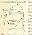
55 of 'History of Middlesex County, Massachusetts ... Illustrated' (11276428324).jpg 1,098 × 1,186; 288 KB
-
Cyclists' road map of Massachusetts part 5 (14773303477).jpg 2,000 × 1,523; 3.8 MB
-
Cyclists' road map of Massachusetts part 6 (14959488142).jpg 2,000 × 1,465; 3.76 MB
-
Cyclists' road map of Massachusetts part 7 (14773165910).jpg 2,000 × 1,603; 3.82 MB
-
Cyclists' road map of Massachusetts part 8 (14773163899).jpg 1,891 × 2,000; 4.35 MB
-
1896 map of Beaver Brook Reservation (BHL40352840).jpg 6,396 × 2,892; 3.13 MB
-
Cliftondale, Saugus and East Saugus, Massachusetts (2675934908).jpg 2,000 × 1,609; 3.3 MB
-
1906 Boston and Northern Street Railway map.png 3,500 × 3,012; 15.97 MB
-
1908 map of Newton Street Railway and connecting lines.jpg 2,189 × 1,712; 815 KB
-
1908 map of Weston, Massachusetts.jpg 5,000 × 3,435; 4.36 MB
-
City of Marlborough (9138716834).jpg 799 × 564; 92 KB
-
City of Melrose (9472522369).jpg 800 × 561; 82 KB
-
Braggville 1850-1880, Map of.svg 2,217 × 1,478; 688 KB
-
Course of canal to Charlestown Millpond (3856249050).jpg 817 × 2,000; 1.18 MB
-
Plan of Framingham Plantation 1699 (3370515494).jpg 2,000 × 1,899; 3.26 MB


