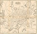
Category:Old maps of Worcester, Massachusetts
Jump to navigation
Jump to search
Subcategories
This category has only the following subcategory.
Media in category "Old maps of Worcester, Massachusetts"
The following 22 files are in this category, out of 22 total.
-
Map of the city of Worcester, Worcester Co., Mass. LOC 2011592135.jpg 5,561 × 5,174; 4.27 MB
-
Map of the city of Worcester, Worcester Co., Mass. LOC 2011592135.tif 5,561 × 5,174; 82.32 MB
-
1874 plan of Worcester and Shrewsbury Railroad.jpg 12,098 × 4,098; 7.14 MB
-
1878 map Worcester Massachusetts byBailey BPL 10182.png 11,314 × 8,386; 40.6 MB
-
Map of the city of Worcester, Mass. (3886419895).jpg 1,582 × 2,000; 2.81 MB
-
Map of the city of Worcester, Worcester Co., Mass. LOC 2012588170.jpg 3,546 × 5,365; 2.56 MB
-
Map of the city of Worcester, Worcester Co., Mass. LOC 2012588170.tif 3,546 × 5,365; 54.43 MB
-
The city of Worcester, Mass. (2675791592).jpg 2,000 × 1,582; 3.45 MB
-
1891 Lake View, Worcester map.jpg 1,600 × 1,050; 443 KB
-
1891 map Worcester Massachusetts byVanValkenburg BPL 12934.png 929 × 696; 908 KB
-
Worcester Consolidated Street Railway 1908 map.jpg 1,118 × 1,106; 119 KB
-
1919 map Worcester Massachusetts BPL.jpg 829 × 1,024; 293 KB
-
A map of Worcester, shire town of the County of Worcester LOC 2012586236.jpg 9,237 × 12,572; 17.73 MB
-
A map of Worcester, shire town of the County of Worcester LOC 2012586236.tif 9,237 × 12,572; 332.24 MB
-
Collections of the Worcester Society of Antiquity (1881) (14774168244).jpg 2,828 × 3,992; 1.09 MB
-
Map of the city of Worcester (2675635192).jpg 1,534 × 2,000; 2.18 MB
-
Map of the village of Worcester.jpg 7,429 × 5,052; 4.95 MB
-
Map of Worcester Mass. (7557598788).jpg 1,618 × 2,000; 3.15 MB
-
Plan of the central part of the city of Worcester (7557377938).jpg 6,123 × 6,755; 41.62 MB
-
Pocket map of the city of Worcester, Mass. (3855703017).jpg 2,000 × 1,562; 3.01 MB


