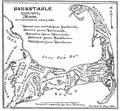
Category:Old maps of Barnstable County, Massachusetts
Jump to navigation
Jump to search
Subcategories
This category has the following 4 subcategories, out of 4 total.
O
P
Media in category "Old maps of Barnstable County, Massachusetts"
The following 18 files are in this category, out of 18 total.
-
Canal du Cap-Cod (7557397698).jpg 4,648 × 3,456; 13.87 MB
-
Canal du Cap-Cod (Massachusetts), 1834 map.jpg 4,433 × 3,175; 2.04 MB
-
Map of the town of Barnstable, Barnstable County, Mass. (3855696519).jpg 1,694 × 2,000; 3.36 MB
-
1857 Map of the town of Sandwich, Barnstable County, Mass. (6094146242).jpg 10,259 × 7,670; 11.09 MB
-
Admiralty Chart No 2489 Monomoy Harbour (Massachusetts). Published 1857.jpg 8,062 × 10,836; 9.11 MB
-
America, East Coast - Monomoy Harbour (IA McGillLibrary-rbsc map bayfield-146-19323).pdf 3,022 × 4,062; 9.63 MB
-
(Planning map for proposed Cape Cod Ship Canal) LOC 2011589346.jpg 8,294 × 3,717; 3.06 MB
-
(Planning map for proposed Cape Cod Ship Canal) LOC 2011589346.tif 8,294 × 3,717; 88.2 MB
-
Plan of Falmouth Heights, Falmouth Mass., April 1st 1873 (3369692883).jpg 2,000 × 1,346; 2.7 MB
-
Plan of Falmouth Heights, Falmouth Mass., April 1st 1873 LOC 2008624182.jpg 10,156 × 6,534; 12.02 MB
-
Plan of Falmouth Heights, Falmouth Mass., April 1st 1873 LOC 2008624182.tif 10,156 × 6,534; 189.86 MB
-
Eldridge's chart no. 10 - Buzzard's Bay (10208126734).jpg 670 × 800; 102 KB
-
Barnstable county 1890.PNG 403 × 374; 140 KB
-
Deyo-map.jpg 1,560 × 1,448; 564 KB
-
Map of Barnstable County Mass 1890.jpg 400 × 371; 65 KB
-
Cyclists' road map of Massachusetts part 10 (14773233768).jpg 1,859 × 2,000; 4.17 MB
-
Hyannis Harbor, Massachusetts (3120842544).jpg 2,000 × 1,926; 3.32 MB


