Category:Old maps of Lusatia
Jump to navigation
Jump to search
Subcategories
This category has the following 6 subcategories, out of 6 total.
1
M
Media in category "Old maps of Lusatia"
The following 55 files are in this category, out of 55 total.
-
Ober-Sachsen, Laußnitz, und Meissen.jpg 4,520 × 4,018; 5.91 MB
-
"Lusatia superior - Barthol. Sculteto Gorlitio" (21635619044).jpg 3,815 × 3,066; 2.56 MB
-
"Saxonia superior, cum Lusatia et misnia" (22245558972).jpg 3,752 × 2,943; 2.55 MB
-
Thüringen, Sachsen, Brandenburg map (1708).jpg 2,000 × 1,404; 732 KB
-
Mapa - Čechy, Morava, Slezsko, Lužice -1747.jpg 2,044 × 1,839; 1.48 MB
-
Regni Bohemiae, Duc. Silesiae, Marchionatuum Moraviae et Lusataie Tabula generalis.jpg 7,598 × 6,547; 18.44 MB
-
Tabula Compendia Saxoniae komplett.jpg 3,768 × 2,245; 12.29 MB
-
Tabula Compendia Saxoniae.jpg 7,257 × 6,007; 58.97 MB
-
BOGUSŁAWSKI(1861) Das Siedlungsgebiet der Sorben im 19. Jahrhundert in der Lausitz.jpg 4,872 × 4,148; 8.85 MB
-
Ernst Muckas Karte der Lausitz (1886).jpg 2,702 × 3,976; 6.99 MB
-
Země Koruny české.jpg 2,847 × 2,260; 1.11 MB
-
Antonio Zatta - Regno di Boemia.jpg 1,000 × 750; 101 KB
-
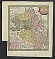
Bautzener Queiskreis. 1730 Matthäus Seutter-Karte.jpg 484 × 643; 159 KB
-
Blaeu 1645 - Saxonia Superior cum Lusatia et Misnia.jpg 3,720 × 3,120; 1.26 MB
-
Bukojna Buchwalde 1908.jpeg 1,850 × 1,072; 1.32 MB
-
Elbe-Elster-Land historisch.PNG 1,034 × 830; 2.46 MB
-
German part of Silesia.png 595 × 400; 163 KB
-
Karte Lausitz 1715.png 7,832 × 5,489; 97.48 MB
-
Kinajcht Kühnicht 1901.jpeg 1,838 × 1,079; 1.22 MB
-
Kleine Spree (Karte des Königreichs Sachsen von 1895).jpg 398 × 631; 64 KB
-
Lausitz map 18thC - Leippa.jpg 397 × 169; 112 KB
-
Lausitz map 18thC.jpg 1,624 × 1,383; 3.01 MB
-
Königreich Sachsen 1895 - Leippa.jpg 327 × 416; 26 KB
-
Luther region 1519.png 1,119 × 712; 2.3 MB
-
Map of Bohemia, 1685.jpg 675 × 900; 444 KB
-
Map of Central Europe in 1791 by Reilly 094.jpg 1,161 × 897; 500 KB
-
MapaSemik2.jpg 3,000 × 4,900; 2.1 MB
-
Mark lausitz 1000.PNG 630 × 449; 199 KB
-
Mark Lausitz, Karte Anno 1200.jpg 567 × 479; 377 KB
-
Mark Meißen und Lausitz um 1600, Bartholomäus Scultetus.jpg 1,406 × 1,999; 627 KB
-
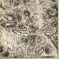
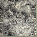
Meilenblatt B 307 Bischofswerda.jpg 9,020 × 9,040; 37.36 MB
-
Meilenblatt B 308 Demitz-Thumitz.jpg 9,020 × 9,030; 38.35 MB
-
Meilenblatt B 309 Göda.jpg 9,000 × 9,010; 32.22 MB
-
Misiniae et Lusatiae Tabula.jpg 5,346 × 7,400; 8.35 MB
-
Móst Smoler korta01.JPG 408 × 274; 69 KB
-
Obersachsen Laußnitz vnd Meissen.jpg 1,648 × 1,198; 674 KB
-
Priebussischer Creis nebst Herrschaft Muska.png 1,732 × 1,100; 4.47 MB
-
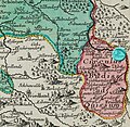
Queiskreis Oberlausitz Seutter 1730 mark Wiesa.jpg 707 × 689; 275 KB
-
Queiskreis Oberlausitz Seutter 1730.jpg 707 × 689; 274 KB
-
Smoler korta01.jpg 1,539 × 2,202; 2.75 MB
-
Tabula Geographica Marchionat. Misniae et Lusatiae.jpg 5,019 × 4,426; 9.87 MB
-
Wulka Nydej Groß Neida 1920.jpeg 1,843 × 1,071; 1.68 MB
-
Карта Верхней Лужицы 1593.jpg 1,608 × 1,189; 1.42 MB


