Category:Maps of Lusatia
Jump to navigation
Jump to search
Wikimedia category | |||||
| Upload media | |||||
| Instance of | |||||
|---|---|---|---|---|---|
| Category combines topics | |||||
| Lusatia | |||||
historical region in Central Europe | |||||
| Instance of | |||||
| Name in native language |
| ||||
| Named after | |||||
| Location | |||||
| Has part(s) | |||||
| Area |
| ||||
| Different from | |||||
| Said to be the same as | White Serbia | ||||
 | |||||
Subcategories
This category has the following 10 subcategories, out of 10 total.
*
G
- Maps of Großröhrsdorf (8 F)
H
- Maps of Hoyerswerda (19 F)
K
- Maps of Königsbrück (11 F)
S
- Maps of Spremberg (12 F)
Pages in category "Maps of Lusatia"
This category contains only the following page.
Media in category "Maps of Lusatia"
The following 48 files are in this category, out of 48 total.
-
Energiefabrik Knappenrode 2016-05-05 (05).jpg 3,648 × 2,736; 2.11 MB
-
Dolná lužica.jpg 527 × 499; 85 KB
-
Germany sorbian region.png 188 × 235; 3 KB
-
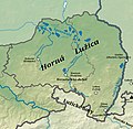
Horna lužica.jpg 758 × 741; 177 KB
-
Karte Lausitzer Gebirge.png 1,470 × 1,470; 643 KB
-
Karte vom Lausitzer Seenland.png 1,968 × 1,726; 1.33 MB
-
KulturaLuzycka 1.png 777 × 471; 20 KB
-
KulturaLuzycka.jpg 777 × 471; 62 KB
-
Lausitz bergbau2.png 1,666 × 1,702; 586 KB
-
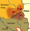
Lausitz unter Böhmen.jpg 669 × 474; 394 KB
-
Lausitzer Seenland, Karte beim Zugang zur Anlegestelle Großkoschen, 01.jpg 3,433 × 2,726; 1.19 MB
-
Lausitzer Seenland, Karte beim Zugang zur Anlegestelle Großkoschen, 02.jpg 4,000 × 3,000; 1.38 MB
-
Lausitzer-Grenzwall Endmoräne Eiszeit.jpg 1,004 × 760; 725 KB
-
LausitzLage.png 259 × 219; 5 KB
-
Location LUS.svg 366 × 285; 1.57 MB
-
Location LUS2.svg 529 × 469; 101 KB
-
Lower Lusatia location map.png 2,549 × 1,646; 552 KB
-
Lusatia Baltic.PNG 450 × 422; 15 KB
-
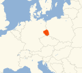
Lusatia in Europe.png 259 × 219; 8 KB
-
Lusatia location map.png 2,619 × 2,932; 1.15 MB
-
Luzica mapa.png 2,363 × 2,835; 572 KB
-
Lužica.svg 512 × 460; 1.12 MB
-
Lužicko.jpg 491 × 500; 87 KB
-
Map Lusatian Mountains work.svg 746 × 746; 1.06 MB
-
Map Lusatian Mountains.svg 746 × 746; 1.4 MB
-
Map of Lusatia.JPG 450 × 400; 28 KB
-
Naturraumkarte Oberlausitz.png 4,129 × 2,633; 10.13 MB
-
Niederlausitz-Karte.png 527 × 390; 419 KB
-
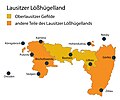
Oberlausitzer Gefilde im Lausitzer Loesshuegelland.jpg 2,641 × 2,207; 680 KB
-
Sorben Siedlungsgebiet Karte.jpg 2,363 × 2,835; 1.26 MB
-
Sorben.jpeg 3,047 × 3,664; 2.18 MB
-
Sorbische Dialekte-dsb.png 1,200 × 1,528; 181 KB
-
Sorbische Dialekte-hsb.png 1,200 × 1,528; 179 KB
-
Sorbische Dialekte-ru.png 1,200 × 1,528; 347 KB
-
Sorbische Dialekte.png 1,200 × 1,528; 181 KB
-
Sorbisches Siedlungsgebiet-dsb.png 1,398 × 1,958; 443 KB
-
Sorbisches Siedlungsgebiet-hsb.png 1,398 × 1,958; 442 KB
-
Sorbisches Siedlungsgebiet.png 1,398 × 1,958; 439 KB
-
Upper Lusatia location map rivers.png 2,271 × 1,552; 831 KB
-
Upper Lusatia location map.png 2,271 × 1,552; 616 KB
-
Wokrejs gorneblotaluzyca.PNG 300 × 350; 9 KB
-
Лужицкие-детские-сады-в-Саксонии-2009.png 500 × 618; 134 KB
-
Лужицкие-школы-в-Саксонии-1954-1955.png 500 × 618; 115 KB
-
Лужицкие-школы-в-Саксонии-2009.png 500 × 618; 109 KB
-
Сокращение-серболужицкого-языкового-ареала.png 1,000 × 1,638; 676 KB


