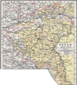
Category:Old maps of Greater Poland
Jump to navigation
Jump to search
Subcategories
This category has the following 3 subcategories, out of 3 total.
M
P
- Palatinatus Posnaniensis (5 F)
Media in category "Old maps of Greater Poland"
The following 7 files are in this category, out of 7 total.
-
WielkoPolska epoki Piastowskiej.jpg 4,075 × 3,613; 10.46 MB
-
Hazaki1910.jpg 1,005 × 579; 218 KB
-
Neu Winiary (Poznan).JPG 2,048 × 1,360; 712 KB
-
OstrzeszówKępnoSycówRychtal 1910-1920.png 1,788 × 1,890; 5.76 MB
-
Posen 1905.png 1,360 × 1,485; 1.09 MB
-
Winiary Poznan old map.JPG 633 × 471; 86 KB
-
Provinz Posen Meyers Zeitungs-Atlas N40.jpg 2,960 × 2,383; 5.98 MB


