Category:Old maps of Finistère
Jump to navigation
Jump to search
Departments of Metropolitan France: Ain [01] · Aisne [02] · Allier [03] · Alpes-de-Haute-Provence [04] · Hautes-Alpes [05] · Alpes-Maritimes [06] · Ardèche [07] · Ardennes [08] · Ariège [09] · Aube [10] · Aude [11] · Aveyron [12] · Bouches-du-Rhône [13] · Calvados [14] · Cantal [15] · Charente [16] · Charente-Maritime [17] · Cher [18] · Corrèze [19] · Corse-du-Sud [2A]† · Haute-Corse [2B]† · Côte-d’Or [21] · Côtes-d'Armor [22] · Creuse [23] · Dordogne [24] · Doubs [25] · Drôme [26] · Eure [27] · Eure-et-Loir [28] · Finistère [29] · Gard [30] · Haute-Garonne [31] · Gers [32] · Gironde [33] · Hérault [34] · Ille-et-Vilaine [35] · Indre [36] · Indre-et-Loire [37] · Isère [38] · Jura [39] · Landes [40] · Loir-et-Cher [41] · Loire [42] · Haute-Loire [43] · Loire-Atlantique [44] · Loiret [45] · Lot [46] · Lot-et-Garonne [47] · Lozère [48] · Maine-et-Loire [49] · Manche [50] · Marne [51] · Haute-Marne [52] · Mayenne [53] · Meurthe-et-Moselle [54] · Meuse [55] · Morbihan [56] · Moselle [57] · Nièvre [58] · Nord [59] · Oise [60] · Orne [61] · Pas-de-Calais [62] · Puy-de-Dôme [63] · Pyrénées-Atlantiques [64] · Hautes-Pyrénées [65] · Pyrénées-Orientales [66] · Bas-Rhin [67] · Haut-Rhin [68] · departmental district of the Rhône [69] · Haute-Saône [70] · Saône-et-Loire [71] · Sarthe [72] · Savoie [73] · Haute-Savoie [74] · Paris [75] · Seine-Maritime [76] · Seine-et-Marne [77] · Yvelines [78] · Deux-Sèvres [79] · Somme [80] · Tarn [81] · Tarn-et-Garonne [82] · Var [83] · Vaucluse [84] · Vendée [85] · Vienne [86] · Haute-Vienne [87] · Vosges [88] · Yonne [89] · Territoire de Belfort [90] · Essonne [91] · Hauts-de-Seine [92] · Seine-Saint-Denis [93] · Val-de-Marne [94] · Val-d'Oise [95]
Overseas departments and regions: Guadeloupe [971] · Martinique [972] · French Guiana [973] · Réunion [974] · Mayotte [976]
Overseas collectivities: Saint Pierre and Miquelon [975] · Saint Barthélemy [977] · Saint-Martin [978] · Wallis and Futuna [986] · French Polynesia [987] · French Southern and Antarctic Lands [984]+
Sui generis territories: New Caledonia [988] · Clipperton Island [989]+
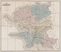
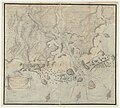
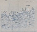
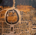
Use the appropriate category for maps showing all or a large part of Finistère. See subcategories for smaller areas:
| If the map shows | Category to use |
|---|---|
| Finistère on a recently created map | Category:Maps of Finistère or its subcategories |
| Finistère on a map created more than 70 years ago | Category:Old maps of Finistère or its subcategories |
| the history of Finistère on a recently created map | Category:Maps of the history of Finistère or its subcategories |
| the history of Finistère on a map created more than 70 years ago | Category:Old maps of the history of Finistère or its subcategories |
Subcategories
This category has the following 12 subcategories, out of 12 total.
1
D
- Dalle de Saint-Bélec (4 F)
- Old maps of Douarnenez (9 F)
O
- Old maps of Concarneau (19 F)
- Old maps of Ouessant (1 P, 97 F)
P
Q
- Old maps of Quimper (7 F)
Media in category "Old maps of Finistère"
The following 95 files are in this category, out of 95 total.
-
210 Forêt de Carnoët Chemin du roi.jpg 2,179 × 2,778; 3 MB
-
4ème carte particulière des côtes de Bretagne - N. F. - btv1b531537089.jpg 9,502 × 6,200; 6.4 MB
-
531Plan d'une partie des bois de l'abbaye de Landévennec.jpg 2,021 × 1,862; 1.76 MB
-
Aber Vrac'h - btv1b5905582s (1 of 2).jpg 7,768 × 6,704; 6.26 MB
-
Admiralty Chart No 1432 Ile Vierge to Point Scoune, Published 1953.jpg 11,243 × 8,284; 18.2 MB
-
Admiralty Chart No 20 Ile d'Ouessant to St Nazaire, Published 1940.jpg 16,258 × 11,101; 59.87 MB
-
Admiralty Chart No 2352 Presqu'ile de Quiberon to Anse de Benodet, Published 1962.jpg 18,776 × 11,268; 44.34 MB
-
Admiralty Chart No 2644 Ile d'Ouesant to Les Sept Iles, Published 1967.jpg 16,280 × 11,207; 22 MB
-
Admiralty Chart No 3640 Anse de Benodet, Published 1907.jpg 16,100 × 11,048; 35.9 MB
-
Audierne plan d'accès port.jpg 1,505 × 2,042; 1.91 MB
-
Baie de Goulven et Anse de Kernic.jpg 762 × 572; 284 KB
-
Blavet fort Tassin 16005.jpg 3,283 × 2,365; 5.45 MB
-
Blavet Tassin 16003.jpg 3,333 × 2,332; 4.29 MB
-
Blavet Tassin 16004.jpg 3,234 × 2,249; 5.05 MB
-
Bourg de Guimaëc, limitrophe de Lanmeur.jpg 457 × 495; 124 KB
-
Brest - la côte de Portsall à Quimper.jpg 985 × 1,214; 110 KB
-
Bénodet Cartographie.jpg 619 × 404; 104 KB
-
Cadastre kerguerhent-reduc.jpg 800 × 520; 81 KB
-
Cadastre Plougar 1938.pdf 2,479 × 1,560; 5.16 MB
-
Cadastre Saint-Coulitz section du bourg.jpg 5,480 × 8,168; 2.83 MB
-
Capitainerie de Morlaix - btv1b53013082r (1 of 3).jpg 4,421 × 2,929; 1.52 MB
-
Carte ancienne île de Batz.jpg 1,000 × 683; 180 KB
-
Carte ancienne Île-Tudy.JPG 2,227 × 1,201; 1.13 MB
-
Carte Bois du Loc'h et anse de Poulmic.jpg 1,492 × 834; 622 KB
-
Carte de Penmarch.jpg 1,327 × 836; 744 KB
-
Carte des côtes de Bretagne de Plouhan à la baie de La Forêt par Jacques-Nicolas Bellin.jpg 5,216 × 3,532; 3.53 MB
-
Carte des côtes de Bretagne en 4 feuilles - par Denis de La Voye - btv1b53216198t (5 of 8).jpg 15,185 × 11,517; 29.17 MB
-
Carte des environs de Brest - btv1b53153653r.jpg 17,252 × 11,316; 25.45 MB
-
Carte des environs de Brest - btv1b53153707v.jpg 16,845 × 10,987; 29.14 MB
-
Carte du département du Finistère - 1790-1793.tif 6,944 × 6,250; 124.22 MB
-
Carte du département du Finistère - 1800.tif 11,740 × 7,165; 240.72 MB
-
Carte Landudec 1917.jpg 1,127 × 883; 513 KB
-
Carte particulière des environs du port de Brest - Cordier - btv1b531536491.jpg 8,788 × 11,986; 11.77 MB
-
Carte région des Abers.jpg 980 × 738; 438 KB
-
Carte état-major estuaire de l'Aulne.jpg 2,322 × 1,151; 1.82 MB
-
Conquereau Tassin 16007.jpg 3,339 × 2,332; 4.52 MB
-
Costes de Bretagne (Penhors - Loctudy) - btv1b530130586.jpg 6,742 × 5,385; 2.8 MB
-
Côtes de Bretagne de Plouganou à Plouescat - btv1b53153148p.jpg 4,194 × 3,462; 1.67 MB
-
Côtes de Bretagne, d'Irvit à Porspoder - btv1b531538361.jpg 8,038 × 6,224; 4.85 MB
-
Description du havre d'Abrevrack - de la Voye - btv1b53153678t.jpg 14,370 × 12,992; 27.57 MB
-
Diocèse de Quimper - dressé par Charle ; gravé par Dumortier - btv1b8445583q.jpg 9,130 × 7,248; 9.22 MB
-
Finisterre (La Coruña). Cartas náuticas. 1879 (1880).jpg 3,465 × 4,840; 2.37 MB
-
Finistère - btv1b84461271.jpg 4,628 × 5,988; 4.94 MB
-
FMIB 43886 Map of Abervrac'h.jpeg 861 × 878; 309 KB
-
Fort du Dellec map.jpg 683 × 490; 210 KB
-
Goulien carte.jpg 619 × 528; 156 KB
-
Havre d'Abbrevrak - btv1b53153169z.jpg 3,818 × 3,426; 1.62 MB
-
Havre d'Abbrevrak - btv1b8492742x.jpg 8,911 × 6,269; 5.72 MB
-
Ile Cigogne - Robelin - btv1b531535647.jpg 9,614 × 6,568; 6.21 MB
-
Ile Cigogne Robelin.jpg 1,437 × 964; 638 KB
-
Ile Longue - Trébéron - btv1b53014892j.jpg 7,541 × 5,588; 4.61 MB
-
L'embouchure de l'Aulne.jpg 501 × 346; 46 KB
-
L'Odet en aval de Quimper.jpg 958 × 1,263; 610 KB
-
La Cornouaille et la Montagne Noire - btv1b8493852z (1 of 2).jpg 6,912 × 6,156; 5.2 MB
-
Lanmeur Guimaëc Locquirec.jpg 388 × 410; 185 KB
-
Les affleurements de kersantite.jpg 320 × 280; 66 KB
-
Les Glénan Villeminot.jpg 1,457 × 921; 651 KB
-
Locronan 101.JPG 2,649 × 2,397; 1.86 MB
-
Locunolé état-major.png 1,066 × 1,068; 2.81 MB
-
Mahalon carte.jpg 759 × 578; 258 KB
-
Old map of Ile Longe.jpg 1,747 × 1,233; 1.07 MB
-
Partie de la côte aux environs de Brest - Demonnot - btv1b53153668d.jpg 14,355 × 11,146; 16.85 MB
-
Plan de la rade de Brest.jpg 1,157 × 814; 553 KB
-
Plan de Landudec par Conen de Saint-Luc.png 1,095 × 769; 190 KB
-
Plan des environs d'Argenton 1816.jpg 936 × 518; 282 KB
-
Plan du château de Kergounadeach.jpg 456 × 318; 32 KB
-
Plan du Conquet et des environs - de la Voye - btv1b531531905.jpg 7,496 × 5,590; 5.76 MB
-
Plan forêt Carnoët.jpg 1,841 × 1,512; 2.22 MB
-
Plan Penmarc'h 1925.jpg 904 × 520; 297 KB
-
Plans de l'église de Loctudy, Paul Gout, 1881.jpg 640 × 479; 92 KB
-
Plozévet carte ancienne.jpg 1,023 × 793; 353 KB
-
Pointe de Creac'h - Meur - btv1b53015123s.jpg 5,524 × 5,528; 3.64 MB
-
Pointe du Toulinguet - btv1b530150939.jpg 7,324 × 5,584; 5.2 MB
-
Pont labbe plan xvii.gif 400 × 385; 58 KB
-
Primelin - btv1b530151069.jpg 5,359 × 6,536; 3.61 MB
-
Rivière de Penzé - btv1b53015003k.jpg 8,981 × 7,755; 9.2 MB
-
The coast of BRETAGNE from Plougoulin to Passage Du Four NYPL1640591.tiff 7,230 × 5,428; 112.28 MB
-
Train patates.jpg 1,000 × 741; 308 KB


