Category:17th-century maps of Finistère
Jump to navigation
Jump to search
Departments of Metropolitan France: Ain [01] · Aisne [02] · Aube [10] · Bouches-du-Rhône [13] · Calvados [14] · Charente [16] · Dordogne [24] · Eure [27] · Eure-et-Loir [28] · Finistère [29] · Haute-Garonne [31] · Ille-et-Vilaine [35] · Indre-et-Loire [37] · Loir-et-Cher [41] · Manche [50] · Marne [51] · Haute-Marne [52] · Morbihan [56] · Nièvre [58] · Nord [59] · Oise [60] · Pas-de-Calais [62] · Saône-et-Loire [71] · Paris [75] · Seine-Maritime [76] · Seine-et-Marne [77] · Yvelines [78] · Tarn [81] · Vaucluse [84] · Vienne [86] · Vosges [88]
Overseas departments and regions: Guadeloupe [971] · Martinique [972]
Overseas departments and regions: Guadeloupe [971] · Martinique [972]
Subcategories
This category has the following 2 subcategories, out of 2 total.
Media in category "17th-century maps of Finistère"
The following 5 files are in this category, out of 5 total.
-
 054 Carte Cornouaille Jansénius 1629.JPG 2,847 × 1,969; 2.81 MB
-
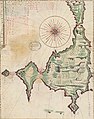 Carte de l'Isle du Conquet 1628.jpg 351 × 446; 148 KB
-
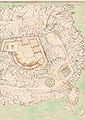 Fort de Bertheaume fin XVIIe s.jpg 452 × 640; 95 KB
-
 Île d'Ouessant - btv1b531532124.jpg 7,326 × 5,542; 3.87 MB
-
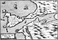 Pointe du conquest 1634 Tassin 16009.jpg 3,278 × 2,261; 4.9 MB


