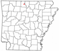
Category:Marion County, Arkansas
Jump to navigation
Jump to search
Counties of Arkansas: Arkansas · Ashley · Baxter · Benton · Boone · Bradley · Calhoun · Carroll · Chicot · Clark · Clay · Cleburne · Cleveland · Columbia · Conway · Craighead · Crawford · Crittenden · Cross · Dallas · Desha · Drew · Faulkner · Franklin · Fulton · Garland · Grant · Greene · Hempstead · Hot Spring · Howard · Independence · Izard · Jackson · Jefferson · Johnson · Lafayette · Lawrence · Lee · Lincoln · Little River · Logan · Lonoke · Madison · Marion · Miller · Mississippi · Monroe · Montgomery · Nevada · Newton · Ouachita · Perry · Phillips · Pike · Poinsett · Polk · Pope · Prairie · Pulaski · Randolph · Saline · Scott · Searcy · Sebastian · Sevier · Sharp · St. Francis · Stone · Union · Van Buren · Washington · White · Woodruff · Yell
county in Arkansas, United States | |||||
| Upload media | |||||
| Instance of | |||||
|---|---|---|---|---|---|
| Named after | |||||
| Location | Arkansas | ||||
| Capital | |||||
| Inception |
| ||||
| Population |
| ||||
| Area |
| ||||
| Different from | |||||
| official website | |||||
 | |||||
Subcategories
This category has the following 14 subcategories, out of 14 total.
A
- Arkansas Highway 14 (20 F)
- Arkansas Highway 235 (6 F)
B
F
M
- Minerals of Rush (1 F)
- Monte Cristo Mine, Rush (4 F)
- Morning Star Mine (1 F)
P
- Philadelphia Mine (8 F)
Y
Media in category "Marion County, Arkansas"
The following 37 files are in this category, out of 37 total.
-
A timeline community members created organizing their goals (18993624539).jpg 1,646 × 610; 207 KB
-
Arkansas 125.png 870 × 516; 41 KB
-
ARMap-doton-Bull Shoals.png 300 × 262; 13 KB
-
ARMap-doton-Flippin.png 300 × 262; 13 KB
-
ARMap-doton-Pyatt.png 300 × 262; 13 KB
-
ARMap-doton-Summit.png 300 × 262; 13 KB
-
ARMap-doton-Yellville.png 300 × 262; 13 KB
-
Bruno–Pyatt High School.jpg 3,166 × 2,111; 1.14 MB
-
Bull shoals state park view.jpg 2,816 × 2,112; 2.9 MB
-
Bullshoals Caverns billboard, Route 178, Bull Shoals, Arkansas LCCN2017704076.tif 5,233 × 3,650; 109.34 MB
-
Conoco gasoline sign, Route 70, Blackfish Lake, Arkansas LCCN2017703763.tif 5,196 × 3,571; 106.21 MB
-
Fall Along Highway 125 - panoramio.jpg 2,848 × 2,136; 3.18 MB
-
Foggy Morning on Highway 125 - panoramio.jpg 1,600 × 1,200; 634 KB
-
Highway 125 near Georges Creek, AR.jpg 3,597 × 2,024; 2.86 MB
-
Looking Down on Becca Hollow - panoramio.jpg 2,848 × 2,136; 3.05 MB
-
Map of Arkansas highlighting Marion County.svg 1,278 × 1,113; 90 KB
-
Marion County Fairgrounds.jpg 3,167 × 2,112; 1.54 MB
-
Morning on Bull Shoals Lake - panoramio.jpg 1,600 × 1,200; 631 KB
-
Mountain Village billboard, Route 178, Bull Shoals, Arkansas LCCN2017704073.tif 5,233 × 3,650; 109.34 MB
-
Old cabins, Pyatt, Arkansas LCCN2017710139.tif 5,325 × 3,655; 111.41 MB
-
Old cabins, Pyatt, Arkansas LCCN2017710140.tif 5,325 × 3,655; 111.42 MB
-
Old Pasture and Gravel Road in Peel - panoramio.jpg 1,600 × 1,200; 632 KB
-
Peel Ferry coming in to dock.jpg 3,655 × 2,056; 1.35 MB
-
Pine Lodge Motel, Bull Shoals, Arkansas LCCN2017710015.tif 5,325 × 3,655; 111.41 MB
-
Rea Valley School, Arkansas (7977383763).jpg 448 × 295; 29 KB
-
US 62 and US 412 at Georges Creek, AR 001.jpg 3,586 × 2,024; 2.12 MB
-
US 62 and US 412 at Georges Creek, AR 002.jpg 4,217 × 2,366; 2.38 MB
-
US 62 and US 412 at Georges Creek, AR 003.jpg 5,248 × 2,952; 6.69 MB
-
US 62 and US 412 at Georges Creek, AR 004.jpg 4,843 × 2,726; 6.79 MB
-
US 62 and US 412 at Georges Creek, AR 005.jpg 5,248 × 2,952; 3.18 MB
-
USA Marion County, Arkansas age pyramid.svg 520 × 600; 7 KB


