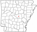
Category:Pulaski County, Arkansas
Jump to navigation
Jump to search
Counties of Arkansas: Arkansas · Ashley · Baxter · Benton · Boone · Bradley · Calhoun · Carroll · Chicot · Clark · Clay · Cleburne · Cleveland · Columbia · Conway · Craighead · Crawford · Crittenden · Cross · Dallas · Desha · Drew · Faulkner · Franklin · Fulton · Garland · Grant · Greene · Hempstead · Hot Spring · Howard · Independence · Izard · Jackson · Jefferson · Johnson · Lafayette · Lawrence · Lee · Lincoln · Little River · Logan · Lonoke · Madison · Marion · Miller · Mississippi · Monroe · Montgomery · Nevada · Newton · Ouachita · Perry · Phillips · Pike · Poinsett · Polk · Pope · Prairie · Pulaski · Randolph · Saline · Scott · Searcy · Sebastian · Sevier · Sharp · St. Francis · Stone · Union · Van Buren · Washington · White · Woodruff · Yell
county in Arkansas, United States | |||||
| Upload media | |||||
| Instance of | |||||
|---|---|---|---|---|---|
| Named after | |||||
| Location | Arkansas | ||||
| Capital | |||||
| Inception |
| ||||
| Significant event |
| ||||
| Population |
| ||||
| Area |
| ||||
| Different from | |||||
| official website | |||||
 | |||||
Subcategories
This category has the following 15 subcategories, out of 15 total.
G
L
P
Media in category "Pulaski County, Arkansas"
The following 46 files are in this category, out of 46 total.
-
Arkansas cotton pickers, 8a16197.jpg 4,112 × 2,748; 4.02 MB
-
Arkansas cotton pickers, 8a16197.tif 4,289 × 3,039; 24.88 MB
-
Arkansas Highway 113 near Martindale.jpg 3,023 × 1,937; 2.05 MB
-
ARMap-doton-Gravel Ridge.png 300 × 262; 13 KB
-
ARMap-doton-Jacksonville.png 300 × 262; 13 KB
-
ARMap-doton-Maumelle.png 300 × 262; 13 KB
-
ARMap-doton-McAlmont.png 300 × 262; 13 KB
-
ARMap-doton-Parkers-Iron Springs.png 300 × 262; 13 KB
-
ARMap-doton-Scott.png 300 × 262; 13 KB
-
ARMap-doton-Sherwood.png 300 × 262; 13 KB
-
ARMap-doton-Sweet Home.png 300 × 262; 13 KB
-
ARMap-doton-Woodson.png 300 × 262; 13 KB
-
ARMap-doton-Wrightsville.png 300 × 262; 13 KB
-
Callicarpa americana 2.jpg 4,288 × 2,848; 11.49 MB
-
Charming steps at Pugh's Mill, aka The Old Mill, North Little Rock, AR.jpg 3,000 × 4,000; 6.35 MB
-
Civilian Conservation Corps Bridge.jpg 2,144 × 1,424; 1.56 MB
-
Cotton farmer and ag extension agent in Pulaski County, Arkansas.jpg 4,802 × 3,505; 7.67 MB
-
Helenium flexuosum.jpg 1,845 × 1,230; 525 KB
-
Highway 365 near Maumelle, Arkansas.jpg 1,925 × 1,448; 964 KB
-
Interstate 530, Pulaski County, Arkansas.jpg 2,951 × 2,215; 2.45 MB
-
Leaning barn 793889485.jpg 3,872 × 2,592; 3.2 MB
-
McAlmont (Harris) Elementary School placard.jpg 1,278 × 720; 272 KB
-
Natural landing.jpg 384 × 288; 18 KB
-
Negro Work - Women, 1928 - NARA - 251665 (page 1).gif 576 × 756; 127 KB
-
Negro Work - Women, 1928 - NARA - 251665 (page 2).gif 756 × 578; 128 KB
-
Nssb2 (2).jpg 367 × 147; 13 KB
-
Pedestrian Bridge at Pugh's Mill, aka The Old Mill, North Little Rock, AR.jpg 3,000 × 4,000; 5.43 MB
-
Photogenic Pugh's Mill, aka The Old Mill, North Little Rock, AR.jpg 3,000 × 4,000; 5.61 MB
-
Pugh's Mill, aka The Old Mill, North Little Rock, AR.jpg 3,000 × 4,000; 6.92 MB
-
Sharecroppers, Pulaski Co., Ark. (3109755193).jpg 760 × 596; 72 KB
-
USA Pulaski County, Arkansas age pyramid.svg 520 × 600; 8 KB


