Category:Maps showing the whole Near East
Jump to navigation
Jump to search
Subcategories
This category has only the following subcategory.
O
Media in category "Maps showing the whole Near East"
The following 18 files are in this category, out of 18 total.
-
Cercano Oriente.png 443 × 247; 13 KB
-
Near East topographic map-blank.svg 2,425 × 1,581; 2.33 MB
-
Mamlukes-Ayyubid Dynasty-ar.png 511 × 346; 91 KB
-
1701 Guillaume Delisle map of the Ottoman and Persian Empires.jpg 7,617 × 5,774; 35.89 MB
-
2000px-Distribution Haplogroup J2 Y-DNA.jpg 1,989 × 1,091; 123 KB
-
Diadochi 301 Shepherd-es.svg 1,248 × 605; 1.12 MB
-
Diádocos-200AC-es.svg 1,239 × 593; 1.04 MB
-
Dzsazíra.JPG 588 × 428; 49 KB
-
Greater israel.jpg 390 × 409; 209 KB
-
Modern Fertile Crescent.jpg 246 × 171; 9 KB
-
The Near East - WDL - LOC.png 1,254 × 1,024; 1.85 MB
-
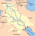
Tigr-euph de.png 1,000 × 1,005; 301 KB
-
Tigr-euph hr.png 1,000 × 1,005; 230 KB
-
Tigr-euph ku.png 1,000 × 1,005; 254 KB
-
Tigr-euph-ar.png 1,000 × 1,005; 229 KB
-
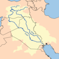
Tigr-euph.png 1,000 × 1,005; 264 KB
-
Тигр-Евфрат мөрөн.png 1,000 × 1,005; 282 KB
-
الهلال الخصيب الحديث.svg 316 × 215; 12 KB


