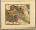
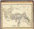
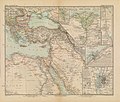
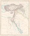
Category:Old maps showing the whole Near East
Jump to navigation
Jump to search
Subcategories
This category has the following 11 subcategories, out of 11 total.
1
Media in category "Old maps showing the whole Near East"
The following 83 files are in this category, out of 83 total.
-
Western Asia 4th-2nd centuries Smith 1915.jpg 1,345 × 852; 225 KB
-
Abraham Ortelius - Tvrcici imperii descriptio.jpg 3,085 × 2,279; 2.64 MB
-
Fernão Vaz Dourado 1570-1.jpg 3,003 × 2,314; 5.58 MB
-
Map of the Russia and Near East. HM 33.jpg 3,433 × 5,093; 5.46 MB
-
John Speed. The Turkish Empire. Newly Augmented by John Speed. 1626.jpg 1,543 × 1,200; 2.78 MB
-
Pierre Du Val. Expeditionis Alexandri Magni Per Europam, Asiam et Africam. 1654.jpg 1,912 × 1,300; 2.86 MB
-
Nicholas Sanson. Romani Imperii qua Oriens est Descriptio Geographica. 1657.jpg 1,813 × 1,300; 2.61 MB
-
Carte du voyage du sieur Daulier Deslandes en Perse (1661).jpg 3,308 × 1,767; 3.06 MB
-
Ottoman Empire 1696 by Jaillot.jpg 2,399 × 2,055; 1.18 MB
-
Imperium Turcicum in Europa, Asia Et Africa.jpg 7,092 × 6,057; 16.29 MB
-
Moll, Herman. Turkey in Asia; or Asia Minor &c. 1736 (A).jpg 2,983 × 2,348; 1.52 MB
-
Moll, Herman. Turkey in Asia; or Asia Minor &c. 1736.jpg 5,253 × 3,080; 2.73 MB
-
Middle East by Robert de Vaugondy.jpg 1,000 × 987; 470 KB
-
Robert de Vaugondy. Map of the Early Ages of the World. 1762.jpg 807 × 800; 231 KB
-
1771 Bonne Map of Turkey, Syria and Iraq - Geographicus - Turkey-bone-1771.jpg 3,500 × 2,432; 2.34 MB
-
Thomas Kitchin. Composite Asia, islands according to d'Anville. 1787 (A).jpg 1,207 × 1,077; 446 KB
-
Rigobert Bonne. Turquie d'Asie. 1791 (A).jpg 2,630 × 1,817; 1.24 MB
-
Rigobert Bonne. Turquie d'Asie. 1791.jpg 3,920 × 2,518; 1.93 MB
-
Samuel Dunn. Turkey in Asia, with Armenia, Syria, Georgia, etc. 1794.jpg 696 × 495; 140 KB
-
1800 Wilkinson Map of the 4 Eastern Churches.jpg 1,802 × 1,378; 1.95 MB
-
1801 Cary Map of Turkey, Iraq, Armenia and Sryia - Geographicus - TurkeyAsia-cary-1801.jpg 4,000 × 3,564; 3.13 MB
-
Bowen, Frances. Turkey in Asia. 1810 (A).jpg 3,844 × 3,433; 1.49 MB
-
Darton, William. Turkey in Asia. 1811 (A).jpg 4,560 × 3,818; 3.29 MB
-
Darton, William. Turkey in Asia. 1811.jpg 6,720 × 5,633; 5.61 MB
-
Chamouin; Giraldon. Turquie D'Asie. 1812.jpg 650 × 476; 129 KB
-
Adrien-Hubert Brué. Asie-Mineure, Armenie, Syrie, Mesopotamie, Caucase. 1822 (A).jpg 3,636 × 2,592; 1.82 MB
-
Turkey in Asia.jpg 8,995 × 7,277; 13.85 MB
-
1855 Colton Map of Turkey, Iraq, and Syria - Geographicus - TurkeyIraq-colton-1855.jpg 3,500 × 3,034; 3.22 MB
-
Garnier, F. A., Turquie, Syrie, Liban, Caucase. 1862. (A).jpg 2,993 × 2,114; 1.85 MB
-
Garnier, F. A., Turquie, Syrie, Liban, Caucase. 1862.jpg 3,835 × 3,090; 2.23 MB
-
Stein, Christ. Gottfr. Dan.West-Asien. 1865 A.jpg 3,796 × 3,146; 2.7 MB
-
Afrika in 6 Blättern, Sheet 2. - DPLA - 39177aedfe3e739eea71ac7e1c8552db.jpg 1,000 × 846; 263 KB
-
II. Abdülhamit zamanında Osmanlı Devleti haritası.jpg 800 × 940; 287 KB
-
Osmanli Ortadogu.jpg 7,374 × 5,629; 9.42 MB
-
Heinrich Kiepert. Asia citerior.jpg 7,061 × 5,637; 7.06 MB
-
Shepherd-c-018-019 cropped Middle East.JPG 1,142 × 914; 350 KB
-
Shepherd-c-018-019.jpg 1,928 × 1,544; 916 KB
-
The Macedonian Empire, 336-323 (William R. Shepherd).jpg 1,730 × 927; 840 KB
-
W. & A.K. Johnston. Asia Minor. 1911 A.jpg 4,676 × 3,626; 3.64 MB
-
1915 bird's eye view map of the Middle Eastern theatre of World War I.jpg 6,440 × 5,240; 5.28 MB
-
The war in April, 1918 (1918) (14576800000).jpg 3,072 × 2,376; 2.18 MB
-
Near East & India 1930, svatlas.jpg 2,289 × 1,700; 1.93 MB
-
Železnice v Západní Asii.jpg 2,828 × 1,771; 796 KB
-
Lands of the Bible, 1956.jpg 4,852 × 3,404; 8.38 MB
-
Middle East, 1967.jpg 4,042 × 2,876; 2.6 MB
-
Arab Caliphate.jpg 888 × 674; 220 KB
-
Arab Caliphate.svg 350 × 334; 1.04 MB
-
Atlas Ortelius KB PPN369376781-088av-088br.jpg 3,000 × 2,194; 4.73 MB
-
Atlas Ortelius KB PPN369376781-093av-093br.jpg 3,000 × 2,194; 4.57 MB
-
Cornelis De Jode. Primae Partis Asiae accurata delineatio. 1579.jpg 2,122 × 1,320; 3.1 MB
-
Homann Imperium Turcium.jpg 768 × 665; 426 KB
-
Johnston, Alexander Keith (1804-1871). Turkey in Asia, Transcaucasia. 1861 (A).jpg 4,064 × 3,124; 2.86 MB
-
Johnston, Alexander Keith (1804-1871). Turkey in Asia, Transcaucasia. 1861.jpg 5,325 × 3,725; 3.4 MB
-
Karte vom türkischen Reich in Asien Platt 1848.pdf 2,325 × 2,779; 705 KB
-
L'Empire des Turcs (Jollain).jpg 652 × 511; 138 KB
-
LAsie antérieure (2675646274).jpg 2,000 × 1,667; 3.31 MB
-
Map of Imperium Turcicum.JPG 3,072 × 2,304; 1.23 MB
-
Nicolas de Fer 1720 Perse Georgie Natolie Arabies Egipte.png 2,350 × 1,635; 9.34 MB
-
Salzburger Residenz Toskanatrakt Kartensaal 03.jpg 1,755 × 2,756; 1.18 MB
-
Salzburger Residenz Toskanatrakt Kartensaal 05.jpg 2,535 × 2,953; 2.32 MB
-
Toskanatrakt Salzburg Landkartensaal Türkisches Reich.jpg 3,669 × 2,084; 8.05 MB
-
Turkey in Asia, 1903.jpg 6,000 × 4,000; 4.67 MB
-
UBBasel Map 1570-1579 Kartenslg Mappe 250-1.tif 9,733 × 8,454, 2 pages; 235.44 MB
-
Zlatà Koruna Kloster- Schule Karte Welt 1770 3.jpg 3,000 × 4,000; 5.41 MB


