Category:Maps of western New Guinea
Wikimedia category | |||||
| Upload media | |||||
| Instance of | |||||
|---|---|---|---|---|---|
| Category combines topics | |||||
| Western New Guinea | |||||
region of Eastern Indonesia on the island of New Guinea | |||||
| Instance of |
| ||||
| Location | Indonesia | ||||
| Inception |
| ||||
| Area |
| ||||
| Different from | |||||
| Said to be the same as | Irian Jaya | ||||
 | |||||
May only include maps that focus on the western part of the island of New Guinea or Papua. If other major islands of Indonesia are visible, use other categories, such as Category:Maps of eastern Indonesia. If showing the location of Papua in relation with Indonesia, use Category:Locator maps of Papua. If not showing the whole of Papua, use the province level category(/categories).
In Indonesian language, "West Papua" (id:Papua Barat) have two meanings, the primary one is the province of West Papua, which is split (in 1999 it was called West Irian Jaya, then in 2007 became West Papua) from the original single province of Papua (the whole "West Papua" in English sense) (before 2001 it was called Irian Jaya). This category shows maps that includes both provinces, as well as historical map of the Province of Papua, when it was still a single entity (pre-1999).
Subcategories
This category has the following 11 subcategories, out of 11 total.
!
*
D
N
Media in category "Maps of western New Guinea"
The following 21 files are in this category, out of 21 total.
-
AMH-6667-KB Map of the Moluccas.jpg 2,400 × 1,914; 1,004 KB
-
Divisions administrativas indonesianas en Nòva Guinèa Occidentala.svg 926 × 742; 156 KB
-
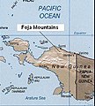
Foja Mountains.JPG 276 × 306; 22 KB
-
Indonesia SabangMerauke.PNG 400 × 163; 23 KB
-
Indonesia Western New Guinea location map.png 1,035 × 1,031; 129 KB
-
Indonesian glaciers dynamics.png 1,493 × 907; 1.55 MB
-
KLM-vlucht 844 map.png 745 × 452; 32 KB
-
Location map West Papua.png 765 × 695; 44 KB
-
LorentzNP-Freeport.jpg 570 × 432; 56 KB
-
Papua linguistic map.png 3,728 × 2,120; 4.78 MB
-
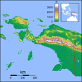
Papua Locator Topography.png 1,591 × 1,591; 1.57 MB
-
Papua.jpg 1,318 × 1,334; 149 KB
-
Papua.png 5,328 × 2,616; 1.56 MB
-
Papuafr.png 1,565 × 981; 218 KB
-
PETA WILAYAH CERITA RAKYAT DAERAH IRIAN JAYA.jpg 506 × 334; 24 KB
-
Prov. Papua.jpg 1,280 × 1,280; 461 KB
-
Província indonesiana de Papoa (1969).svg 294 × 389; 258 KB
-
WestPapua topo.jpg 1,200 × 921; 139 KB
-
Westpapua1.png 397 × 330; 38 KB
-
Автономная провинция Папуа.png 1,069 × 1,158; 856 KB


