Category:Maps of eastern Indonesia
| NO WIKIDATA ID FOUND! Search for Maps of eastern Indonesia on Wikidata | |
| Upload media |
Maps showing not whole, but only eastern part of Indonesia, it may include several of the following islands (but not focusing on): Kalimantan, Sulawesi, the Moluccas, the Lesser Sunda Islands, the Western Papua, and Java to some extent, even parts of Papua New Guinea, the Philippines, and Timor Leste. It may not include Sumatra. If the depicted map is only focusing on one major islands, use the subcategories below.
It may include depictions of part or whole of Timor Leste, which share the island of Timor with Indonesia, eastern Malaysia, and Brunei, which share the island of Kalimantan with Indonesia.

Subcategories
This category has the following 7 subcategories, out of 7 total.
!
M
S
W
~
Media in category "Maps of eastern Indonesia"
The following 31 files are in this category, out of 31 total.
-
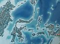
 Map of Eastern Indonesia.png 2,560 × 963; 140 KB
-

-
 Annali del Museo civico di storia naturale di Genova (1878) (18412730091).jpg 3,854 × 2,814; 2.43 MB
-
 Borneo(E),Sulawesi(Celebes),Maluku(Molluccas),BirdsHead(Papua).jpg 716 × 526; 50 KB
-
 Borneo,Sulawesi(Celebes).jpg 716 × 532; 54 KB
-
 Celebes See.jpg 578 × 342; 40 KB
-
 Central MP languages.png 3,200 × 2,144; 2.07 MB
-
 HKU Stephen Hui Geological Museum 地球儀 earth Globe map October 2016 Lnv 汶萊 印度尼西亞.jpg 3,264 × 2,448; 2.96 MB
-
 Indonesia Maluku-Western New Guinea topography location map.png 1,474 × 1,036; 1.87 MB
-
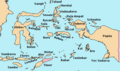 Indonesia Oriental.PNG 535 × 317; 8 KB
-
 Indonesian earthquake with a magnitude above 7.jpg 947 × 653; 89 KB
-
 Indonesian Speckled Carpetshark Range.png 133 × 108; 5 KB
-
 IndonesianGreatEast.jpg 759 × 484; 99 KB
-
 Map of Western and Eastern Indonesia.png 2,560 × 963; 140 KB
-
 Molucca Passage.jpg 680 × 540; 92 KB
-
 Rattus Sulawesi & Moluccas.PNG 161 × 114; 5 KB
-
 S 10, E 118.5 - N 3, E 131.1 slope map.png 8,546 × 8,849; 12.68 MB
-
 South Halmahera-West New Guinea languages.png 3,200 × 2,144; 2.07 MB
-
 StateofEastIndonesia.jpg 623 × 484; 101 KB
-
 Sultanat of Ternate and Tidore en 1800.png 3,353 × 2,356; 629 KB
-
 Sultanat of Ternate in 1570.png 588 × 414; 77 KB
-
 TimezonesID.svg 1,875 × 749; 355 KB
-
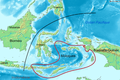
 TransOceania m.png 1,276 × 802; 48 KB
-
 TransOceania.PNG 1,276 × 833; 47 KB
-
 TransOceania.png 1,276 × 802; 46 KB
-
 Wallace Island Life p452.png 1,492 × 1,858; 66 KB
-
 Wallacea biodiversity.png 344 × 265; 9 KB
-
 Wallacea Hotspot Map.png 344 × 265; 9 KB
-
 Wallacea Map.png 344 × 265; 8 KB
-
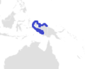
 Wallacea- blank map.png 1,868 × 1,392; 339 KB
-
 Wallacea-id.png 1,868 × 1,392; 384 KB

_(18412730091).jpg)
,Sulawesi(Celebes),Maluku(Molluccas),BirdsHead(Papua).jpg)
.jpg)


