Category:Maps of islands in Indonesia
Jump to navigation
Jump to search
Partly: Indonesia
| NO WIKIDATA ID FOUND! Search for Maps of islands in Indonesia on Wikidata | |
| Upload media |
Subcategories
This category has the following 16 subcategories, out of 16 total.
!
*
B
J
M
R
S
~
Media in category "Maps of islands in Indonesia"
The following 11 files are in this category, out of 11 total.
-
Biak Archipelago.png 5,400 × 5,400; 19.15 MB
-
Halmahera - Ternate - Tidore - Mare - Moti - Makian.jpg 3,937 × 5,176; 2.67 MB
-
Indonesia map with name of islands.png 1,280 × 586; 205 KB
-
Java & Madura 150.000, KK 049-04-01053-12-10.pdf 2,593 × 3,606, 454 pages; 1.66 GB
-
Kepulauan Selayar.png 1,388 × 1,068; 475 KB
-
Mega Island.png 1,604 × 1,248; 24 KB
-
Noemfoor Assault Plan.jpg 1,420 × 2,006; 3.19 MB
-
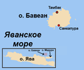
Peta Pulau Bawean (ru).png 370 × 309; 24 KB
-
Sebuku Island Location.jpg 631 × 401; 12 KB
-
TogianIslandMap.svg 1,910 × 2,063; 783 KB
-
Анамбас і Натуна.gif 307 × 186; 4 KB


