Category:Maps of volcanoes in Italy
Jump to navigation
Jump to search
Subcategories
This category has the following 19 subcategories, out of 19 total.
*
A
- Maps of Alban Hills (3 F)
- Maps of Alicudi (13 F)
B
- Maps of Lake Bolsena (2 F)
C
E
- Maps of Monti Ernici (1 F)
S
- Maps of Salina (14 F)
V
- Maps of Lake Vico (2 F)
Media in category "Maps of volcanoes in Italy"
The following 6 files are in this category, out of 6 total.
-
Italy volcano map.png 329 × 353; 16 KB
-
Aeolian Arc.jpg 925 × 676; 140 KB
-
CentralMediterranean-GeotectonicMap.jpg 9,451 × 6,203; 20.29 MB
-
Comparing surface deformation data ESA341141.jpg 3,271 × 2,720; 2.4 MB
-
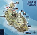
Mappa di Vulcano.jpg 2,948 × 2,794; 4.15 MB
-
Unrest at Campi Flegrei since 1950.webp 997 × 2,329; 236 KB


