Category:Topographic maps of volcanoes in Italy
Jump to navigation
Jump to search
Media in category "Topographic maps of volcanoes in Italy"
The following 11 files are in this category, out of 11 total.
-
GiorcesEolie1ab.png 1,749 × 1,263; 1.57 MB
-
Gulf of Naples He.jpg 942 × 794; 204 KB
-
Lange diercke sachsen europaeische landschaften neapel.jpg 1,258 × 932; 528 KB
-
Mount Etna Relief Map, SRTM-1.jpg 1,500 × 2,000; 1.94 MB
-
Mount Vesuvius Relief Map, SRTM-1.jpg 1,600 × 1,200; 836 KB
-
Phlegraean Fields Relief Map, SRTM-1.jpg 1,600 × 1,200; 624 KB
-
Sicily topographic map-blank.svg 2,373 × 1,582; 4.66 MB
-
Vesuvius SRTM3.png 942 × 794; 922 KB
-
Vesuvius SRTM3.xcf 942 × 794; 2.33 MB
-
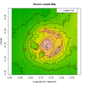
Vulcano laziale.png 525 × 525; 58 KB
-
Zona rossa Vesuvio.png 942 × 794; 904 KB


